 MineArchive
Benallt Mine
| Also known as | Benallt No. 2 Mine, Rhiw Manganese Mines, Mwynglawdd Benallt |
|---|---|
| Location | Rhiw, near Aberdaron, Llŷn Peninsula, Gwynedd — 52.8219, -4.6401 (exact) |
| Commodity | Manganese |
| Type | Metal |
| Worked | 1886–December 1945 |
| Operators | North Wales Iron and Manganese Company (1903–1939), British Manganese Company (1903–1939), Ministry of Supply (1939–1945) |
Overview
Britain's most productive manganese ground, on a headland at the far end of the Llŷn — worked in fits and starts from 1886, then requisitioned in 1941 when the Atlantic convoys stopped bringing ore, and finished for good four months after the war ended.
History
Manganese working began at Benallt and the adjoining Rhiw mine in 1886. The two were separately owned but sat on the same orebody, and their surface and underground workings were eventually run together. Benallt produced until 1894 and was then abandoned; in 1903 the North Wales Iron and Manganese Company and the British Manganese Company were formed to develop Benallt and Rhiw respectively, and Benallt was reworked from 1904 as the No. 2 mine on newly proved reserves. Those were close to exhausted by 1914, at which point the company opened up a further orebody, the Nant mine, above Porth Ysgo. Between them Benallt, Rhiw and Nant raised more than 160,000 tons of manganese ore in the first half of the 20th century, far more than any other district in the British Isles. The mine's most intense phase came last. Reopened by the Ministry of Supply in 1939 and requisitioned outright in 1941 as the Battle of the Atlantic cut off imported ore, it was worked with colliers brought in from South Wales and tin miners from Cornwall, and its underground development found a major new ore zone that yielded 30,000 tons — enough to keep the mine going for the rest of the war.
Geology
The manganese ore of the Llŷn occurs as beds within the Ordovician sedimentary and volcanic sequence of Mynydd Rhiw, rather than in veins, which is why the workings follow the ore horizon across the headland and appear at surface as opencast cuts as readily as underground levels. The site is also one of the more remarkable mineralogical localities in Britain: several mineral species were first described from Benallt, and the assemblage has been the subject of dedicated study since.
Geological setting: Sedimentary Beds and Seams (well documented example)
Workings
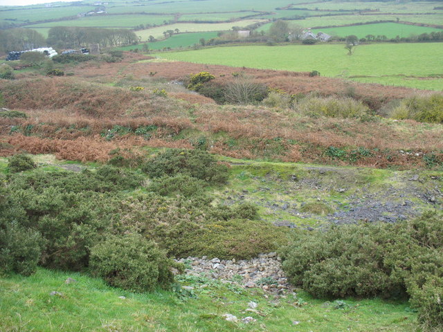
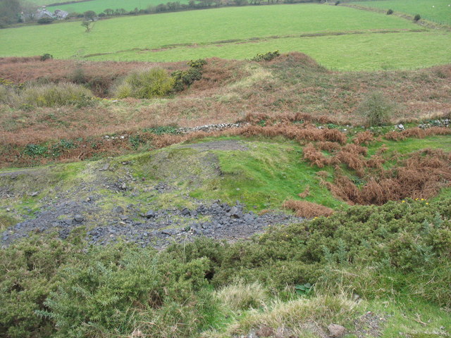
A mixture of opencast cuts and underground levels following the ore beds, served by a shaft complex and by a tramway with a series of self-acting inclines that dropped the ore down to the coast at Nant y Gadwen and Porth Ysgo for shipping by sea — the Llŷn had no railway worth the name. Ore was also worked at the small Tyddyn Meirion and Ty Canol mines immediately to the south, which were folded into the wartime operation. The Ministry of Supply used Benallt to trial magnetometer surveying as a way of finding concealed ore, the first time the technique had been applied to manganese prospecting in Britain, and it worked.
Closure
The mines were abandoned in December 1945 and have not been worked since; the abandonment plan covering Benallt, Ty Canol and the associated takes is dated 7 March 1946. Peacetime meant imported ore again, against which a small, remote British manganese field could not compete.
What remains
Abandoned and unmanaged, on open ground above the sea. A 2019 exploration report covers Benallt, Rhiw and Nant together in detail, and the site remains a well-known destination for mine explorers and mineral collectors.
Considerable, and unusually legible: ruined mine buildings, the main shaft head and spoil tips, the trackbed and inclines of the tramway with the drum of the inclined plane still in place, and surviving winding gear at the Nant mine above Porth Ysgo.
Redevelopment
None — the ground is within the Llŷn Area of Outstanding Natural Beauty and has been left as it was.
Recorded claims
Individual factual claims, each attached to the source(s) that support it below. Where sources disagree, both are kept.
- Mining began at Benallt and the adjoining Rhiw mine in 1886; Benallt produced until 1894 and was then abandoned. 1
- In 1903 the North Wales Iron and Manganese Company and the British Manganese Company were formed to develop Benallt and Rhiw respectively; Benallt was reworked from 1904 as the No. 2 mine, and the Nant orebody was opened up in 1914 as Benallt's reserves ran thin. 1
- Benallt, Rhiw and Nant together produced over 160,000 tons of manganese ore in the first half of the 20th century, far exceeding any other region in the British Isles. 1
- The Ministry of Supply reopened Benallt in 1939 and requisitioned it in 1941 as manganese imports fell away during the Battle of the Atlantic, bringing in colliers from South Wales and tin miners from Cornwall; underground development found an ore zone that yielded 30,000 tons. 2
- The Ministry of Supply trialled magnetometry at Benallt as a means of locating concealed ore — the first use of the technique for manganese prospecting in Britain, and a successful one. 2
- Benallt is a type locality: several mineral species were first described from the mine, and its assemblage has been the subject of dedicated mineralogical study. 3
- The mines were abandoned in December 1945 and have not been worked since; the abandonment plan covering Benallt and Ty-Canol is dated 7 March 1946. 4,2
- A 2019 exploration report documents surviving surface buildings, the shaft head, spoil tips, the tramway inclines with the drum still in place, and winding gear at the Nant mine. 5
Photographs & further reading
The Royal Commission's national monument record for the site.
View sourceSources
- (secondary) The Manganese Mines of North Wales (British Mining 14, 1980) — Northern Mine Research Society
- (primary) Manganese — element of the month — Amgueddfa Cymru / Museum Wales
- (secondary) The rediscovery of type mineral species at the Benallt Manganese Mine, Rhiw, Pen Llŷn — Journal of the Russell Society
- (primary) Mine plans KP19220, KP19221, OM14052 and OM11679: Benallt — British Geological Survey / Mining Remediation Authority mine plans catalogue
- (observational) Benallt, Rhiw and Nant Manganese mines, N. Wales, May 2019 — 28DaysLater
Record created: 24 August 2026 · Last researched: 24 August 2026