 MineArchive
Bailey Brook Colliery
| Location | Langley Mill and Aldercar, west of Bailey Brook Drive, Amber Valley, Derbyshire — 53.0226, -1.3526 (exact) |
|---|---|
| Commodity | Coal |
| Type | Coal |
| Worked | By 1835–1938 |
| Operators | Butterley Company (?–1938, owner) — Butterley Co., later Butterley Co. Ltd (DMM b251; Derbyshire HER) |
A Butterley Company colliery at Langley Mill, on the Derbyshire side of the Erewash, with pits marked on an 1835 map, new shafts sunk in 1847 to the Deep Soft and Deep Hard seams and deepened to the Kilburn about 1918. It closed in 1938.
Location
Recorded location. The large pin is this mine; the small round markers are the nearest mines on record. Click one for its page. View on full map
History
'Bayley Brook Pit' appears on Sanderson's map of 1835, with a second pit a little to the north and a third to the east, and a horse-drawn tramroad linked the pits with the Erewash Canal. In 1847 further pits were sunk to work the Deep Soft and Deep Hard seams, and by the 1880s the old shafts of the 1835 map were marked as old coal shafts, with the core of the colliery lying further west. A saw mill built between two of the old shafts, served by a short siding, had gone by 1900.
The colliery belonged to the Butterley Company, later the Butterley Co. Ltd, one of three collieries the company worked in the Langley Mill area. It employed 411 in 1894, between 300 and 430 until the 1920s, and 593 in 1933. About 1918 the company deepened the shafts to the Kilburn seam, which let the Piper and Low Main seams be worked too, and some of its workings were planned together with neighbouring Ormonde's.
The company closed Bailey Brook in 1938, when production was concentrated on Ormonde; its Deep Hard and Deep Soft workings at Loscoe were abandoned in November that year. The whole area was later opencasted, and nothing of the colliery survives.
Geology
The Deep Soft and Deep Hard seams from 1847, the Tupton by 1900, and from about 1918 the Kilburn, Piper and Low Main seams after the shafts were deepened.
Workings
A shaft colliery with several pits; the 1847 sinkings reached the Deep Soft and Deep Hard seams, and the shafts were deepened to the Kilburn about 1918. Some workings were planned jointly with Ormonde's, and a tramroad and later a mineral railway took the coal away.
Closure
The Butterley Company closed the colliery in 1938 and concentrated production on Ormonde; the Deep Hard and Deep Soft workings at Loscoe were abandoned on 9 November 1938.
What remains
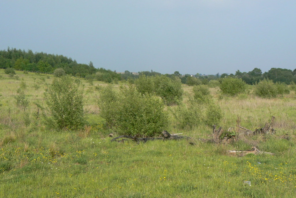
The site was opencasted in the 1980s and 1990s, and no trace of the colliery survives.
None.
Related mines
- Loscoe Colliery — Both Butterley Company pits of the New Langley group; Bailey Brook's last Deep Hard and Deep Soft workings were planned as Bailey Brook, Loscoe.
- Ormonde Colliery — Both Butterley Company pits; workings in the Low Main and Piper seams were planned jointly as Bailey Brook and Ormonde, and Bailey Brook's output went to Ormonde when it closed in 1938.
Nearby mines
- Ormonde Colliery — 0.5 miles (0.8 km) W
- Loscoe Colliery — 0.7 miles (1.2 km) W
- Denby Hall Colliery — 1.8 miles (2.8 km) W
- Brinsley Colliery — 2.0 miles (3.3 km) NE, Nottinghamshire
- Cotmanhay Colliery — 2.3 miles (3.8 km) SE
Straight-line distance, within 9 miles (15 km). Show on the map.
Recorded claims
Individual factual claims, each attached to the source(s) that support it below. Where sources disagree, both are kept.
- 'Bayley Brook Pit' is marked on Sanderson's map of 1835, linked to the Erewash Canal by a horse-drawn tramroad. 1
- In 1847 further pits were sunk to work the Deep Soft and Deep Hard seams. 1
- About 1918 the Butterley Company deepened the shafts to the Kilburn seam, allowing the Piper and Low Main seams to be worked. 1
- The colliery employed 411 in 1894 and 593 in 1933. 2
- The Butterley Company closed Bailey Brook Colliery in 1938. 1,3,4
- Some workings in the Low Main (or Tupton) and Piper seams were planned jointly as Bailey Brook and Ormonde, abandoned in 1914. 5
- The colliery belonged to the Butterley Co. Ltd. 2,6
Photographs & further reading
The county Historic Environment Record entry, with the 1835 pits, the 1847 sinkings, the deepening and the closure.
View sourceSources
- (primary) MDR8184 - Bailey Brook Colliery, west of Bailey Brook Drive, Langley Mill (Derbyshire Historic Environment Record) — Derbyshire County Council
- (primary) Bailey Brook Colliery (Durham Mining Museum) — Durham Mining Museum
- (primary) BGS mine plan: BAILEY BROOK, LOSCOE, Deep Hard seam, abandoned 9 November 1938 — British Geological Survey
- (observational) Site of Bailey Brook Colliery (Geograph 1897318) — Geograph (Alan Murray-Rust)
- (primary) BGS mine plan: BAILEY BROOK & ORMONDE, Low Main (or Tupton) and Piper seams, abandoned 13 July 1914 — British Geological Survey
- (secondary) NMRS deaths database record 33635: John William Hicking, Bailey Brook, 1911 — Northern Mine Research Society
Record created: 4 November 2026 · Last researched: 4 November 2026