 MineArchive
Alltycrib Mine
| Also known as | Talybont Mine, Allt-y-crib Mine |
|---|---|
| Location | Talybont, Ceulanamaesmawr, Ceredigion — 52.4840, -3.9909 (exact) |
| Commodities | Lead, Silver |
| Type | Metal |
| Worked | 17th century–1914 |
| Maximum depth | About 20 fathoms below the deep adit (Child's shaft) |
| Operators | J. H. Murchison and Co. (1859–1865, owner) — Held by J. H. Murchison under this name from 1859 to 1865. |
Alltycrib, or Talybont mine, works two lodes across the wooded hill above the village of Talybont in north Ceredigion, and is one of the oldest lead mines of the district. It has an opencast and lines of close-set shafts on the hilltop that may be seventeenth-century, and it was reopened again and again until 1914. Since 1845 it has returned 1,335 tons of lead ore.
Location
Recorded location. The large pin is this mine; the small round markers are the nearest mines on record. Click one for its page. View on full map
History
Talybont was counted with Goginan and Darren among the old mines of Cardiganshire granted to the Myddelton family under James I, and the hilltop workings, an opencast and rows of shafts a few yards apart, are of that early kind. The north lode was followed down from the opencast and from Child's shaft, and the south lode from Wilkins's level, above which large quantities of potters' ore are said to have been won.
The mine on record belongs to the nineteenth century. Ore was returned in 1845 and 1851-52, and then more regularly: 1858, 1860 to 1865, 1870 to 1873, 1875 to 1880 and 1886 to 1890. From 1859 to 1865 it was held by the London share dealer J. H. Murchison, trading as J. H. Murchison and Company. The best year was 1872, with 174 tons.
A last attempt was made in the years before the First World War. It is said to have been the work of Talybont Lead Mines Ltd, formed in 1910. A new cross-cut, Pryse's tunnel, was driven north from the foot of the wood to cut the south lode in depth; it went far enough, but the ore worked in the upper levels was not there, only scattered galena in a wide belt of ground. Ore was returned in 1907 and from 1911 to 1914, and the mine was last working in 1913. Its plan could not be found afterwards.
Geology
Two north-dipping lodes cross the hill on parallel courses about 100 yards apart, with many branches leaving the north lode at surface. A third, the Cwm Leri lode, crosses the River Leri half a mile below the village and strikes north-west; it was rich in the upper two of its three adits and barren in the lowest. The south lode grows poorer downward: productive in the upper drives, it was ill-defined in Pryse's tunnel, with the ore dispersed through a width of ground. In 1912 the ground above the second drive was reckoned at about a ton of galena to the square fathom.
Geological setting: Veins and Lodes (well documented example)
Workings
The north lode was worked in a large opencast on the brow of the hill above the village and from Child's shaft, about 200 yards to the west. A deep adit driven west from the River Ceulan cut the lode and ran on under the shaft, which goes down about 20 fathoms below it to stopes that gave good ore. The south lode was worked at its outcrop and from shallow cross-cuts, the chief of them Wilkins's level, about 12 fathoms below the surface. Below that came two further drives and, lowest, Pryse's tunnel. A plan of 1886 to 1915 covers the workings at Wilkins's level.
Closure
The mine was last working in 1913, and the last return of ore is for 1914.
What remains
Very little is left at surface. The lower site, with the deep adit mouth and dressing floors, was levelled in the 1930s and is now a private garden. Underground, a club visit in January 2018 found the main adit level and Wilkins's level still open, with a flooded working and a greater horseshoe bat in residence.
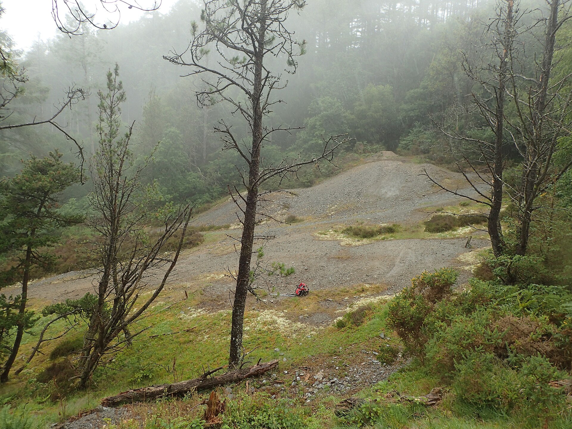
Much pitting and opencast work on the hilltop, with several lines of shafts about 6 yards apart, and old adits running into the hillside lower down.
Related mines
- South Darren Mine — J. H. Murchison and Co. held Alltycrib from 1859 to 1865 and South Darren from 1858 to 1881.
- Tanyrallt Mine — On the same ridge above Talybont: Tanyrallt's lodes run into the old Alltycrib workings, and some Talybont returns may include Tanyrallt ore.
Nearby mines
- Erglodd Mine — 0.7 miles (1.2 km) N
- Penpontbren Mine — 0.8 miles (1.2 km) NE
- Brynarian Mine — 1.8 miles (2.8 km) NE
- Leri Valley Mine — 1.7 miles (2.8 km) E
- Dolclettwr Mine — 1.8 miles (2.9 km) N
Straight-line distance, within 9 miles (15 km). Show on the map.
Further reading
The Royal Commission's site record, with a diagram of the works layout.
View sourceA club's account of a visit underground in January 2018, with photographs.
View sourceSources
- (primary) Lead and Zinc: The Mining District of North Cardiganshire and West Montgomeryshire (Special Reports on the Mineral Resources of Great Britain, vol. XX), O. T. Jones, 1922 — Memoirs of the Geological Survey
- (primary) Alltycrib Mine (NPRN 33802) — Coflein, Royal Commission on the Ancient and Historical Monuments of Wales
- (secondary) A Glimpse at Cwm Brwyno Mine, by R. von Arx (British Mining No. 41, 1990, pp. 64-67) — Northern Mine Research Society
- (observational) Report - Allt-y-Crib (Talybont) 10/3/11 — 28DaysLater
- (observational) Talybont (Alltycrib) Mine Trip, Club Trip 2018 — Shropshire Caving and Mining Club
- (primary) Mine plan: Alltycrib and Tan yr Allt Mine, with a plan of Williams's working at Wilkins level, 1886-1915 (KP16905) — British Geological Survey
Record created: 18 November 2026 · Last researched: 18 November 2026