 MineArchive
Wheal Betsy
| Also known as | North Wheal Friendship, Prince Arthur Consols |
|---|---|
| Location | Mary Tavy, western Dartmoor, Devon — 50.5487, -4.1235 (approximate) |
| Commodities | Lead, Arsenic, Copper, Silver, Zinc |
| Type | Metal |
| Worked | 1740–1877 |
| Operators | John Taylor (1806–?) |
Overview
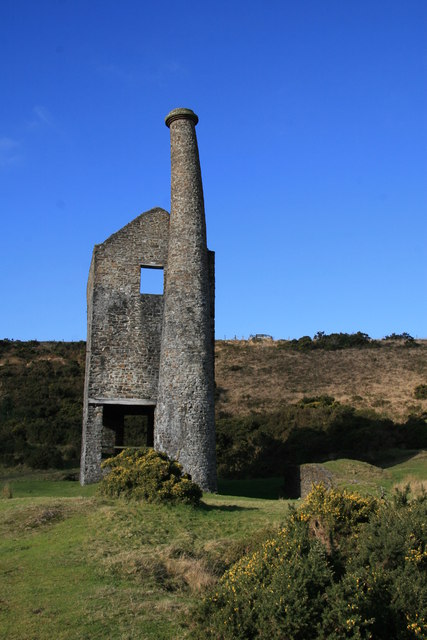
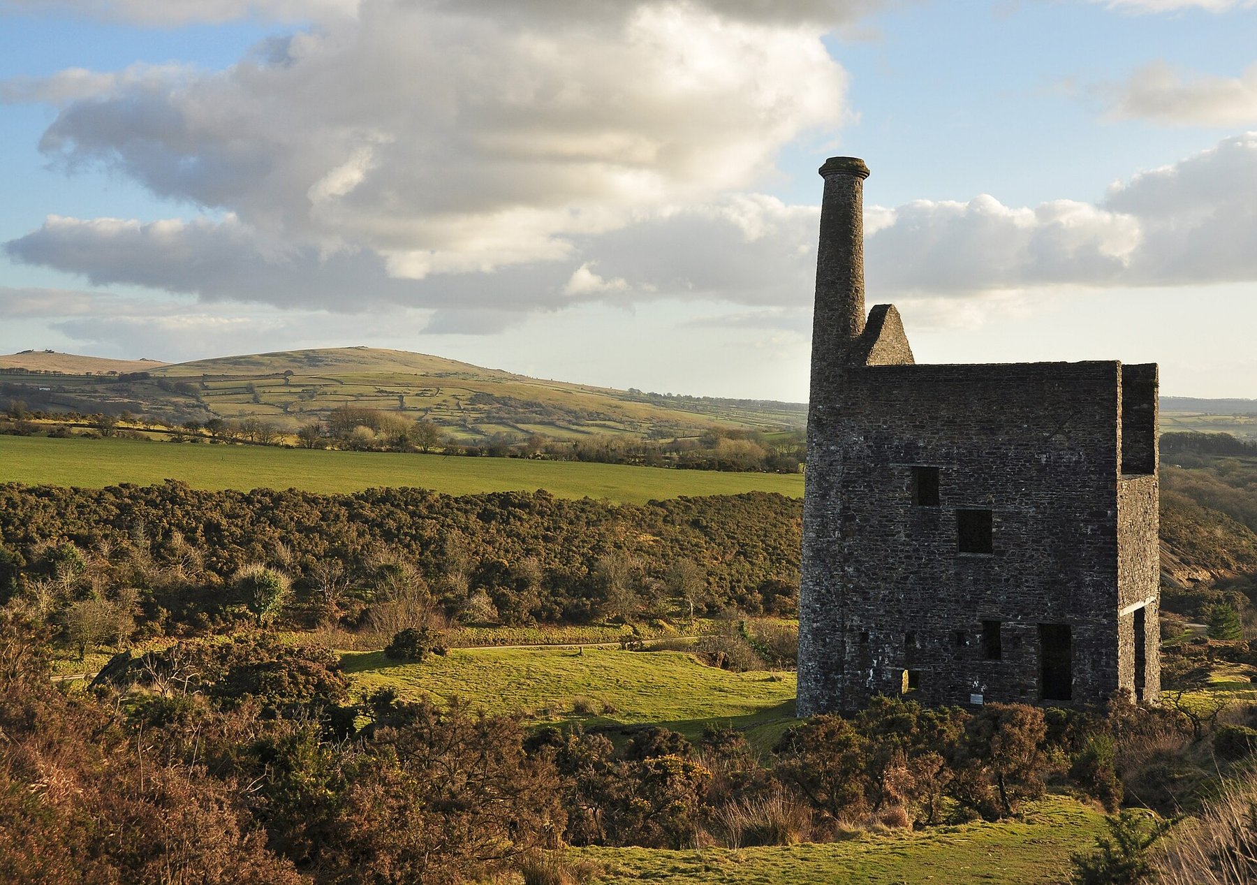
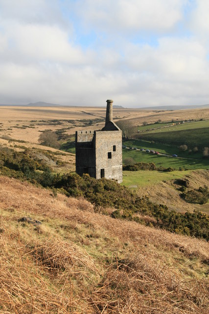
Wheal Betsy, beside the A386 at Mary Tavy on the western edge of Dartmoor, was a lead, silver and zinc mine whose engine house — saved from Army demolition in 1954 and now cared for by the National Trust — is the last one still standing on the moor.
History
The mine opened around 1740, or possibly earlier, and worked until the late 18th century before reopening in 1806 under manager John Taylor, working alongside the neighbouring Wheal Friendship from around 1816. The two separated again in 1837, and, according to the Devon and Dartmoor Historic Environment Record, Wheal Betsy ceased working altogether by 1846 before reopening under new owners as Prince Arthur Consols in 1863.
Its most prosperous decade came in the 1820s: between 1821 and 1830 Wheal Betsy yielded 52,302 ounces of silver and around 4,000 tons of pig lead, generating net income of £102,661; the silver, present in significant enough quantities to need on-site cupellation refining, was fashioned by the London silversmiths Rebecca Emes and Edward Barnard into commemorative snuff boxes around 1820. Lead prices crashed in 1828–29, and although the mine saw further working under later operators, including as Prince Arthur Consols from 1863, it finally closed in 1877 after 137 years of intermittent working, once falling lead prices made continued pumping uneconomic. A Cornish beam pumping engine, housed from 1868 in the granite engine house that still stands today, operated at Job's Shaft until closure.
In 1954 the Army, which used the surrounding moor for training, sought permission to demolish the derelict engine house; campaigners including the Cornish historian A.K. Hamilton Jenkin intervened, and the building was saved. It passed to the National Trust in 1967, which repaired the ruin and secured its distinctively leaning chimney stack against collapse.
Geology
The mine worked a lode running roughly north-south from Job's Shaft, developed over about three-quarters of a mile and yielding lead, copper, silver, zinc and arsenic; the ore was principally galena, and historic mineralogical surveys also record chalybite, limonite and vivianite occurring at the site.
Workings
The surviving engine house was built in 1868 from locally quarried, roughly dressed granite to house a Cornish beam pumping engine at Job's Shaft, which operated there until the mine's closure in 1877; five water wheels also provided power for pumping and milling elsewhere on the site over its working life. The building originally had a timber gantry extending from its front wall to allow maintenance of the beam, and timber door and window lintels, none of which survive; much of the original internal plaster does.
Closure
The mine closed in 1877, becoming uneconomic to keep pumping once lead prices had fallen to their lowest. It had seen near-continuous activity from 1804, but according to a 1992 archaeological survey was genuinely prosperous only during the 1830s and 1860s, the intervening years dominated by drainage problems that demanded heavy, recurring investment in pumping machinery. Between 1845 and 1875 alone, recorded output was 540 tons of lead and over 2,000 ounces of silver.
What remains
The engine house at Job's Shaft — the only one still standing on Dartmoor — remains a National Trust property beside the A386. Repaired and consolidated as a ruin by the National Trust in 1967, it lost its original floor joists in the process and had a tie bar fitted to stop its distinctively leaning chimney stack from collapsing; both remain in place today.
Beyond the engine house, the mine's core area preserves a ruined wheelpit and a well-preserved ore-dressing floor with buddles and in-situ dressing waste, described by a 1991 archaeological assessment as including the only known surviving 18th- to early-19th-century washing floors in the Devon and Cornwall mining region. The wider mining landscape along the Cholwell Brook extends well beyond this core: to the north, earthworks of spoil heaps, leats, rakes and probable hushes; to the south, earlier washing floors on both banks of the stream with cobbled floors and at least one rectangular buddle, along with bellpits and further dressing waste tips.
Related mines
- Devon United Mine — The north-south cross-course that heaves the Wheal Friendship and Devon United lodes is believed to be the southerly extension of the Wheal Betsy structure, the lead lode proved for some 6.5 km at the north end of this orefield.
- Wheal Friendship — The two mines worked alongside each other from around 1816 until separating again in 1837.
- Wheal Jewell — The Mary Tavy hydroelectric generators drew on a leat that had originally fed both Wheal Betsy and Wheal Friendship.
Nearby mines
- Wheal Crebor — 2.5 miles (4.0 km) SW
- Wheal Friendship — 2.7 miles (4.3 km) N
- Merrivale Quarry — 3.1 miles (5.0 km) E
- Wheal Jewell — 3.3 miles (5.3 km) N
- Devon United Mine — 3.6 miles (5.8 km) NE
Straight-line distance, within 9 miles (15 km). Show on the map.
Recorded claims
Individual factual claims, each attached to the source(s) that support it below. Where sources disagree, both are kept.
- Between 1821 and 1830, Wheal Betsy's most prosperous decade, the mine yielded 52,302 ounces of silver and around 4,000 tons of pig lead, generating net income of £102,661. 1
- Silver from Wheal Betsy was fashioned by the London silversmiths Rebecca Emes and Edward Barnard into commemorative snuff boxes around 1820. 1
- A Cornish beam pumping engine operated at Job's Shaft from 1868 until the mine's closure in 1877. 2
- In 1954 the Army sought permission to demolish the derelict engine house; campaigners including the Cornish historian A.K. Hamilton Jenkin intervened to save it, and it passed to the National Trust in 1967. 1
- The surviving engine house was built in 1868 from locally quarried, roughly dressed granite to house the Cornish beam pumping engine at Job's Shaft; it originally had a timber gantry for maintaining the beam and timber door and window lintels, none of which survive, though much of the original internal plaster does. 3
- The mine worked a lode running roughly north-south from Job's Shaft, developed over about three-quarters of a mile, and is recorded by both Historic England and the Devon and Dartmoor Historic Environment Record as having produced lead, copper, silver, arsenic and zinc. 3,4
- The mine's core area preserves a ruined wheelpit and a well-preserved ore-dressing floor with buddles and in-situ dressing waste, assessed in 1991 as including the only known surviving 18th- to early-19th-century washing floors in the Devon and Cornwall mining region. 4
- Beyond the engine house's core area, the surrounding mining landscape along the Cholwell Brook includes, to the north, earthworks of spoil heaps, leats, rakes and probable hushes, and to the south, earlier washing floors on both banks of the stream with cobbled floors, at least one rectangular buddle, bellpits and further dressing waste tips. 4
- Having worked jointly with the neighbouring Wheal Friendship from around 1816, Wheal Betsy separated again in 1837 and, per the Devon and Dartmoor Historic Environment Record, ceased working altogether by 1846 before reopening under new owners as Prince Arthur Consols in 1863. 4,5
- Recorded output between 1845 and 1875 was 540 tons of lead and over 2,000 ounces of silver; a 1992 archaeological survey found the mine had seen near-continuous activity since 1804 but was genuinely prosperous only during the 1830s and 1860s, its intervening years dominated by drainage problems that demanded heavy, recurring investment in pumping machinery. 4
- The mine closed in 1877 when it became uneconomic to keep pumping at a time when lead prices were at their lowest. 3
- When the National Trust repaired and consolidated the engine house as a ruin in 1967, its original floor joists were removed and a tie bar was fitted to stop the leaning chimney stack from collapsing; both remain in place today. 3
- Water was the mine's persistent problem: in 1835 the adit of the neighbouring Wheal Friendship, then worked by the same company, was driven to drain Wheal Betsy down to the 40-fathom level, before the two concerns separated in 1837. 6,7
- By 1842 the mine was equipped with four overshot waterwheels for pumping, hoisting and crushing lead ore; it was nonetheless running at a loss again by 1846 and was abandoned. 6
- The mine employed 128 men in 1868, the year the steam pumping engine house was built; the investment did not pay, the mine passed to another company in 1869, and that company worked it on a reduced scale until final closure in 1877. 6,7
- A new Glasgow-based company reopened the mine in 1863 under the name Prince Arthur Consols and installed a great deal of new equipment; its 1866 output of around 210 tons of lead ore, realising £2,882, did not cover the outlay. 1,6
Photographs & further reading
A photographed walk across Kingsett Down past the workings of the former copper and lead mines around Wheal Betsy, with grid-referenced views of the shafts, spoil and Wheal Jewell reservoir.
View sourceThe NMRS's concise dated history of the mine from the 1700s to 1877, with the 1835 adit, the 1842 waterwheels and the 1868 workforce figure.
View sourceA short National Trust film of the engine house and its surroundings, useful for a current view of the consolidated ruin and the leaning stack.
View sourceDrone footage over the engine house, the Cholwell Brook valley and the surrounding spoil and shaft sites, showing how the mining landscape sits against the A386.
View sourceSources
- (secondary) Wheal Betsy — a place of history and legend — Legendary Dartmoor
- (secondary) Wheal Betsy (North Wheal Friendship; Prince Arthur Consols), Mary Tavy, West Devon — Mindat
- (primary) Wheal Betsy pumping house, Mary Tavy — Historic England (Scheduled Monument listing 1003191)
- (primary) Wheal Betsy Mine (HER MDV3185) — Devon and Dartmoor Historic Environment Record
- (secondary) Wheal Betsy Mine, Devon — Mining in Devon Database
- (secondary) Wheal Betsy — Northern Mine Research Society
- (secondary) Shining a spotlight on West Devon's heritage: Wheal Betsy (13 November 2025) — West Devon Borough Council
Record created: 19 August 2026 · Last researched: 3 September 2026