 MineArchive
Wharncliffe Carlton Colliery
| Location | Smithies, north of Barnsley, South Yorkshire — 53.5706, -1.4752 (exact) |
|---|---|
| Commodity | Coal |
| Type | Coal |
| Worked | c. 1878–1910 |
| Maximum depth | 160 yards |
| Operators | Craik and Company (1878–1893), J. J. Edey (1893–1910) |
Overview
A single-shaft Barnsley-seam colliery at Smithies, sunk by Robert Craik in the later 1870s and ventilated through his East Gawber Hall Colliery a mile and a half away. Twenty men died in an explosion in October 1883, after which it was flooded; it closed in 1910.
History
Wharncliffe Carlton Colliery stood on the south edge of Smithies, a mile and a half north of Barnsley on the border of Monk Bretton and Carlton, close to the Manchester, Sheffield and Lincolnshire Railway. Robert Craik sank it in the later 1870s to raise more coal from the ground he already worked at East Gawber Hall Colliery, a mile and a half away, and R. Craik and Co. ran the two as one: Wharncliffe Carlton had a single downcast shaft, 13 feet 6 inches across and 160 yards deep, and its return air travelled the connecting road to be drawn up East Gawber's upcast. Between them the pits employed about 800 people in the Barnsley seam.
The seam here averaged nine feet and was worked longwall, all the coal being taken except where pillars were left beside faults. Faults were frequent; one, the St Helens throw, displaced the seam by 30 yards and was passed by a stone drift 130 yards long for the intake and a staple pit for the return. Beyond it lay the Dip district, with 31 acres worked by 1883, and a newer Rise district with a face of about 80 yards.
Just after midnight on 18 October 1883 an explosion in the Dip killed all twenty of the repairers at work there; five men elsewhere in the pit escaped. Fire was found burning three days later and a second explosion followed while the inquest was sitting. The pit was sealed off from East Gawber and flooded to put the fire out, and stood for weeks; three of the bodies were never recovered.
Craik sold the colliery in 1893 to J. J. Edey, and it closed in 1910.
Geology
The Barnsley seam of the South Yorkshire Coal Measures, nine feet thick on average and dipping gently from east to west, much broken by faults; the St Helens throw displaced it by 30 yards.
Geological setting: Sedimentary Beds and Seams (well documented example)
Workings
One downcast shaft, 13 feet 6 inches in diameter and 160 yards deep, with the return air carried by a connecting road to the upcast at East Gawber Hall Colliery (155 yards). Longwall working in a Dip district beyond the St Helens fault, reached by a 130-yard stone drift and a 30-yard staple pit and divided into Gilliot's level, the Jump, the Low South and Nos. 1 and 2 slants, and a smaller Rise district. The main intake was an engine plane.
Closure
Closed in 1910 under J. J. Edey, who had bought it from Craik in 1893.
What remains
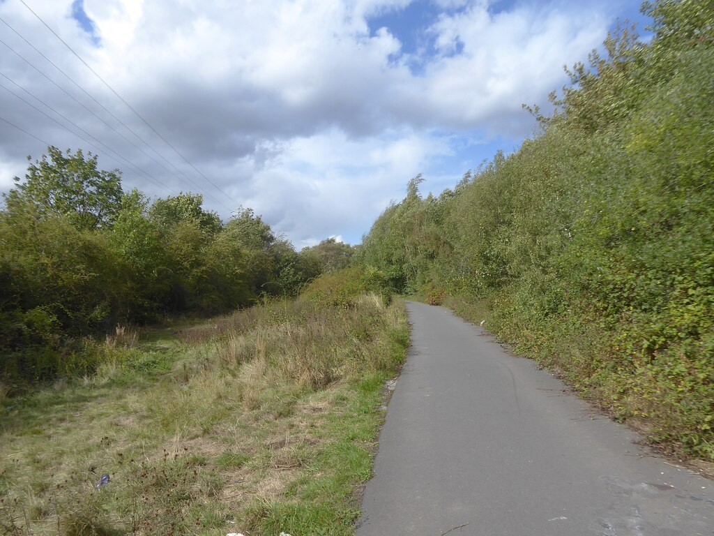
The site is used by Barnsley Council as a commercial waste centre; a surfaced path runs beside it along the former Barnsley Coal Railway extension.
Related mines
- East Gawber Colliery — Sunk by Robert Craik to serve East Gawber Hall Colliery; the two were connected underground and Wharncliffe Carlton's return air went up East Gawber's upcast.
Nearby mines
- East Gawber Colliery — 0.3 miles (0.5 km) NW
- Wharncliffe Woodmoor Colliery — 1.0 miles (1.6 km) NE
- North Gawber Colliery — 1.4 miles (2.2 km) NW
- Mount Osborne Colliery — 1.5 miles (2.4 km) S
- Barnsley Main Colliery — 1.6 miles (2.5 km) SE
Straight-line distance, within 9 miles (15 km). Show on the map.
Disasters & major incidents
-
Wharncliffe Carlton Colliery explosion, 1883
18 October 1883 · Explosion · 20 fatalities
Just after midnight on 18 October 1883 gas exploded in the dip district of Wharncliffe Carlton Colliery, Barnsley, killing all 20 men on the night shift there. Fire followed, the pit was flooded to put it out, and only 17 bodies were recovered.
Recorded claims
Individual factual claims, each attached to the source(s) that support it below. Where sources disagree, both are kept.
- The colliery was owned by Messrs R. Craik and Company and worked with their East Gawber Colliery, to which it was connected underground. 1,2
- Robert Craik sank the colliery to increase the output of his East Gawber Hall Colliery; it had been working about five years in 1883. 3
- The single downcast shaft was 13 feet 6 inches in diameter and 160 yards deep; the upcast, at East Gawber, was 155 yards deep. 1
- The Barnsley seam averaged nine feet and was worked longwall; the St Helens fault threw it 30 yards. 1
- Craik employed about 800 people in the Barnsley seam at the two connected pits. 3
- An explosion in the Dip district just after midnight on 18 October 1883 killed twenty men and boys. 1,3,2,4
- After a second explosion the colliery was sealed off from East Gawber and flooded to put out the fires; three bodies were never recovered. 3,4
- Craik sold the colliery in 1893 to J. J. Edey, and it closed in 1910. 3
- The site is now a Barnsley Council commercial waste centre, beside the former Barnsley Coal Railway extension. 3,5
- Plans of the Barnsley Bed at Wharncliffe Carlton are held in the mine plans catalogue. 6
Photographs & further reading
The colliery's shaft, districts, faults and ventilation, with the course of the explosion and the inquiry.
View sourceA local historian's account of the pit's short life, the 1883 disaster, its sale in 1893 and its closure.
View sourceA 2025 photograph of the path along the former railway beside the site of the colliery.
View sourceSources
- (secondary) Wharncliffe Carlton Colliery Explosion - Barnsley - 1883 — Northern Mine Research Society
- (primary) Wharncliffe Carlton Colliery — Durham Mining Museum
- (secondary) The Wharncliffe Carlton Colliery Explosion - 140 Years Later — AroundTown Magazine
- (secondary) Smithies, South Yorkshire — Wikipedia
- (observational) Path on former railway (photograph) — Geograph
- (primary) Mine plan: WHARNCLIFFE CARLTON, Barnsley Bed (feature 21890535) — British Geological Survey / Mining Remediation Authority mine plans catalogue
Record created: 3 October 2026 · Last researched: 3 October 2026