 MineArchive
Westerton Colliery
| Location | Westerton, near Bishop Auckland, County Durham — 54.6812, -1.6332 (exact) |
|---|---|
| Commodity | Coal |
| Type | Coal |
| Worked | 1840 (sinking)–October 1961 |
| Maximum depth | 480 ft (80 fathoms, 1894) |
| Operators | Black Boy Coal Company (1841–?), Bolckow, Vaughan and Company (1872–1929), Dorman, Long and Company (1929–1947), National Coal Board (1947–1961) |
Overview
A colliery at Westerton, near Bishop Auckland, sunk in 1840 by Nicholas Wood's Black Boy Coal Company and worked with Binchester by Bolckow, Vaughan from 1872, with nearly 400 coke ovens between them; abandoned in stages from 1928, it worked again under the National Coal Board until October 1961.
History
Westerton Colliery lay at Westerton, on the ridge north-east of Bishop Auckland, seven miles south-south-west of Durham. Borings in 1838 proved the Main Coal, and on 21 January 1840 a sinking was begun to the Five Quarter and then, once the pumps and engines were working, about 11 fathoms further to the Main Coal. The colliery began shipping coal in 1841. Its first owners were Nicholas Wood and his partners, trading as the Black Boy Coal Company, and Nicholas Wood held it in the 1850s.
Bolckow, Vaughan and Co. took it over on 1 April 1872. By 1894 they worked the royalty through two pits, Westerton and Binchester, which were one as far as the surface was concerned: Binchester drew 800 tons a day from the Harvey at 40 fathoms and the Brockwell at 80, and Westerton 350 tons from the Five Quarter and Main Coal at 80 fathoms. A Guibal fan 36 feet across at Westerton ventilated both, coal for coking was washed in Robinson's patent washers, the waste gas from 395 coke ovens heated the boilers, and the two pits employed some 800 men and boys. Westerton's own workforce rose from 409 in 1883 to 625 in 1910 and 750 in 1921, across its North and South pits.
By 1925 it was all but closed, with 70 men, and the Hutton was abandoned in December 1928. Dorman, Long and Co. took it over on 1 November 1929 and had 357 men there in 1930, but the Brockwell was abandoned in June 1930, the Busty and Beaumont in October 1931 and the remaining seams in October 1932, on plans that took in old workings from Black Boy and Leasingthorne and those of Byers Green and Newfield. The colliery was standing in 1940. The National Coal Board worked it again, with 198 men in 1960, until it closed in October 1961 with the abandonment of the Bottom Hutton; the shaft was kept as a pumping station into the mid-1960s. The museum's list of those killed holds 58 names.
Geology
Durham coalfield: the account of the sinking records the Five Quarter, 4 ft 4 in thick at 96 ft, and the Main Coal, 4 ft 6 in at 169 ft 6 in. By 1894 the Five Quarter and Main were worked at 80 fathoms; the Brockwell, Harvey, Busty, Beaumont, High Main, Hutton and Bottom Hutton were worked later.
Workings
North and South pits, worked with the adjoining Binchester pit as one surface plant in the 1890s, and a North Hutton drift in 1925.
Closure
Abandoned in stages from 1928 to 1932 and standing in 1940; worked again under the National Coal Board and closed in October 1961, after which the shaft served as a pumping station.
What remains
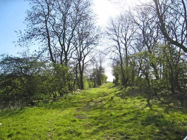
The trackbed of the mineral railway that served Westerton and Leasingthorne collieries survives off Windlestone Lane.
Redevelopment
Unknown.
Related mines
- Black Boy Colliery — Both belonged to the Black Boy Coal Company, and Westerton's 1932 plans include old Black Boy workings.
- Byers Green Colliery — Westerton's plans of 1932 were deposited together with those of Byers Green and Newfield.
- Leasingthorne Colliery — Westerton's 1932 abandonment plans include workings from Leasingthorne, and one mineral railway served both collieries.
Nearby mines
- Middlestone Moor Colliery — 0.1 miles (0.2 km) SE
- Leasingthorne Colliery — 1.3 miles (2.0 km) SE
- Byers Green Colliery — 1.3 miles (2.1 km) NW
- Merrington Colliery — 1.4 miles (2.3 km) NE
- Whitworth Park Colliery — 1.6 miles (2.6 km) NE
Straight-line distance, within 9 miles (15 km). Show on the map.
Recorded claims
Individual factual claims, each attached to the source(s) that support it below. Where sources disagree, both are kept.
- A sinking was begun on 21 January 1840, and the colliery began shipping coal in 1841. 1
- Nicholas Wood and partners, the Black Boy Coal Company, owned it in 1841. 1
- Bolckow, Vaughan and Co. took it over on 1 April 1872. 1
- In 1894 Westerton drew 350 tons a day from the Five Quarter and Main at 80 fathoms, worked with Binchester; the two employed some 800 and had 395 coke ovens. 1
- The Hutton seam was abandoned in 1928. 2,3
- The colliery closed in October 1961 with the abandonment of the Bottom Hutton. 1,4
Photographs & further reading
The museum's page for the colliery, with owners, employment, seams, the 1894 directory description and a list of those killed.
View sourceSources
- (primary) Westerton Colliery — Durham Mining Museum
- (primary) Westerton Colliery: catalogue of plans of abandoned mines — Durham Mining Museum
- (primary) BGS mine plan: Westerton, Hutton seam, abandoned 1928 — British Geological Survey
- (primary) BGS mine plan: Westerton, Bottom Hutton 'L2', abandoned 1961 — British Geological Survey
Record created: 6 October 2026 · Last researched: 6 October 2026