 MineArchive
Sykes Mine
| Also known as | Sykes Lead Mine |
|---|---|
| Location | Sykes, Trough of Bowland, Losterdale Brook, Lancashire — 53.9615, -2.5682 (exact) |
| Commodities | Lead, Barite |
| Type | Metal |
| Worked | By 1767–By 1857 |
| Maximum depth | Unknown. |
Overview
Two lead levels driven along the Sykes anticline on either side of Losterdale Brook in the Trough of Bowland, worked in a small way from at least 1767 and probably in the 1820s and 1830s; marked as an old lead mine by 1857.
History
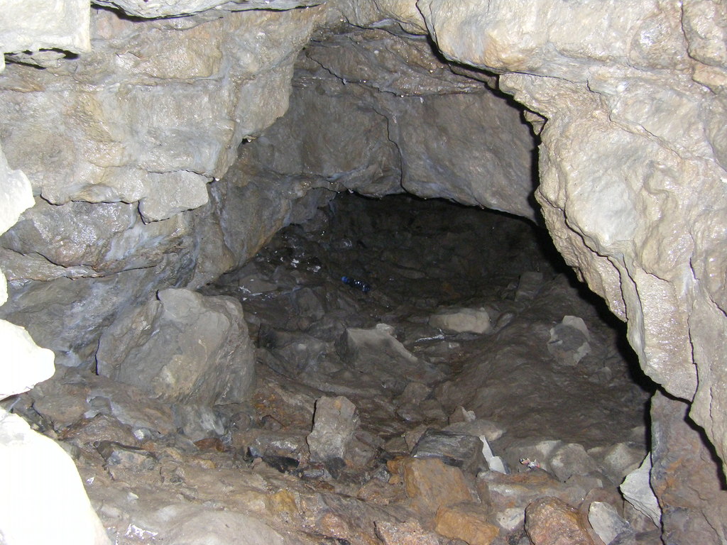
Sykes Mine lies in the Trough of Bowland, by Sykes farm, where two levels were driven on either side of Losterdale Brook along the Sykes anticline, which has limestone at its core and runs north-east towards Whitendale. Faults at the top of the Lower Limestone are mineralised with blende, galena, copper pyrites, malachite, fluorspar, barytes and quartz, and the principal vein is a fault along the axis of the anticline. In the quarry on the west bank an adit is said to have been driven west on the main vein for some 126 metres; on the east bank, nearly opposite, another level runs north-east for about 198 metres, also on the main vein, with a shallow sump where it crosses a cross vein 24 metres in.
The age of the workings is not known. In 1767 James Swale of Grassington raised enough ore at Sykes to make 12 hundredweight of lead at the Grassington Low Smelt Mill. Fenwick Coulthard, a miner from Stanhope in County Durham, lived near Newton in Bowland from about 1820 to the late 1830s and may have worked here, which may date the two levels to 1820-39. The site was marked as an 'Old Lead Mine' on the 1857 Ordnance Survey map and disappears from later maps. Galena, barytes and copper staining are common in the tips, though the amounts raised were never great, and a barytes vein up to a metre wide shows in the face of the western quarry, from which building stone was also taken.
Geology
A fault vein along the axis of the Sykes anticline (pericline), in the Lower Limestone with chert, carrying blende, galena, copper pyrites, malachite, fluorspar, barytes and quartz.
Workings
Two levels on the main vein, about 126 m (west bank, from a quarry) and 198 m (east bank) long, with a shallow sump at a cross vein.
Closure
Shown as an old lead mine on the 1857 Ordnance Survey map.
What remains
Both adits survive in the Sykes quarries, with mineralised tips.
Adit entrances in the two quarries and waste tips with galena, barytes and copper staining.
Redevelopment
Unknown.
Related mines
- Brennand Mine — Bowland lead workings on the Sykes and Brennand anticlines, about 3 km apart.
Nearby mines
- Brennand Mine — 1.9 miles (3.0 km) NE
- Ashnott Lead Mine — 4.6 miles (7.5 km) SE
Straight-line distance, within 9 miles (15 km). Show on the map.
What's uncertain
Points where sources disagree or the record could not be settled; both accounts are kept. All open questions in the archive.
- The two levels may date from 1820-1839, when Fenwick Coulthard lived near Newton. (uncertain) 1
Recorded claims
Individual factual claims, each attached to the source(s) that support it below. Where sources disagree, both are kept.
- Two levels, one on either side of Losterdale Brook, were driven along the Sykes anticline, about 126 m and 198 m on the main vein. 1
- Adits on both the east and west sides of Losterdale Brook in the Sykes Quarries testify to former workings; galena, barytes and copper staining are common in the tips, but the amounts extracted were never great. 2
- In 1767 James Swale of Grassington raised enough ore at Sykes to make 12 cwt of lead. 1
- Sykes is marked as an 'Old Lead Mine' on the 1857 Ordnance Survey map. 1
- The two levels may date from 1820-1839, when Fenwick Coulthard lived near Newton. (uncertain) 1
- The two disused Sykes quarries, in the core of the Sykes Anticline, give spectacular evidence of tectonically induced gravity slide and slump structures. 3
Sources
- (secondary) Sykes Mine — Northern Mine Research Society
- (primary) Geology of the Trough of Bowland area (SD 65 SW), BGS Technical Report WA/87/46 — British Geological Survey
- (secondary) Sykes Quarries, Lancashire (GCR potential site) — GeoGuide (Scottish Geology Trust, from JNCC GCR volume 29)
Record created: 17 October 2026 · Last researched: 17 October 2026