 MineArchive
Sutton Colliery
| Location | Stanton Hill, Sutton-in-Ashfield, Nottinghamshire — 53.1346, -1.2803 (approximate) |
|---|---|
| Commodity | Coal |
| Type | Coal |
| Worked | 1874–25 August 1989 |
| Maximum depth | 1,394 feet (425 m), below the Low Main |
| Operators | National Coal Board (1947–1989) |
Overview
A colliery at Stanton Hill, Sutton-in-Ashfield, opened in 1874 to replace Skegby Colliery, known locally as Brierley Colliery or the 'Bread and Herring Pit'. An explosion in 1957 killed five; it closed in 1989 and its site is now Brierley Forest Park.
History
Sutton Colliery was opened in 1874 to replace Skegby Colliery, three quarters of a mile to the west; a plaque on the site names the Skegby Colliery, Lime and Brick Company, while Wikipedia gives the Stanton Iron and Coal Company. Two small shafts were sunk to the Top Hard at about 600 feet. Staffordshire colliers brought in to sink them are said to have named it Brierley Colliery, after Brierley Hill; it was also called the 'Bread and Herring Pit' for its poor condition. Between 1896 and 1902 the shafts were widened to 14 feet and deepened below the Low Main horizon to 1,394 feet; No. 1, the upcast, wound from the Deep Hard and No. 2 from the Low Main.
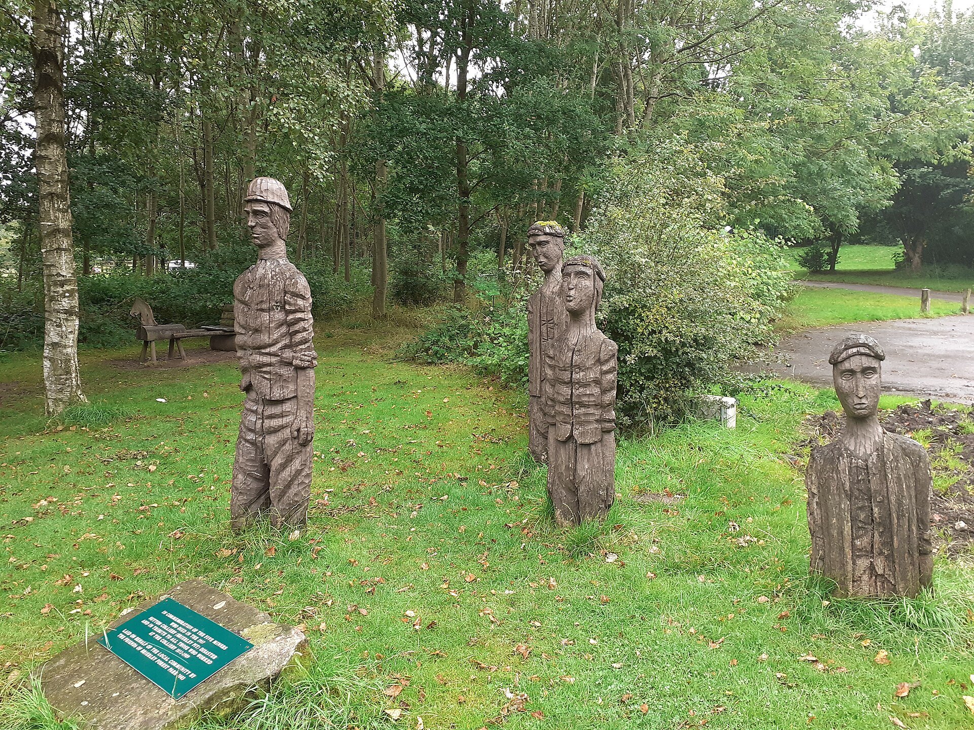
The Top Hard and Dunsil were worked out by 1922 and 1916. An explosion in the Low Main killed five in February 1957 (see Disasters, below). The Piper and Deep Hard were exhausted when the colliery closed on 25 August 1989. Its site became the 250-acre Brierley Forest Park, where wooden figures of miners recall the five dead of 1957.
Geology
Nottinghamshire Coal Measures: the Top Hard, Dunsil, Deep Hard, Deep Soft, Low Main and Piper seams.
Workings
Two shafts, sunk in 1874 to about 600 feet and widened to 14 feet and deepened to 1,394 feet in 1896-1902; No. 1 upcast winding from the Deep Hard, No. 2 downcast from the Low Main; mechanised faces with an Anderson shearer by 1957.
Closure
Closed on 25 August 1989, when the Piper and Deep Hard seams were exhausted.
What remains
Wooden sculptures of miners and a memorial stone stand on the site.
Redevelopment
The site is Brierley Forest Park, a local nature reserve since 2006.
Nearby mines
- Silverhill Colliery — 0.4 miles (0.6 km) NE
- Teversal Colliery — 1.4 miles (2.2 km) N
- Tibshelf Colliery — 2.0 miles (3.2 km) W, Derbyshire
- Kirkby Colliery — 2.2 miles (3.5 km) SE
- B Winning Colliery — 2.2 miles (3.6 km) SW, Derbyshire
Straight-line distance, within 9 miles (15 km). Show on the map.
Disasters & major incidents
-
Sutton Colliery explosion, 1957
21 February 1957 · Explosion · 5 fatalities
At about 11.30 on 21 February 1957 a stone fell from a gas-filled cavity over the loader gate of the new 28's face in the Low Main at Sutton Colliery, Sutton-in-Ashfield, and smashed a conveyor motor's terminal box. The flash fired the firedamp; twenty-five men were burned and five died.
What's uncertain
Points where sources disagree or the record could not be settled; both accounts are kept. All open questions in the archive.
- The shafts were sunk in 1874 by the Stanton Iron and Coal Company. (disputed) 3
- It was opened by the Skegby Colliery, Lime and Brick Company. (disputed) 1,2
Recorded claims
Individual factual claims, each attached to the source(s) that support it below. Where sources disagree, both are kept.
- The colliery opened in 1874 to replace Skegby Colliery, three quarters of a mile to the west. 1,2
- The shafts were sunk in 1874 by the Stanton Iron and Coal Company. (disputed) 3
- It was opened by the Skegby Colliery, Lime and Brick Company. (disputed) 1,2
- It was known locally as Brierley Colliery or the 'Bread and Herring Pit'. 3,2
- In 1896-1902 the shafts were widened to 14 feet and deepened to 1,394 feet below the Low Main. 3,1
- An explosion in the Low Main on 21 February 1957 burned twenty-five men; five died. 3,1
- The colliery closed on 25 August 1989. 3
Photographs & further reading
The shafts, seams, 1957 explosion and Brierley Forest Park.
View sourceThe 1957 explosion, with the colliery's shafts and seams.
View sourceSources
- (secondary) Sutton Colliery Explosion - Mansfield - 1957 — Northern Mine Research Society
- (observational) Sutton Colliery black plaque — Open Plaques
- (secondary) Sutton Colliery — Wikipedia
Record created: 4 October 2026 · Last researched: 4 October 2026