 MineArchive
Stags Fell Quarries
| Also known as | Sedbusk Mine, Stags Fell Quarry |
|---|---|
| Location | Stags Fell (Abbotside Common), above Sedbusk, High Abbotside, North Yorkshire — 54.3263, -2.1991 (approximate) |
| Commodities | Sandstone, Flagstone |
| Type | Quarry |
| Worked | By 1854–1930s |
| Maximum depth | Shallow drift workings: the underground sections run about 50 yards or less into the hillside. |
| Operators | A. Alton (1880–1890), John Alton (1900–1910), J. W. Astley (1910–1920), T. G. and A. Metcalf (1920–1925) |
Overview
Extensive sandstone flag and roofing-slate workings on Stags Fell above Sedbusk in upper Wensleydale — a line of quarries and short drift mines, opencast by 1854 and with up to seven levels by 1910, worked into the 1930s.
History
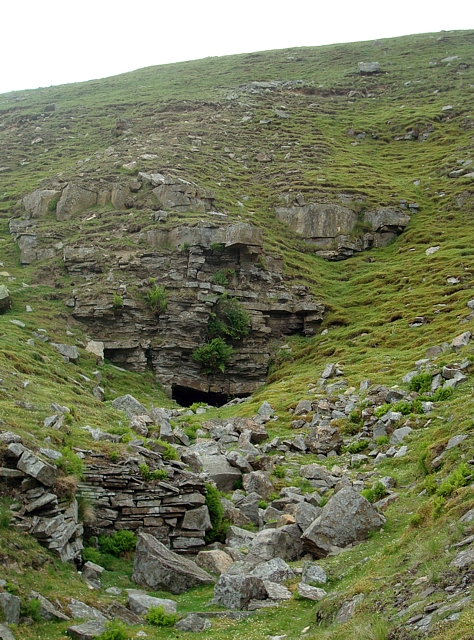
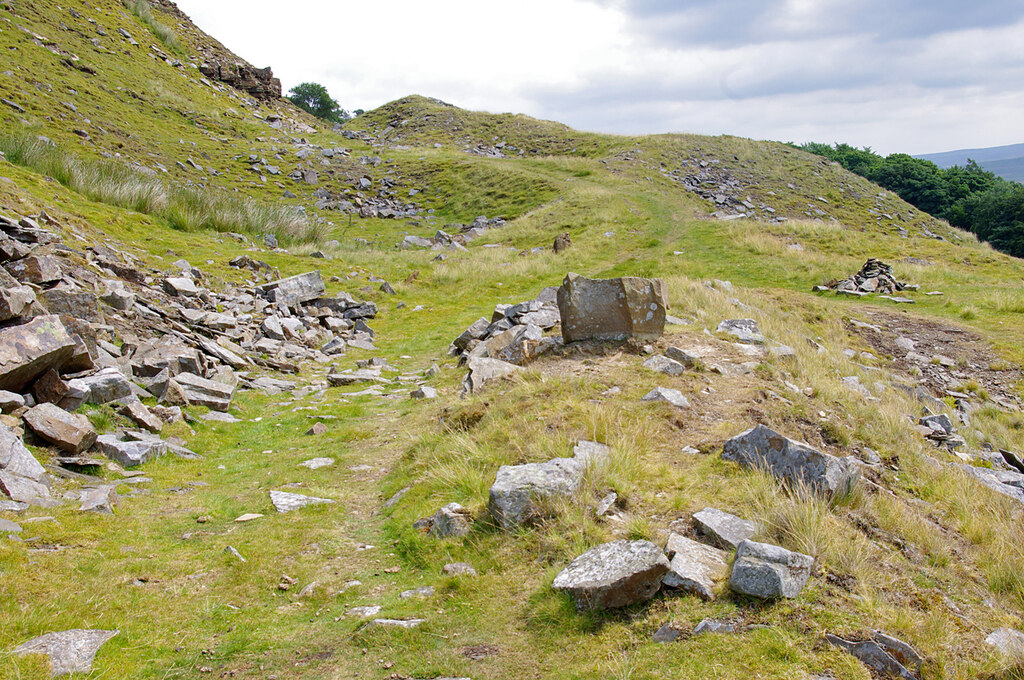
Sedbusk lies on the north side of upper Wensleydale, beneath Stags Fell, which was formerly a centre of quarrying for stone. The Stags Fell Quarries — New, Low, High and Old Quarry among them — are the most extensive stone workings in the Yorkshire Dales, still visible from Hawes as an unbroken line of spoil heaps along the edge of the fell. Though called quarries, much of the stone was won from short drift mines driven into the hillside. They produced split sandstone for roofing, flagstones and millstones: old maps show an opencast quarry here by 1854 and up to seven levels by 1910, and roofing 'slates' sold as Hardraw Slates, after the nearest hamlet, were made until the 1930s. The stone went first to Hawes, Gayle and nearby villages, carried down a nineteenth-century tramway to the road; once the railway reached Hawes it found much wider markets, and stone from the fell is said to have been used for Manchester's Victoria Station. The official Lists of Mines name the operators as A. Alton in the 1880s, John Alton in the 1900s, J. W. Astley in the 1910s and T. G. and A. Metcalf in the 1920s, with a workforce of only two to eight, typically half of them underground; the quarry was not worked in 1915. The fell also had a small colliery, though its coal is believed to have been worked only to fuel lime-burning rather than for wider sale, and lime kilns and lead workings survive higher on the moor. Quarrying here ceased in the 1930s. This is a more modest working than the lead mines elsewhere in Wensleydale, an area that had produced lead since at least monastic times and whose ore, in 1378, was used to rebuild the gatehouse of Carlisle Castle. In 1964 the site was photographed as 'derelict land' for the North Riding council's Eyesores programme, when afforestation was suggested.
Geology
Bands of easily split sandstone (gritstone) worked for roofing flags, flagstones and millstones. Wikipedia's article on Sedbusk calls the stone Yoredale Limestone; the National Park's historic environment team, the official Lists of Mines (flagstone, slate and sandstone, with 'whinstone' in 1902) and Geograph contributors all describe sandstone or gritstone.
Workings
Opencast quarries and short drift mines along several levels of the fell side — up to seven by 1910 — with underground sections of about 50 yards or less, their chambers left among heaps of waste rock. A tramway carried the flags to the road, and enclosures beside the quarries suggest ponies and horses helped move the stone.
Closure
Quarrying ceased in the 1930s; the official lists last record a workforce, of four, in 1925.
What remains
The tunnels cut into the hillside during quarrying survive but are considered dangerous to enter. A 2023 report describes most levels as blocked, with collapses inside those examined.
An unbroken line of spoil heaps along the edge of Stags Fell, quarry faces and drift entrances, piles of worked stone, the course of the nineteenth-century tramway, lime kilns, and walled enclosures and folds beside the quarries.
Nearby mines
- Lover Gill Mine — 2.4 km NE
- Burtersett Flag Stone Mine — 4.4 km SE
- Crackpot Moor Mine — 5.6 km N
- Beldi Hill Mine — 6.9 km NE
- Beezy Mine — 7.8 km E
Straight-line distance, within 15 km. Show on the map.
What's uncertain
Points where sources disagree or the record could not be settled; both accounts are kept. All open questions in the archive.
- Wikipedia describes the Stags Fell stone as Yoredale Limestone; the National Park and the Lists of Mines describe sandstone, flagstone and slate. (disputed) 1,3,5
- A level track along the fell is probably the course of a 19th-century tramway that took flags to the road for carting to Hawes station. (uncertain) 6
Recorded claims
Individual factual claims, each attached to the source(s) that support it below. Where sources disagree, both are kept.
- Stags Fell had a small colliery believed to have supplied coal only for lime-burning, alongside the Yoredale Limestone quarrying that was the fell's main activity. 1
- Wensleydale had produced lead since at least monastic times; in 1378 lead from the dale was used to rebuild the gatehouse of Carlisle Castle. 2
- Stags Fell Quarries (New, Low, High and Old Quarry) are the most extensive stone workings in the Dales; technically drift mines, they produced split sandstone for roofing, flagstones and millstones, reaching wider markets once the railway came. 3
- Old maps show an opencast quarry in 1854 and up to seven levels by 1910; roofing 'slates' known as Hardraw Slates were produced until the 1930s, and underground sections are about 50 yards long or less (2023 report). 4
- The Lists of Mines record A. Alton (1880s), John Alton (1900s), J. W. Astley (1910s) and T. G. & A. Metcalf (1920s), with 2 to 8 employed and none in 1915. 5
- Wikipedia describes the Stags Fell stone as Yoredale Limestone; the National Park and the Lists of Mines describe sandstone, flagstone and slate. (disputed) 1,3,5
- A level track along the fell is probably the course of a 19th-century tramway that took flags to the road for carting to Hawes station. (uncertain) 6
- In 1964 the area was photographed as 'Derelict Land' for the North Riding council's Eyesores programme, with afforestation suggested. 3
Photographs & further reading
The National Park's historic environment account of the quarries, their products and the remains around them (HER MYD53504).
View sourceOwners, products and workforce from the official Lists of Mines, 1884 to 1925.
View sourceA 2022–23 underground report with photographs of the drift workings and notes on the map history.
View sourceSources
- (secondary) Sedbusk — Wikipedia
- (secondary) Wensleydale — Wikipedia
- (secondary) The Quarries at Stags Fell (Dales Archaeology Site of the Month, June 2018) — Yorkshire Dales National Park Authority
- (observational) Mines 28 – Pennine Sandstone Mines 3, Stags Fell and Carperby (Yorkshire, 2022–2023) — 28DaysLater (urbanchemist)
- (secondary) Stags Fell Quarry (Whinstone) — Durham Mining Museum
- (observational) Quarry workings, Stags Fell (Geograph photo 1379711, 2009) — Geograph Britain and Ireland
Record created: 1 September 2026 · Last researched: 16 September 2026