 MineArchive
Southfield Colliery
| Location | Shotts, North Lanarkshire — 55.8135, -3.7242 (approximate) |
|---|---|
| Commodity | Coal |
| Type | Coal |
| Worked | 1920 (sinking)–May 1959 |
| Operators | Shotts Iron Company (1920–1947, owner) — Sank the colliery about 1920. National Coal Board (1947–1959) |
The Shotts Iron Company's colliery east of Shotts, being sunk in 1920 and one of the larger pits of the district by nationalisation, with 510 people raising 125,000 tons in 1947. It worked the Main coal and sold blaes as well, and closed in May 1959.
Location
Approximate location. The large pin is this mine; the small round markers are the nearest mines on record. Click one for its page. View on full map
History
Southfield Colliery lies on the moor east of Shotts, about ten miles north-north-east of Lanark. The Shotts Iron Company sank it about 1920, when the Lists of Mines return 33 people at work on the sinking.
The local papers recorded accidents there between the wars: William Boland, a 56-year-old shotfirer of Stane, was killed while working alone one Sunday night in March 1937, in circumstances that were not established at the time; a miner from Fauldhouse was injured by a roof fall in 1938; and Robert Walker, 45, of Shotts, died in Glasgow Royal Infirmary in July 1939 after a fall of stone.
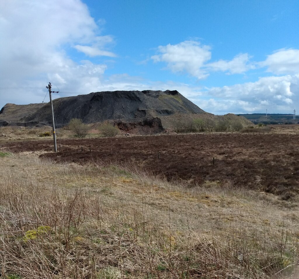
When the National Coal Board took the colliery over in 1947 it employed 510 people and raised 125,000 tons of gas, household, industrial, manufacturing and steam coal. In 1954 it had 448 people working the Main coal for household and steam use, and was also selling blaes. Southfield closed in May 1959. Its large coal bing still stands on the moor, though its profile has changed in recent years.
Geology
Lanarkshire coalfield: the Main coal, with blaes sold from the colliery.
Workings
Shafts sunk from about 1920; a large coal bing.
Closure
Closed by the National Coal Board in May 1959.
What remains
A large black coal bing stands on the moor near the site, its profile changing in recent years.
A coal bing.
Nearby mines
- Fauldhouse Colliery — 0.6 miles (0.9 km) NE, West Lothian
- Knowes Colliery — 0.9 miles (1.5 km) NE, West Lothian
- Braehead Colliery — 1.0 miles (1.6 km) N, West Lothian
- Muldron Ironstone Pits — 1.0 miles (1.6 km) SE, West Lothian
- Headless Cross Colliery — 1.2 miles (2.0 km) W
Straight-line distance, within 9 miles (15 km). Show on the map.
Further reading
Owners, employment, output and seam.
View sourceNewspaper reports of accidents in the Shotts district, including Southfield.
View sourceOpening and closing dates of every colliery the National Coal Board took over in Scotland.
View sourceSources
- (primary) Southfield Colliery — Durham Mining Museum
- (secondary) NCB Collieries - Scotland (Northern Mine Research Society) — Northern Mine Research Society
- (primary) Shotts parish accidents post 1900 — Scottish Mining Website — Scottish Mining Website
- (observational) Coal Bing: Southfield Colliery (Geograph 6831371) — Geograph
Record created: 4 October 2026 · Last researched: 4 October 2026