 MineArchive
South Medomsley Colliery
| Also known as | Pontop Hall Colliery |
|---|---|
| Location | Between Annfield Plain and Dipton, County Durham — 54.8729, -1.7764 (approximate) |
| Commodities | Coal, Fireclay |
| Type | Coal |
| Worked | 1861–July 1980 |
| Maximum depth | 629 feet (192 m) to the Brockwell, Annie Pit, 1864 |
| Operators | South Medomsley Colliery Co. Ltd (?–1947), National Coal Board (1947–1980), Muschamp, Bainbridge & Co. |
Overview
A colliery between Annfield Plain and Dipton, also called Pontop Hall, whose Annie and Mary pits were sunk in 1864 and 1867; it made firebricks and coke as well as coal, lost three men in an explosion in 1934, and worked under the National Coal Board until July 1980.
History
South Medomsley Colliery, also known as Pontop Hall Colliery, lay between Annfield Plain and Dipton. Boring was in progress on the South Medomsley royalty in 1863, and the colliery is dated from 1861. The South Medomsley Coal Company sank the Annie Pit, 13 feet across, to the Brockwell seam in 1864, and the Mary Pit, 700 yards to the north, in 1867. Muschamp, Bainbridge and Co. owned it in the 1860s, and the South Medomsley Colliery Co. Ltd from the 1890s.
In 1894 the colliery worked the Hutton, six feet six inches thick at 46 fathoms, the Low Hutton, Main Coal, Harvey, Busty and Three Quarter, down to the Brockwell at 104 fathoms; the Five Quarter and Brass Thill were worked out. Coal from the Main Coal and Busty was drawn at the Mary Pit, the Hutton seams were worked through a drift in the valley about a mile north, and the clay from the Busty was made into firebricks on the spot. There were 217 coke ovens.
Employment rose from 248 in 1894 to more than 500 before the First World War and stayed between about 260 and 480 between the wars. On 29 March 1934 an explosion killed two hewers and a putter. The National Coal Board took the colliery over in 1947; it employed 384 in 1955 and 305 in 1961, and closed in July 1980.
Geology
Durham coalfield: the Hutton (6 ft 6 in at 46 fathoms), Low Hutton, Main Coal, Harvey, Busty (with sagger clay between top and bottom coal), Three Quarter and Brockwell (104 fathoms), with the Five Quarter, Brass Thill, Shield Row and Tilley.
Workings
Annie Pit (1864, 13 ft diameter) and Mary Pit (1867) to the Brockwell; a drift to the Hutton seams; the Coronation Drift and a Main Coal Drift; firebrick works and 217 coke ovens.
Closure
Closed in July 1980 under the National Coal Board.
What remains
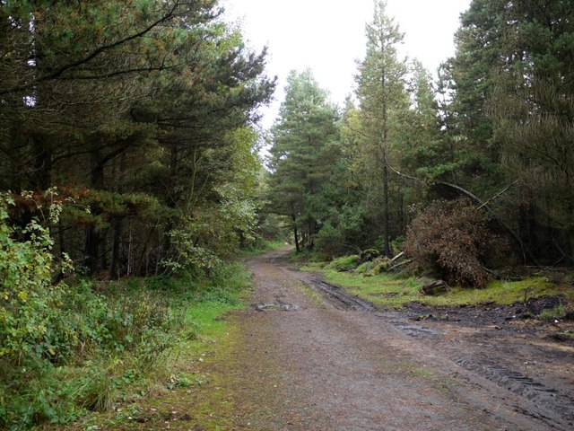
The site is wooded.
Redevelopment
Woodland.
Nearby mines
- Dipton Colliery — 0.6 miles (1.0 km) E
- Eden Colliery — 1.0 miles (1.5 km) SW
- East Pontop Colliery — 1.2 miles (1.9 km) E
- Derwent Colliery — 1.7 miles (2.7 km) NW
- Iveston Colliery — 1.8 miles (2.8 km) SW
Straight-line distance, within 9 miles (15 km). Show on the map.
Culture
- The Sooth Medomsley Strike (Music)
The song is about a strike at South Medomsley Colliery and the eviction of its miners' families from the colliery houses.
What's uncertain
Points where sources disagree or the record could not be settled; both accounts are kept. All open questions in the archive.
- Opened in 1867. (disputed) 3
Recorded claims
Individual factual claims, each attached to the source(s) that support it below. Where sources disagree, both are kept.
- Opened in 1861. 1,2
- The Annie Pit was sunk in 1864 and the Mary Pit in 1867. 3,1,2
- Clay from the Busty seam was made into firebricks at the colliery, which had 217 coke ovens. 1,2
- The Annie Pit, 13 ft in diameter, was sunk to the Brockwell at about 629 ft. 4
- Closed in July 1980. 1,2
- Opened in 1867. (disputed) 3
Photographs & further reading
Owners, employment and Whellan's 1894 description, with a 1947 map of the colliery's branch line.
View sourceSources
- (primary) Durham Mining Museum: South Medomsley Colliery — Durham Mining Museum
- (secondary) South Medomsley Colliery — South Pelaw Junction
- (secondary) Wikipedia: Dipton, County Durham — Wikipedia
- (primary) Durham Mining Museum: South Medomsley Colliery Annie Pit shaft details — Durham Mining Museum
Record created: 6 October 2026 · Last researched: 6 October 2026