 MineArchive
Roachburn Colliery
| Location | Coalfell, near Hallbankgate, Cumbria — 54.9314, -2.6001 (approximate) |
|---|---|
| Commodity | Coal |
| Type | Coal |
| Worked | 1893 or 1895–1912 |
| Maximum depth | Drawing shaft 43 fathoms (about 79 m); the main level lay 55 fathoms below the shaft bottom. |
| Operators | M. Thompson and Sons (?–1912) |
Overview
A colliery on the moorland edge east of Brampton, the first in Cumbria to be worked by electricity, and one of three pits run by Messrs Thompson and Sons on the Northumberland border. It employed about three hundred men underground and raised some 290 tons a day until January 1908, when saturated peat and clay poured into the workings from beneath two small tarns, killed three men and effectively finished the pit.
History
Thompson and Sons had worked coal along the Northumberland and Cumberland border for more than seventy years by 1908, latterly from three collieries on one seam — Byron in Northumberland, Roachburn six miles south-west in Cumberland, and the small Bishop Hill, whose coal went mostly for lime burning. Roachburn stood near the site of an older colliery that had worked the rise coal, and beside the firm's own railway from Brampton Junction to Lambley; the coal lay under land of the Earl of Carlisle. Thomas Croudace, of Haltwhistle, held the manager's certificate for all three pits, with George Turner as undermanager at Roachburn. The pit was notable for its power: it was the first electrically operated coal mine in Cumbria, with a generating house raising direct current from a steam-driven set, electric pumps underground lifting some 600 gallons a minute to a drift near the surface, and a rare Bull steam beam engine in a separate house dealing with water from the old rise workings. Three hundred people worked underground in the various shifts and the daily output was about 290 tons. About four years before the end the workings were connected underground to Byron Colliery, through a whin dyke eleven yards thick; the survey error found when the two met was eleven yards. On 28 January 1908 a face driven up to the outcrop under Denton Fell gave way and about 90,000 cubic yards of moss, sand, clay and water ran into the mine, cutting off and killing three men (see Disasters, below). Two thirds of the workforce were laid off, and the colliery was abandoned in 1912.
Geology
The seam worked at Roachburn, Byron and Bishop Hill lies in the upper part of the Carboniferous Limestone and is known as the Acomb, Blenkinsopp or Little Limestone coal. At Roachburn it averaged 3 feet 6 inches, lay on a hard ganister floor under a roof of shale with sandstone bands, and dipped south-east: about a mile north of the pits the dip along the outcrop reaches 45 degrees, flattening to 35 degrees where the shafts stand. A whin dyke eleven yards thick crossed the workings between Roachburn and Byron. Coal beyond the main level, in the district called the Jubilee Winnings, had been baked by the dyke into a soft friable coal that had lost its coking quality and was practically unsaleable.
Workings
Four shafts reached the seam. The drawing shaft, 14 feet across and 43 fathoms deep, was the downcast and carried two cages; a second, 9½ feet across, was the upcast and had a fan on top; the other two served a rise section and the pumping of its water. From the shaft bottom a main dip ran 530 yards to a main level 55 fathoms lower, which was driven more than 2,000 yards north-east towards the Jubilee Winnings. Inclines called lanches climbed from the main level to the saleable coal nearer the outcrop, worked as self-acting endless-rope banks; tubs were led by ponies on the levels, by main-and-tail rope for the first 350 yards, and up the main dip by an endless rope from a surface engine. A shallow shaft only 30 feet deep on Denton Fell, No. 7 pit, was a downcast fitted with ladders, and became the escape route for most of the men on the Byron side when the inflow came.
Closure
The inrush of 1908 was, in the inspector's words, the loss of the colliery and a serious pecuniary loss to its owner. Most of the workforce went within months and the mine was abandoned four years later.
What remains
The upstanding and buried remains are a scheduled monument. The electricity generating house stands roofless to its full height; the pumping house, which held the Bull engine, also stands two storeys with roof timbers surviving, though the engine has gone. A second generating house has been converted into an occupied house and is excluded from the scheduling.
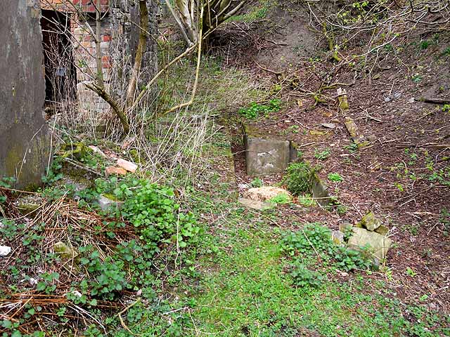
The generating house, the pumping house, the wall round three sides of the sealed drawing shaft, a concrete-lined ventilation fan compartment sunk beside the generating house, and the brick and concrete foundations of a headgear support pillar.
Redevelopment
One of the two generating houses is now a dwelling; the rest of the site is pasture and scrub.
Related mines
- Blenkinsopp Colliery — Both were worked by Thompson and Sons on the Cumberland–Northumberland border, and their abandonment plans are catalogued together by the BGS as one filed set.
Nearby mines
- Blenkinsopp Colliery — 7.0 km NE, Northumberland
- Plenmeller Colliery — 12.5 km E, Northumberland
- Church Burn Mine — 13.7 km E, Northumberland
Straight-line distance, within 15 km. Show on the map.
Disasters & major incidents
-
Roachburn Colliery inrush, 1908
28 January 1908 · Flooding / Inundation · 3 fatalities
About noon on 28 January 1908 the face of a working driven up to the outcrop under Denton Fell gave way, and roughly 90,000 cubic yards of saturated peat, sand, clay and water poured into Roachburn Colliery near Hallbankgate. About 120 men were underground; all but three got out. Two of the three were officials who had gone back for the third. No body was recovered, so no inquest could be held, and the Home Office ordered a formal investigation instead.
What's uncertain
Points where sources disagree or the record could not be settled; both accounts are kept. All open questions in the archive.
- Roachburn Colliery opened in 1895. (disputed) 2
- The colliery had been established fifteen years by January 1908, which places its opening in 1893. (disputed) 1
Recorded claims
Individual factual claims, each attached to the source(s) that support it below. Where sources disagree, both are kept.
- Three hundred people worked underground in the various shifts and the daily output was about 290 tons. 1
- The drawing shaft was 14 feet in diameter and 43 fathoms deep, with the main level a further 55 fathoms below the shaft bottom. 1
- The seam, known as the Acomb, Blenkinsopp or Little Limestone coal, averaged 3 feet 6 inches at Roachburn and lay on a hard ganister floor. 1
- Roachburn Colliery opened in 1895. (disputed) 2
- The colliery had been established fifteen years by January 1908, which places its opening in 1893. (disputed) 1
- Roachburn was the first electrically operated coal mine in Cumbria, and its pumping house held a rare Bull steam-powered beam engine. 2
- The workings breached the base of a tarn in 1908 and the mine was abandoned four years later. 2
Photographs & further reading
J. B. Atkinson's report for the Home Office, which describes the colliery, its seam, shafts and haulage in detail as well as the inrush.
View sourceA local account of the disaster and its effect on the district, with the text of the inspector's report and a note of the memorial at Coalfell.
View sourceSources
- (primary) Report on the Causes and Circumstances attending the Accident which occurred at Roachburn Colliery, Cumberland, on the 28th January, 1908, by J. B. Atkinson, HM Chief Inspector of Mines — Durham Mining Museum (transcript of the Home Office report)
- (primary) Roachburn Colliery, Farlam (List entry 1017643) — Historic England
- (primary) Abandoned mine plan catalogue entry: BLENKINSOPP AND ROACHBURN — British Geological Survey
- (primary) Roachburn Colliery Accident (HC Deb 13 February 1908 vol 184 c205) — Hansard
Record created: 22 September 2026 · Last researched: 22 September 2026