 MineArchive
North Motherwell Colliery
| Location | North side of Motherwell, North Lanarkshire — 55.7938, -4.0168 (exact) |
|---|---|
| Commodity | Coal |
| Type | Coal |
| Worked | by 1878–1922 |
| Operators | Merry & Cuninghame (1878–1922, owner) — Messrs Merry and Cunninghame, then Merry and Cunninghame Ltd, from the 1870s (DMM) |
Merry and Cuninghame's colliery on the north side of Motherwell, worked from the late 1870s by three pits and some 600 men, raising gas, household and steam coal from seams from the Ell to the Splint until its main workings were abandoned in 1922.
Location
Recorded location. The large pin is this mine; the small round markers are the nearest mines on record. Click one for its page. View on full map
History
North Motherwell Colliery was sunk in the late 1870s for Merry and Cuninghame, the Coatbridge coal and iron masters, who became a limited company in that decade. A sinker was killed in August 1879 when the skeleton cage fell on him from the surface. Its No. 2 and No. 3 pits lay a little north-east of the main site. The colliery employed 615 people in 1894, 553 in 1900 and between 630 and 644 from 1905 to 1915, and raised coal for gas, household, manufacturing and steam use from a wide spread of seams: the Ell, Main, Pyotshaw and Splint in 1905, with the Blackband, Upper Drumgray and Virtuewell added by 1910.
Thirty deaths are recorded at the colliery between 1878 and 1924, most from falls of roof. Three men were killed together by a fall at a junction on a longwall drawing road in August 1881; a father and son, Andrew and Alexander Anderson, died together in December 1908 opening out the Upper Drumgray coal from a stone mine; and in April 1911 a fireman was killed by an explosion during his inspection. Employment then fell, to 592 in 1920 and 361 in 1923. The Ell, Pyotshaw, Virtuewell, Blackband and Splint workings were abandoned in 1922, and a plan of the Main Coal is dated 1941.
Geology
The Lanarkshire coal measures, worked in the Ell, Main, Pyotshaw, Splint, Virtuewell, Upper and Upper Drumgray coals and the Blackband ironstone.
Workings
Three pits, the main colliery and Nos. 2 and 3; longwall and stoop and room working, with stooping of the Ell and Main coals.
Closure
The Ell, Pyotshaw, Virtuewell, Blackband and Splint workings were abandoned in 1922; employment had fallen to 361 by 1923, and a Main Coal plan is dated 1941.
What remains
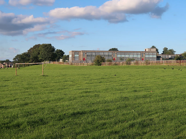
The site of No. 2 pit is occupied by St Bernadette's Primary School.
Redevelopment
St Bernadette's Primary School stands on the site of No. 2 pit.
Nearby mines
- Motherwell Colliery — 0.5 miles (0.9 km) E
- Parkneuk Colliery — 1.0 miles (1.6 km) E
- Douglas Park Colliery — 1.1 miles (1.8 km) NW
- Hamilton Palace Colliery — 1.2 miles (1.9 km) W, South Lanarkshire
- Parkhead Colliery — 1.4 miles (2.2 km) SE
Straight-line distance, within 9 miles (15 km). Show on the map.
Further reading
Owners, pit locations, seams and employment from 1894 to 1923, and the deaths recorded at the colliery.
View sourceSources
- (primary) North Motherwell Colliery (Durham Mining Museum) — Durham Mining Museum
- (primary) BGS mine plan: MOTHERWELL NORTH, Ell, abandoned 1922 (catalogue 7459) — British Geological Survey
- (primary) BGS mine plan: MOTHERWELL NORTH, Main, abandoned 1941 (catalogue 10602) — British Geological Survey
Record created: 5 November 2026 · Last researched: 6 November 2026