 MineArchive
Longannet Colliery
| Also known as | Longannet Complex |
|---|---|
| Location | Kincardine-on-Forth, Fife — 56.0574, -3.6957 (approximate) |
| Commodity | Coal |
| Type | Coal |
| Worked | 1969–2002 |
| Maximum depth | Around 1,200m to the principal seams; the Castlebridge shaft itself reached 426m (381m below sea level). |
| Operators | National Coal Board (1969–1994), Scottish Coal (Deep Mine) Ltd (1994–2002) |
Overview
A large deep coal mine at Kincardine-on-Forth, Fife, that fed the adjoining Longannet Power Station and was, by the time of its sudden flooding in March 2002, the last operating deep coal mine in Scotland.
History
Longannet began production in 1969 as part of the Longannet Complex, a group of connected workings built to supply coal directly to the new, 2,400 MW Longannet Power Station next door. At its fullest extent the complex comprised five collieries — Bogside, Castlebridge, Castlehill, Solsgirth and Longannet itself — linked underground by several miles of tunnel. Bogside closed during the 1980s, and the Castlehill and Solsgirth workings' reserves were largely depleted by the early 1990s; the Castlebridge shaft, sunk in 1978 to a depth of 426m (381m below sea level), was the last deep coal mine shaft sunk anywhere in Scotland, but its own section ceased production in 2000 and was sealed off from the still-active Kincardine workings by engineered underground dams. In the mine's final years, new roadways were driven to reach a further coal seam beneath the Firth of Forth, downstream of the Kincardine Bridge.
It was run by the National Coal Board and its successor British Coal until the 1994 privatisation of the coal industry, after which it passed to Mining (Scotland) Ltd and then Scottish Coal (Deep Mine) Ltd. On 23 March 2002, the workings flooded suddenly; the 15 miners underground at the time reached safety, but investigators concluded one of the underground dams, or the strata around it, had probably failed, and the mine never reopened — ending deep coal mining in Scotland.
Geology
The complex worked the Upper Hirst, a low-sulphur coal seam found within the Upper Limestone Group of strata — above the Limestone Coal Group but below the Productive Coal Measures — whose low sulphur content made it especially well suited to power-station use. The seams occupy the Leven Syncline, which extends south beneath the Firth of Forth as far as Musselburgh; an estimated 40 million tonnes of coal, known as the Kincardine Reserves, lay beneath the Forth and on beyond its southern shore into the Falkirk district, largely unworked at the time of closure.
Geological setting: Anticlines and Synclines (historical documentary reference)
Workings
The complex worked several seams, principally the Upper Hirst, from connected underground workings; by 2000 the older Castlebridge section had ceased production and was sealed off from the still-active Kincardine workings by engineered underground dams. An 8.8km tunnel connected the Solsgirth section to Longannet itself and housed what was claimed at the time to be the longest underground conveyor belt in the world, part of a system designed to deliver 10,160 tons of coal a day directly to the adjoining power station. At full capacity the complex could produce around two million tonnes of coal a year — roughly 40,000 tonnes a week — and employed some 366 miners alongside 150 surface support staff.
Closure
See Disasters, below, for the March 2002 flooding that ended mining at Longannet; the mine's operator, Scottish Coal (Deep Mine) Ltd, entered receivership in its aftermath, and the mine adit was formally sealed in January 2003.
What remains
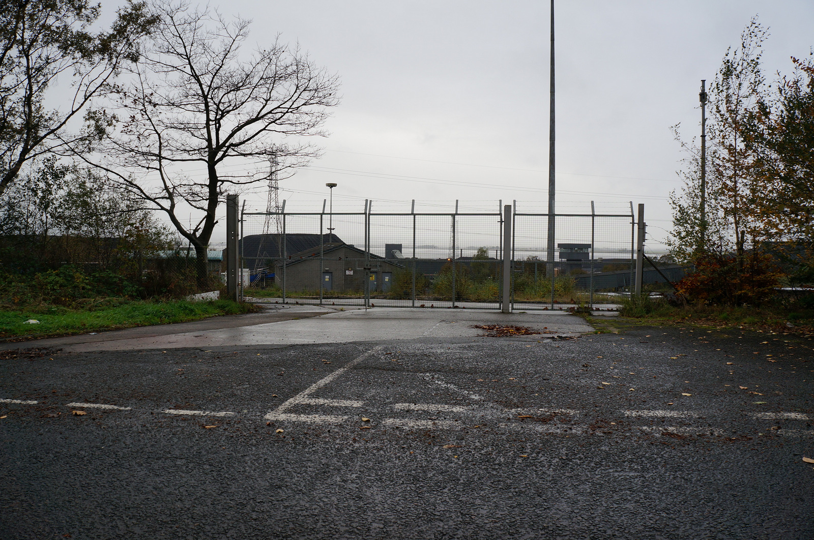
The colliery shaft was capped and the surface buildings largely demolished; reopening was costed at up to £100 million and never pursued. The site, along with the adjoining power station, was completely flattened in 2019.
None: both the colliery and the adjoining power station were completely demolished in 2019, and no above-ground structures survive on the site.
Related mines
- Bogside Colliery — Bogside fed the Longannet complex's underground conveyor system from 1964 and was connected underground to its neighbouring collieries.
- Castlehill Mine — Castlehill was linked underground to Longannet Mine as part of the Longannet complex.
- Solsgirth Colliery — Solsgirth fed coal directly into the Longannet complex's underground conveyor system from 1965.
Nearby mines
- Bogside Colliery — 1.2 miles (1.9 km) NW
- Grangemouth Colliery — 2.3 miles (3.8 km) SW, Falkirk
- The Moat Pit — 2.5 miles (4.0 km) E
- Castlehill Mine — 3.1 miles (5.0 km) NE
- Brucefield Colliery — 3.3 miles (5.3 km) N, Clackmannanshire
Straight-line distance, within 9 miles (15 km). Show on the map.
Disasters & major incidents
-
The Longannet Flooding
23 March 2002 · Flooding / Inundation · 0 fatalities
On the evening of Saturday 23 March 2002, roadways near the bottom of the Castlehill section of the Longannet Complex flooded within minutes, most likely through or around an underground dam sealing off older, worked-out ground. Fifteen men underground at the time were evacuated safely; the mine never reopened, ending deep coal mining in Scotland.
Recorded claims
Individual factual claims, each attached to the source(s) that support it below. Where sources disagree, both are kept.
- Longannet was the last operating deep coal mine in Scotland at the time of its closure. 1,2
- The Castlebridge section of the complex ceased production around 2000 and was sealed off from the active Kincardine workings by underground dams. 2
- The colliery and its adjoining power station were completely demolished by 2019. 3
- At its fullest extent the Longannet Complex comprised five collieries — Bogside, Castlebridge, Castlehill, Solsgirth and Longannet itself — linked underground by several miles of tunnel; Bogside closed during the 1980s, well before the others. 1,4
- The Castlebridge shaft, sunk in 1978 to a depth of 426m (381m below sea level), was the last deep coal mine shaft sunk anywhere in Scotland. 4
- The complex worked the Upper Hirst, a low-sulphur seam of the Upper Limestone Group occupying the Leven Syncline, which extends south beneath the Firth of Forth as far as Musselburgh; an estimated 40 million tonnes of coal, the Kincardine Reserves, lay beneath the Forth and beyond its southern shore into Falkirk district, largely unworked at closure. 1,5
- At full capacity the complex could produce around two million tonnes of coal a year, designed to deliver 10,160 tons a day directly to the adjoining power station, and employed some 366 miners alongside 150 surface support staff. 1
- Scottish Coal (Deep Mine) Ltd entered receivership in the aftermath of the March 2002 flooding, and the mine adit was formally sealed in January 2003. 4
- The Upper Hirst is a coal seam of central Scotland, known locally also as the Jenny Pate or the Janet Peat, mined on a large scale from the 1950s to 2002 mainly to supply Kincardine and later Longannet power stations; it is a low-quality coal, long disregarded, whose low sulphur content made it well suited to power-station use, and it lies within the Upper Limestone Group above the Limestone Coal Group and below the Productive Coal Measures. 5
Sources
- (secondary) Longannet coal mine — Wikipedia
- (primary) The Circumstances Surrounding the Flooding of the Longannet Complex Mine, Fife, Scotland, 23 March 2002 — HM Inspectorate of Mines / Health and Safety Executive
- (observational) Longannet Colliery, Fife, Jan. 2009 — 28DaysLater.co.uk
- (secondary) Longannet Mine — Scottish Cave and Mine Database (Grampian Speleological Group)
- (secondary) Upper Hirst — Wikipedia
- (primary) Mine plan: LONGANNET — BGS / Mining Remediation Authority mine plans catalogue
- (secondary) Pit-L-12. Longannet Mine (Longannet Complex) — fifepits.co.uk
Record created: 25 August 2026 · Last researched: 27 August 2026