 MineArchive
Lanemark Colliery
| Location | Lanemark, New Cumnock, East Ayrshire — 55.3837, -4.2164 (approximate, low confidence) |
|---|---|
| Commodity | Coal |
| Type | Coal |
| Worked | 1865–1908 |
| Operators | Lanemark Coal Company (1865–1909, owner) |
The Lanemark Coal Company's colliery at New Cumnock in Ayrshire. The company was formed in 1865 to work coal around Lanemark Farm and built miners' rows and a brickworks; its pits employed over 600 in the 1890s before the company failed and went into liquidation in 1909.
Location
Approximate location, low confidence. The large pin is this mine; the small round markers are the nearest mines on record. Click one for its page. View on full map
History
In 1863 John Hunter of Waterside, Dalmellington, took a lease of the minerals of Lanemark at New Cumnock in Ayrshire and, with John Paton, a builder from Ayr, approached Robert Brown, an Ayr mining engineer who had opened the Craigie pits; instead of hiring him the three joined forces, and in 1865 the Lanemark Coal Company was formed to work coal around Lanemark Farm, where its first colliery, Rigfoot No. 1, stood. In 1866 the company leased the Afton minerals near Straid, and Brown built a branch railway from the Creoch line to South Boig and on to the Afton No. 1 pit, sunk in 1871, with Afton No. 2 following two years later.
As the work grew the company built terraced miners' rows, most densely at Connel Park in the South Boig area and at Burnfoot by the Afton pit, and its coalmaster Brown lived at Ardnith House on the Boig Road. The company ran cricket and football clubs and annual athletic games for its workforce; the football club, which played its first match in August 1875, had the use of the company's field and club-house at Connel Park. It made bricks at its own Lanemark brickworks, managed in 1893 by a Mr Roberts, and in 1885 it became a limited company.
The colliery worked gas, household, manufacturing and steam coals, with fireclay. Its No. 1 pit appears in the inspectors' returns of the 1870s: on 20 January 1876 a seventeen-year-old drawer, Alexander Thomson, fell down the pit, and in 1878 one collier was run over by a hutch on an incline and another killed while blasting. In 1894 the colliery employed 632, 479 of them underground. By 1900 only the No. 2 pit is listed, with 346 men, and by 1905 it had 142. The Eight Feet seam was abandoned in 1908, and in 1909 the Lanemark Coal Company went into voluntary liquidation.
Geology
Ayrshire Coal Measures: the Eight Feet, Four Feet and Lower Gas (Five Feet) seams, with fireclay.
Workings
Lanemark No. 1 and No. 2 pits; a brickworks beside the railway.
Closure
The Eight Feet seam was abandoned in 1908 and the company went into voluntary liquidation in 1909.
What remains
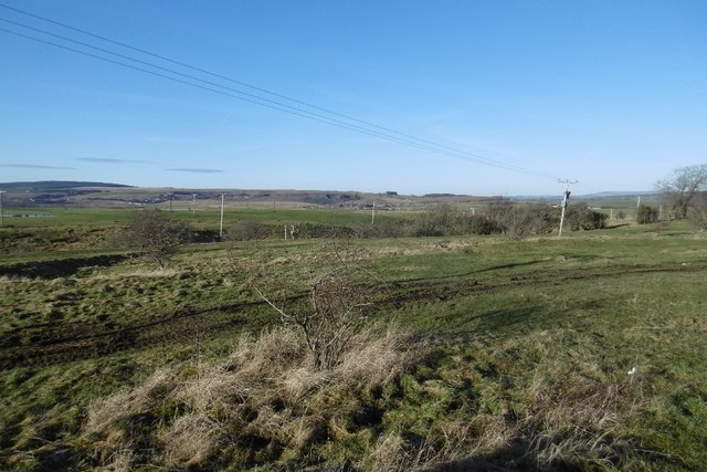
The site is disturbed grassland near Craigbank.
Related mines
- Afton Colliery — The Lanemark Coal Company also held the Afton minerals and worked a shaft there until 1909.
Nearby mines
- Seaforth Colliery — 0.4 miles (0.6 km) E
- Bank Colliery — 0.5 miles (0.7 km) S
- Knockshinnoch Castle Colliery — 0.8 miles (1.3 km) E
- Afton Colliery — 1.2 miles (1.9 km) SW
- Coalburn Colliery, New Cumnock — 2.0 miles (3.2 km) NW
Straight-line distance, within 9 miles (15 km). Show on the map.
Culture
- Lanemark F.C. (Sports)
The club, founded in 1877, took its name from the Lanemark Coal Company, formed in 1865 to work this colliery's coal around Lanemark Farm.
Further reading
The company's incorporation and liquidation.
View sourceThe company's brickworks and its later neighbour, the Afton works.
View sourceOwners, employment and those killed at the colliery.
View sourceSources
- (secondary) Lanemark F.C. — Wikipedia
- (secondary) Lanemark Coal Co — Grace's Guide to British Industrial History
- (primary) Lanemark Colliery — Durham Mining Museum
- (primary) BGS mine plan: Lanemark, Eight Feet, abandoned 1908 — BGS / Mining Remediation Authority mine plans
- (secondary) Lanemark Brickworks, New Cumnock, East Ayrshire — Scotland's Brick and Tile Manufacturing Industry
- (observational) Lanemark Collieries (Geograph 5264235) — Geograph
- (secondary) Lanemark — New Cumnock History
Record created: 4 October 2026 · Last researched: 4 October 2026