 MineArchive
Hungry Chert Quarries
| Location | Mouldside, Arkengarthdale, North Yorkshire — 54.4176, -2.0180 (approximate) |
|---|---|
| Commodity | Chert |
| Type | Stone |
| Worked | 1932–Early 1950s |
| Maximum depth | Unknown. |
| Operators | Hungry Chert Quarries (1932–?) |
Overview
The last of the Arkengarthdale chert workings, run from 1932 until the early 1950s in the old lead hushes at Mouldside and in new levels driven beside them. Chert is a form of quartz, nearly pure silica, and it went to the Staffordshire potteries: Josiah Wedgwood had found in the 18th century that flint ground between chert stones gave a better white base for china than anything else. The business took its name from Hungry Hush, one of the water-scoured gashes the lead miners had left on the moor.
History
Chert was quarried in Swaledale and Arkengarthdale from about 1904 until 1954 and sold chiefly to the Staffordshire potteries. The trade existed because of an 18th-century discovery: Josiah Wedgwood, trying to match fine oriental porcelain, found that flint ground between chert stones produced a superior white base for china, and the hard, almost pure silica of these dales suited the grinding pans. Up to 1922 the principal working was the underground quarry high on Fremington Edge. In that year a second was opened higher up Arkengarthdale, on the west side, at the mouth of the abandoned Old Moulds lead level, and worked until 1932. From 1932 until the early 1950s the same business moved into the Mouldside area and became the Hungry Chert Quarries, working partly opencast in the former lead hushes around Hungry Hush and partly underground in newly driven levels. The chert went away by lorry to Staffordshire. The market collapsed in the middle of the century and the quarries closed with it. The workings here have been researched by Stephen Eastmead for the Swaledale and Arkengarthdale Archaeology Group.
Geology
Chert is a form of quartz made up mainly of silica, and it occurs in beds within the limestone of these dales — the same limestone and chert beds that carry the lead veins worked here first. Its hardness and purity are what made it worth quarrying for grinding flint in the potteries.
Geological setting: Sedimentary Beds and Seams (well documented example)
Workings
Partly opencast, in the lead hushes around Hungry Hush — the gashes scoured out of the hillside by releasing dammed water down the line of a vein — and partly underground, in levels driven for the chert itself. The same business had previously worked from the mouth of the abandoned Old Moulds lead level, between 1922 and 1932. The hushes sit on the north-east slopes of Reeth High Moor, reached by a network of old miners' tracks.
Closure
The Swaledale and Arkengarthdale Archaeology Group puts the business at Mouldside from 1932 until the early 1950s, and chert quarrying in the two dales as ending in 1954, when the market for chert collapsed. A history of Arkengarthdale has the chert of the Hungry Hushes ceasing after 1940.
What remains
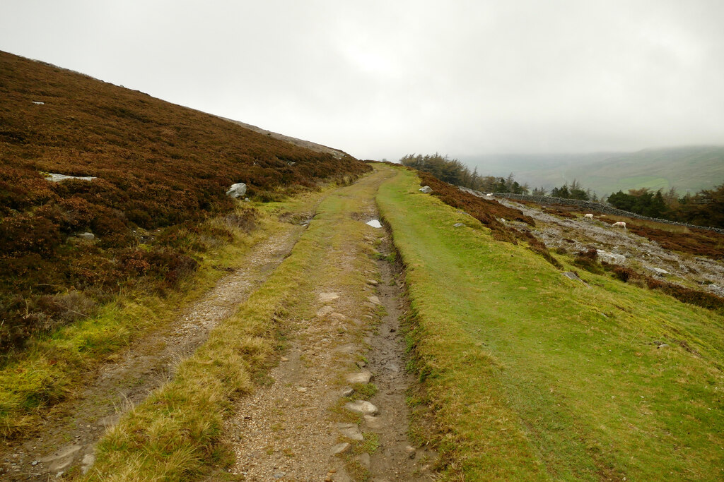
The hushes and the spoil remain on the north-east slopes of Reeth High Moor, crossed by the old miners' tracks that served them; one track climbs above Turf Moor Hush towards the Hungry Hushes.
The opencast workings in the hushes, the spoil, and the tracks up to them. Graffiti cut at the Hungry Hushes in 1828 survives from the lead-mining years before the chert.
Redevelopment
None; the ground is open moor.
Nearby mines
- Cragg End Flag Stone Mine — 1.0 km NE
- Arkendale Mine — 1.5 km E
- CB Mine — 1.5 km E
- Whaw Mine — 1.5 km SE
- Moulds Side Mine — 1.7 km E
Straight-line distance, within 15 km. Show on the map.
What's uncertain
Points where sources disagree or the record could not be settled; both accounts are kept. All open questions in the archive.
- Chert was taken from the Hungry Hushes and along Fremington Edge, ceasing after 1940. (disputed) 3
Recorded claims
Individual factual claims, each attached to the source(s) that support it below. Where sources disagree, both are kept.
- Chert was quarried in Swaledale and Arkengarthdale from about 1904 until 1954 and sold chiefly to the Staffordshire potteries. 1
- The Hungry Chert Quarries worked the Mouldside area from 1932 until the early 1950s, partly opencast in the former lead hushes around Hungry Hush and partly underground in newly driven levels. 1
- The same business had worked chert from the abandoned Old Moulds lead level between 1922 and 1932. 1
- Josiah Wedgwood found that flint ground between chert stones produced a superior white base for china manufacture. 1
- The chert was taken by lorry to Staffordshire for use in producing china and porcelain. 2
- Chert was taken from the Hungry Hushes and along Fremington Edge, ceasing after 1940. (disputed) 3
Photographs & further reading
The sequence of chert workings in the two dales, what the stone was for, and where the research on each quarry can be found.
View sourceSources
- (secondary) Chert and Flagstone Quarries — Swaledale and Arkengarthdale Archaeology Group (SWAAG)
- (secondary) Fremington Edge — Wikipedia
- (secondary) Arkengarthdale — Wikipedia
Record created: 23 September 2026 · Last researched: 24 September 2026