 MineArchive
Haytor Iron Mine
| Location | Haytor Vale, west of Ilsington, near Bovey Tracey, Devon — 50.5801, -3.7364 (exact) |
|---|---|
| Commodity | Iron |
| Type | Iron |
| Worked | By 16th century–After 1918 |
| Maximum depth | About 36 m below the opencast, at adit level |
Overview
A magnetite mine at Haytor Vale near Bovey Tracey, worked for 'lode stones' by the sixteenth century, opencast and by incline shaft before 1828 and then by an adit, prospected again around the First World War; it is a classic magnetite skarn studied by geologists.
History
Haytor Iron Mine lies at Haytor Vale, about 4.5 km west of Bovey Tracey, some 500 metres east of the edge of the Dartmoor granite, within its metamorphic aureole. It is the largest and best developed of a group of iron mines west of Ilsington, with Smallacombe and Atlas, notable for magnetite and calc-silicate minerals. 'Lode stones' were known from Haytor Mine in the sixteenth century or earlier, and in the nineteenth century it produced magnetite, 'brown hematite' and mineral pigments. Before 1828 it was worked opencast and by an incline shaft; afterwards an adit was driven south-west from a portal in the valley bottom about 200 metres east of the Rock Inn, meeting the ore about 36 metres below the opencast. There was some prospecting in the years before and during the First World War, after which the mines stayed closed.
The ore lies in three conformable beds, 3.05, 4.27 and 1.83 metres thick, dipping north-east at 30 to 35 degrees in siliceous metapelite, separated by hornfels and worked in two stopes. It is an intergrowth of magnetite and green-brown amphibole, massive or banded, with garnet (andradite), axinite, siderite, calcite, apatite and traces of sulphides. The deposit is a magnetite skarn formed by contact metamorphism and hydrothermal alteration, and is a Geological Conservation Review site. It also gave its name to 'haytorite', pseudomorphs of chalcedony after datolite once thought to be a separate mineral.
Geology
A magnetite skarn in metapelite of the Dartmoor granite's metamorphic aureole: three ore beds of magnetite and ferro-edenite with andradite garnet, axinite, siderite, calcite and apatite.
Workings
An opencast and incline shaft (before 1828), then an adit from the valley bottom to the ore beds, worked in two stopes.
Closure
Prospecting before and during the First World War was the last activity; the mines then remained closed.
What remains
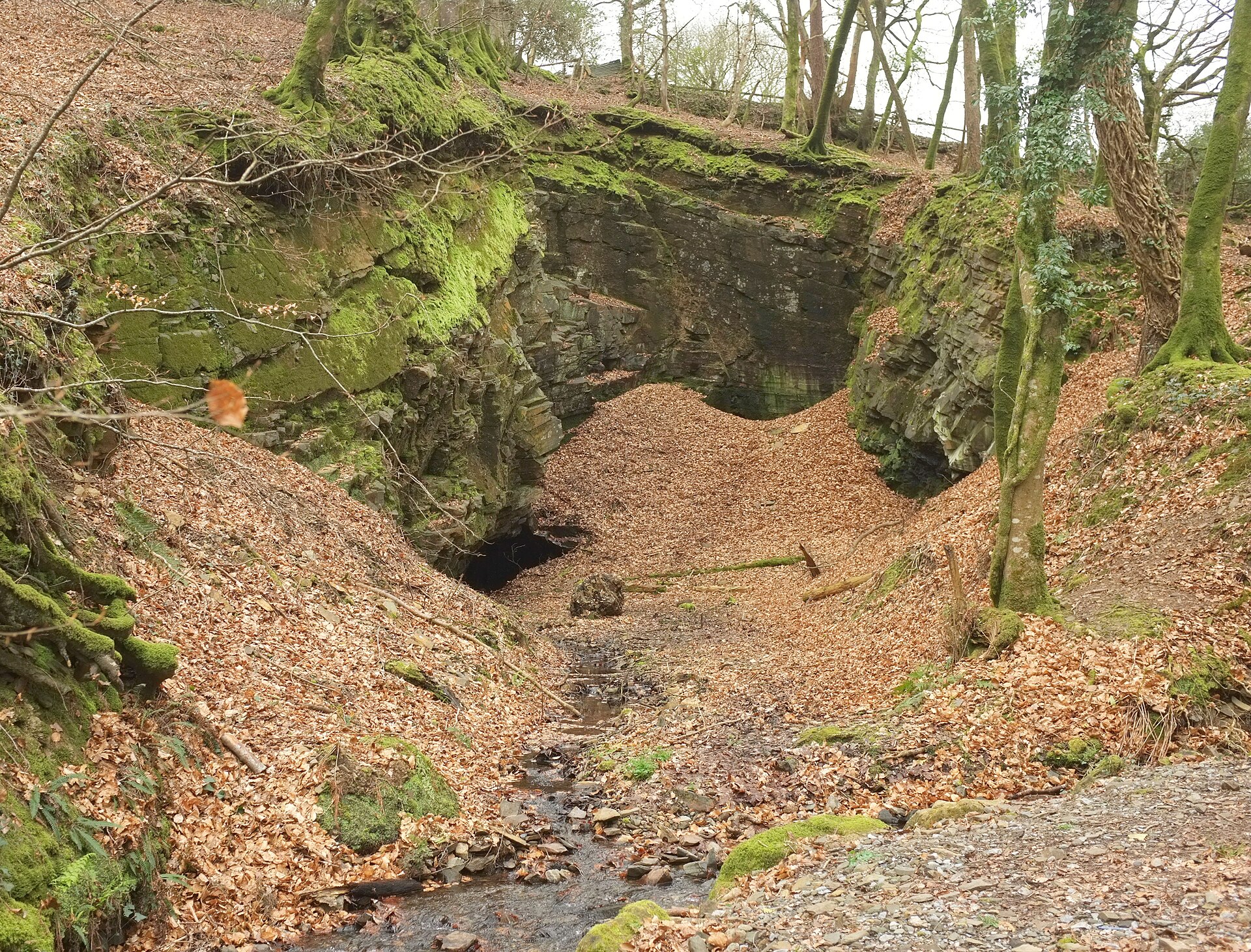
The opencast survives in woodland; the adit is the principal access to the ore beds.
The opencast cutting and the adit portal.
Redevelopment
Unknown.
Related mines
- Haytor Granite Quarry — Neighbouring Haytor workings; George Templer had an interest in the iron mine.
Nearby mines
- Bagtor Mine — 0.4 miles (0.6 km) S
- Haytor Granite Quarry — 0.7 miles (1.1 km) SE
- Yarner Copper Mine — 1.6 miles (2.5 km) N
- Silverbrook Mine — 1.6 miles (2.6 km) SE
- Hemsworthy Mine — 1.8 miles (2.9 km) W
Straight-line distance, within 9 miles (15 km). Show on the map.
Recorded claims
Individual factual claims, each attached to the source(s) that support it below. Where sources disagree, both are kept.
- 'Lode stones' were known from Haytor Mine in the 16th century or earlier. 1
- Developed opencast and by an incline shaft before 1828, and afterwards worked by an adit that met the ore about 36 m below the opencast. 1
- There was some prospecting before and during the First World War, after which the mines remained closed. 1
- The ore is finely intergrown magnetite and green-brown amphibole (ferro-edenite) with andradite, axinite, siderite, calcite and apatite. 1,2
- Pseudomorphs of chalcedony after datolite from the mine were once termed 'haytorite'. 1,2
- An iron-ore plan of Haytor is held by the British Geological Survey. 3
Sources
- (secondary) Haytor Iron Mine (Geological Conservation Review vol. 36) — GeoGuide (from JNCC Geological Conservation Review)
- (secondary) Magnetite skarn - Haytor — UK Virtual Microscope (Open University)
- (primary) BGS mine plan: Haytor, iron ore — British Geological Survey
Record created: 17 October 2026 · Last researched: 17 October 2026