 MineArchive
Harrow Hill Flint Mines
| Location | Harrow Hill, near Angmering, West Sussex (about 5 miles north-west of Worthing; OS grid TQ 082 100), West Sussex — 50.8789, -0.4636 (approximate) |
|---|---|
| Commodity | Flint |
| Type | Mineral |
| Worked | Early Neolithic (c. 3710 BC)–No reliable closure date has yet been located. |
| Maximum depth | An excavated shaft was about 6.7 metres deep; the shafts are bell-shaped pits reaching seams of flint. |
Overview
A Neolithic flint mine on Harrow Hill near Angmering, one of the Sussex Downs group with Cissbury, Church Hill and Blackpatch. About 245 shafts and pits cover some 8 hectares of the hilltop; a shaft dug in the 1920s proved nearly 7 metres deep with six galleries radiating along the flint at its base. An antler pick has been radiocarbon-dated to about 3710 BC. A much later Bronze Age to Iron Age enclosure overlies the southern edge of the workings.
History
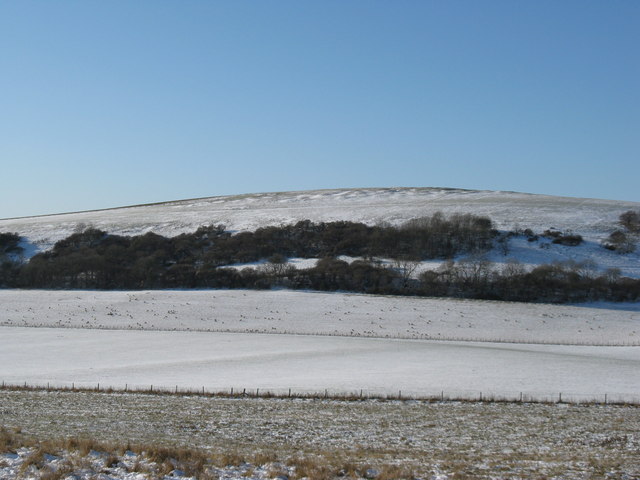
Harrow Hill is a chalk hill on the South Downs about 3 miles north of Angmering, its crown covered by around 245 flint-mine shafts and pits over some 8 hectares. The shafts survive as roughly circular hollows up to 19.5 metres across and 1.8 metres deep, with overlapping spoil heaps up to a metre high; the hummocky southern ground is thought to be a slightly different phase of mining. Eliot and Eliot Cecil Curwen, for the Worthing Archaeological Society, excavated a single shaft in 1924-25. It was about 6.1 metres wide and 6.7 metres deep, a bell-shaped pit that had worked three seams of flint, with six galleries radiating along the lowest seam at its floor. Finds within the shafts included mining tools of worked flint, animal bones, carved chalk blocks and charcoal, and an antler pick was radiocarbon-dated to about 3710 BC. Engraved designs above some gallery entrances were read by the excavators as miners' tallies, and analysis of the snail species in the shaft fills showed the hill had been under woodland when it was mined. The flint was worked for trade beyond the site. On the western side, overlying mine shafts at its north-east corner, is a rectangular Martin Down style enclosure of the Late Bronze Age to Early Iron Age, named after a Hampshire example. A bank up to 6 metres wide with an external ditch encloses about a third of a hectare, with an entrance on the west. Partly excavated in 1936, it yielded pottery of about 600 BC and the skulls of 50 to 100 oxen; the bank had held a timber palisade and the entrance a timber gateway, and it may have served to hold stock. The monument was scheduled in 1933.
Geology
Shafts sunk through the chalk to bell-shaped pits that worked three seams of flint, the lowest reached by radiating galleries.
Workings
About 245 shafts and pits over some 8 hectares, surviving as circular hollows up to 19.5 metres across with spoil heaps up to a metre high; an excavated shaft had six galleries radiating from its base.
Closure
Unknown. The later enclosure on the hill is Bronze Age to Iron Age, long after the mining, but no date for the end of mining is recorded.
What remains
Earthworks survive on the hill crown as circular hollows and spoil heaps, with the later enclosure on the western side. A scheduled monument.
The shaft hollows and spoil heaps, and the bank and ditch of the Martin Down style enclosure.
Redevelopment
None; the hill is downland, with a reservoir on the west side of the enclosure.
Related mines
- Blackpatch Flint Mines — Neighbouring Sussex Downs flint mines, about 1.6 km apart.
- Church Hill Flint Mines — Neighbouring Neolithic flint mines on the Sussex Downs, about 3.5 km apart.
- Cissbury Flint Mines — Neighbouring Sussex Downs flint mines of about the same date, some 6 km apart.
Nearby mines
- Blackpatch Flint Mines — 1.7 km SE
- Church Hill Flint Mines — 3.6 km SE
- Amberley Chalk Pits — 5.6 km W
- Cissbury Flint Mines — 6.1 km E
Straight-line distance, within 15 km. Show on the map.
Recorded claims
Individual factual claims, each attached to the source(s) that support it below. Where sources disagree, both are kept.
- The mine covers about 8 hectares of the hill crown with roughly 245 shafts and pits, surviving as circular hollows up to 19.5 metres across. 1,2
- Eliot and Eliot Cecil Curwen excavated a shaft in 1924-25 that was about 6.7 metres deep, with six galleries radiating from its base along the flint. 1,3
- An antler pick from a shaft was radiocarbon-dated to about 3710 BC. 1,2
- Engraved designs above some gallery entrances were interpreted as miners' tallies, and snail species in the shaft fills show the hill was wooded when it was mined. 2
- A Martin Down style enclosure of the Late Bronze Age to Early Iron Age overlies mine shafts on the south; excavated in 1936 it gave pottery of about 600 BC and the skulls of 50 to 100 oxen. 1,2
- The flint mine and enclosure were scheduled in 1933 (National Heritage List 1015239). 2
Photographs & further reading
The official scheduling for the Harrow Hill flint mine and enclosure.
View sourceThe Curwens' excavation of the hill and its mines, with the enclosure.
View sourceSources
- (secondary) Harrow Hill, West Sussex — Wikipedia
- (primary) Prehistoric flint mine and a Martin Down style enclosure on Harrow hill, 850m south east of Lee Farm (National Heritage List 1015239) — Historic England, National Heritage List for England (reproduced by ancientmonuments.uk)
- (secondary) Harrow Hill — Sussex Archaeological Society (Sussex Archaeology and Folklore)
Record created: 21 September 2026 · Last researched: 22 September 2026