 MineArchive
Gilmilnscroft Colliery
| Location | Gilmilnscroft, between Sorn and Auchinleck, East Ayrshire — 55.4835, -4.2827 (approximate) |
|---|---|
| Commodity | Coal |
| Type | Coal |
| Worked | By 1828–c. 1925 |
| Maximum depth | Unknown. |
| Operators | Gilmour, Wood and Anderson, Gauchalland Coal Company, William Baird & Company |
Overview
A colliery on the Gilmilnscroft estate between Sorn and Auchinleck, worked by Gilmour, Wood and Anderson, the Gauchalland Coal Company and William Baird and Company. Coal pits there appear on a map of 1828; the later pits near Auchinleck employed 408 people in 1894, and the last plans were closed in 1925.
History
Gilmilnscroft is an estate in Sorn parish, and coal was worked on it early. Thompson and Williamson's map of 1828 shows a 'Gilmilnscroft Colliery' near Gilmilnscroft House, where a survey in 2005 found the remains of pits, bings, buildings, a lime kiln and a possible winding engine. Plans of workings on the estate abandoned in 1843, 1851 and 1858 survive.
The colliery of the Lists of Mines lay about two and a half kilometres to the south, near Auchinleck, through its No. 3, No. 5 and No. 6 pits, and later Nos. 1 and 4. Its owners were Gilmour, Wood and Anderson, then the Gauchalland Coal Company, which had the No. 3 Pit in 1900, and William Baird and Company, which had the No. 6 by 1913. It employed 408 people in 1894 and 394 in 1900, raising household, manufacturing and steam coal from the Ell, Main, Maid and Low Maid seams, but fell to 180 by 1920.
Twenty-two deaths are recorded between 1869 and 1924. On 18 June 1880 a collier, Michael Curdie, and his son of the same name died in a firedamp explosion (see Disasters, below). An engineman who had overwound the cage fell down the shaft in 1890; a joiner fell when a bunton gave way in 1895; and in 1913 a stoneminer's drill struck gelignite left from an earlier shot. The Maid and Low Maid workings were abandoned in 1925.
Geology
The Ell, Claud, Main, Major, Maid and Low Maid coals of the Ayrshire coalfield.
Workings
Early pits near Gilmilnscroft House, shown in 1828, with a lime kiln and probable winding engine; later the No. 1, 3, 4, 5 and 6 pits near Auchinleck.
Closure
The last plans, of the Maid and Low Maid seams, were closed in 1925; the colliery is last returned in 1923.
What remains
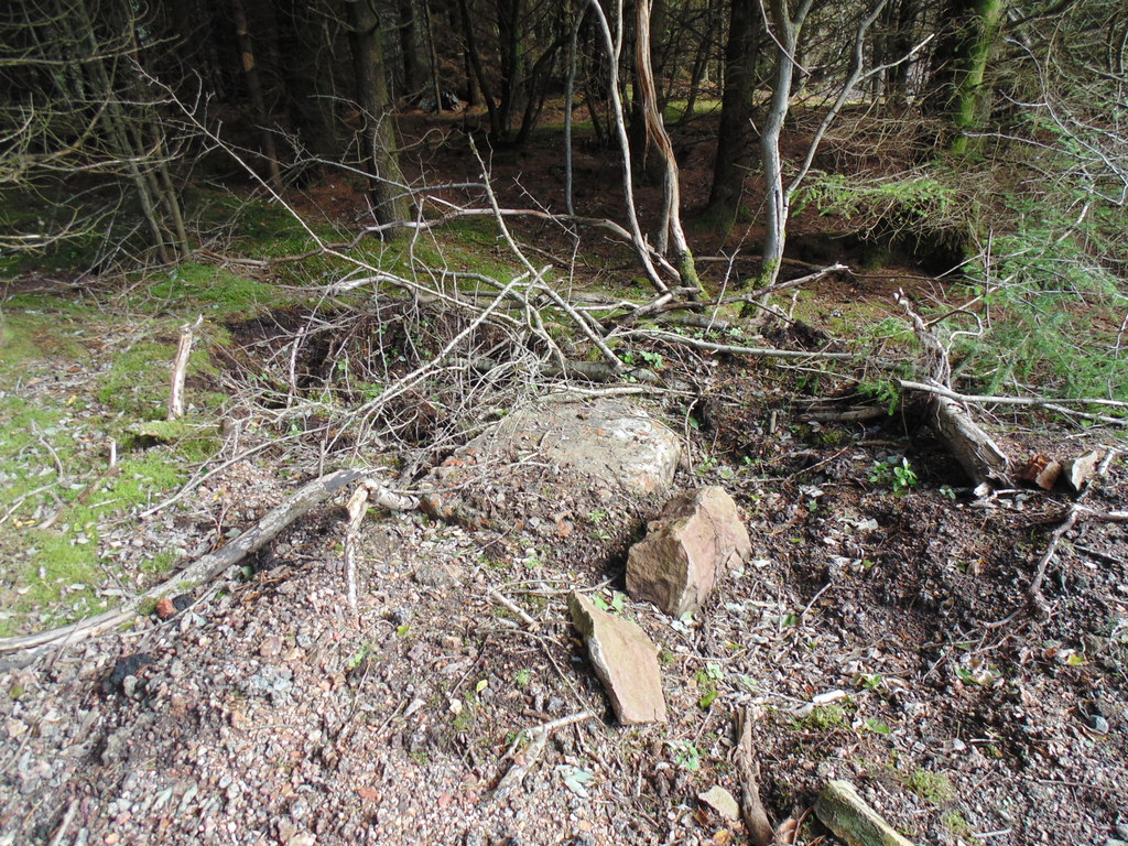
The site of the No. 3 pit lies in a forestry plantation, with brick debris, foundations and ash among the trees.
Overgrown debris and foundations of the No. 3 buildings; remains of pits, buildings and a lime kiln at the early site near Gilmilnscroft House.
Redevelopment
Much of the colliery ground has been planted with conifers.
Related mines
- Gauchalland Colliery — Both worked by the Gauchalland Coal Company.
- Goatfoot Colliery — Both worked by the Gauchalland Coal Company.
Nearby mines
- Highhouse Colliery — 1.3 miles (2.0 km) SW
- Ballochmyle Colliery — 1.4 miles (2.2 km) S
- Barony Colliery — 2.2 miles (3.5 km) SW
- Lugar Mine — 2.2 miles (3.6 km) SE
- Knockterra Colliery — 2.9 miles (4.6 km) S
Straight-line distance, within 9 miles (15 km). Show on the map.
Disasters & major incidents
-
Gilmilnscroft Colliery explosion, 1880
18 June 1880 · Explosion · 2 fatalities
A Gilmilnscroft collier and his seventeen-year-old son died on 18 June 1880 after the son fired gas in a mine thought free of it, and the afterdamp kept rescuers back for three hours.
What's uncertain
Points where sources disagree or the record could not be settled; both accounts are kept. All open questions in the archive.
- The museum dates the same fireman's death to 16 May 1901. (disputed) 2
Recorded claims
Individual factual claims, each attached to the source(s) that support it below. Where sources disagree, both are kept.
- A 'Gilmilnscroft Colliery' near Gilmilnscroft House in Sorn parish is shown on Thompson and Williamson's map of 1828, and the remains of its pits, buildings and a lime kiln were surveyed in 2005. 1
- The colliery's owners were Gilmour, Wood and Anderson, the Gauchalland Coal Company and William Baird and Co. Ltd. 2
- The Gauchalland Coal Company worked Gilmilnscroft No. 3 Pit in 1900. 3
- William Baird and Co. Ltd worked Gilmilnscroft No. 6 Pit in 1913 and 1914. 4,5
- Gilmilnscroft employed 408 people in 1894 and 180 in 1920, raising household, manufacturing and steam coal. 2
- In 1910 the colliery worked the Ell, Low Maid, Maid and Main seams. 2
- A fireman was killed and three men injured in a gas explosion at the No. 3 Pit on 16 May 1900. 3
- The museum dates the same fireman's death to 16 May 1901. (disputed) 2
- Plans survive of Gilmilnscroft workings abandoned in 1843 and of the Maid and Low Maid seams abandoned in 1925. 6,7
Photographs & further reading
Historic Environment Scotland's record of the early colliery site near Gilmilnscroft House, shown on the map of 1828 and surveyed in 2005.
View sourceSources
- (secondary) Gilmilnscroft Colliery and Coal Hall (NRHE 275674) — Historic Environment Scotland (trove.scot / Canmore)
- (primary) Gilmilnscroft Colliery — Durham Mining Museum
- (secondary) James Crighton, fireman, Gilmilnscroft No.3 Pit, 16 May 1900 (accident record) — Northern Mine Research Society
- (secondary) William Gilroy, stoneminer, Gilmilnscroft No.6 Pit, 24 January 1913 (accident record) — Northern Mine Research Society
- (secondary) Walter McLauchlan, miner, Gilmilnscroft No.6 Pit, 23 January 1914 (accident record) — Northern Mine Research Society
- (primary) GILMILNSCROFT: abandonment plan catalogue entry (1843) — British Geological Survey / Mining Remediation Authority
- (primary) GILMILNSCROFT, Maid and Low Maid: abandonment plan catalogue entry (1925) — British Geological Survey / Mining Remediation Authority
Record created: 4 October 2026 · Last researched: 8 October 2026