 MineArchive
Coalisland Collieries
| Also known as | Tyrone Coalfield, East Tyrone Coalfield, Annagher Colliery, Newtownkelly Colliery |
|---|---|
| Location | Coalisland and Annagher, East Tyrone, County Tyrone — 54.5424, -6.7050 (approximate) |
| Commodities | Coal, Fireclay |
| Type | Coal |
| Worked | 1654–By 1920 |
| Maximum depth | The Drumglass shaft was 384 ft deep by 1834 |
| Operators | Ulster Fireclay Works (1890–1960), Sir Samuel Kelly (1921–1927) |
Overview
A town that owes both halves of its name to mining — coal from the pits, island from the canal basin dug to carry it away. The Tyrone coalfield never delivered what was expected of it, and the largest colliery ever attempted in Ulster lasted three years.
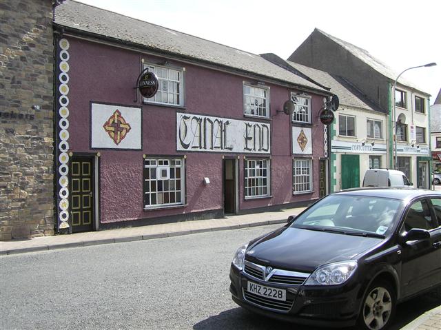
History
Coal mining in East Tyrone was first reported in 1654, and over the following three centuries workings opened at Annagher, Annaghone, Congo, Creenagh, Derraghadoan, Derry, Drumglass and Lurgaboy. Francis Seymour was mining from a 156-foot Engine Pit at Brackaville — later Coalisland — by 1723, and by 1834 the principal colliery at Drumglass had two steam engines, a 70-horsepower one pumping and a 30-horsepower one winding coal from a shaft 384 feet deep. The town grew on the back of it, with potteries, brickworks, textile mills and weaving factories alongside the pits. The most ambitious attempt came last: in 1921 Sir Samuel Kelly began a new colliery at Annagher, promising a thousand jobs and building a hundred houses at Gortgonis, renaming the district Newtownkelly. Two hundred miners and their families came from Scotland and Cumberland by July 1924, and the pit worked three shifts round the clock. It was a failure: the coal proved far harder to reach and much scarcer than expected, and in April 1927 the largest coal mining operation ever attempted in Ulster was abandoned.
Geology
The East Tyrone coalfield is small and severely faulted, and that faulting is the whole story of why it disappointed. Seams could be rich where you found them — hewers worked coal sometimes as little as 60 cm thick — but the ground was broken enough that following a seam was expensive and unpredictable, and reserves that looked substantial on paper proved hard to reach. Beneath the coal lay fireclay, and that by-product turned out to be the more durable industry of the two.
Geological setting: Faults and Fractures (well documented example)
Workings
Shafts and pits scattered across the townlands east of Dungannon rather than one great colliery. Getting the coal out was the constraint, and the answer was the Coalisland Canal, also called the Tyrone Navigation: begun in 1733 and finally opened in 1787, it let 80-ton barges reach Coalisland and carried coal, sand, bricks, pottery, fireclay goods and timber out to Lough Neagh and on to Belfast. An extension, Dukart's Canal, was built to reach the Drumglass coalfield and opened in 1777, but it was an engineering failure and closed when the main canal opened.
Closure
The coalfield never achieved what was expected of it, and work had all but ended by 1920 — the Newtownkelly venture of the 1920s being a late and unsuccessful exception. Some working continued into the early 1960s. Canal traffic peaked in 1931 and the navigation was abandoned in 1954.
What remains
The pits are gone. The Coalisland Canal is disused, its basin in the centre of the town the clearest survival of the industry that made the place. The fireclay works outlasted the collieries.
The canal and its basin, and the industrial fabric of the town — the pottery, brick and pipe works that the coal was dug to fire.
Redevelopment
The town has absorbed the sites; the canal basin survives as a public space.
Nearby mines
- Derry Colliery, Coalisland — 0.4 miles (0.7 km) W
Straight-line distance, within 9 miles (15 km). Show on the map.
Disasters & major incidents
-
Congo Pit flooding, 1895
10 December 1895 · Flooding / Inundation · 6 fatalities
At ten past one in the morning of 10 December 1895 the Emerald Pit in the townland of Congo flooded catastrophically and six men were killed. The colliery's head engineer had warned that old water-filled shafts lay nearby and that breaching one would be disastrous. That is exactly what happened. -
Annagher Pit fireball, 1898
29 September 1898 · Explosion · 3 fatalities
Coal had been coming out of the new Annagher pit for barely a month when, shortly after one o'clock on 29 September 1898, gas ignited sixty metres down and engulfed four miners in a fireball. Three died. Two men who went back down after them were decorated for it, one with the Royal Humane Society's highest award.
Recorded claims
Individual factual claims, each attached to the source(s) that support it below. Where sources disagree, both are kept.
- Coal mining in East Tyrone was first reported in 1654; workings opened over the following centuries at Annagher, Annaghone, Congo, Creenagh, Derraghadoan, Derry, Drumglass and Lurgaboy. 1
- Francis Seymour was mining from a 156-foot Engine Pit at Brackaville by 1723; by 1834 the principal colliery at Drumglass had a 70-horsepower engine pumping and a 30-horsepower engine winding from a shaft 384 feet deep. 2
- The Coalisland Canal, or Tyrone Navigation, was begun in 1733 and opened in 1787, letting 80-ton barges reach Coalisland and carrying coal, bricks, pottery and fireclay goods to Lough Neagh and Belfast; Dukart's Canal, an extension to the Drumglass field opened in 1777, was an engineering failure. 1
- The Royal Commission of Inquiry into Children's Employment reported in 1842 that no young children appeared to be employed underground in Ireland 'except some in the small collieries of Drumglass and Coal Island, in the county of Tyrone'. 1
- Sir Samuel Kelly began a colliery at Annagher in 1921, promising a thousand jobs and building a hundred houses at Gortgonis; 200 miners came from Scotland and Cumberland by July 1924 and the pit worked three shifts, but it was abandoned in April 1927. 1
- The coalfield never achieved what was expected of it because severe faulting made mining difficult; work had all but ended by 1920. 2
- Canal traffic peaked in 1931 and the navigation was abandoned in 1954. 1
Photographs & further reading
A detailed historical essay on the coalfield.
View sourceSources
- (primary) Digging Deep: A History of the East Tyrone Coalfields — Lough Neagh Partnership
- (secondary) Tyrone (Coal Island) Coalfield — Northern Mine Research Society
Record created: 24 August 2026 · Last researched: 24 August 2026