 MineArchive
Chislehurst Caves
| Also known as | Chislehurst Chalk Mines, Chislehurst Caverns |
|---|---|
| Location | Chislehurst, London Borough of Bromley, Kent — 51.4087, 0.0583 (exact) |
| Commodities | Chalk, Flint |
| Type | Mineral |
| Worked | at least the 13th century–1830s-40s |
Overview
Twenty-two miles of chalk and flint workings under a Kent suburb, misnamed as caves, credited to Druids on the strength of one Edwardian theory — and then, for five years, home to an underground town of up to 15,000 Londoners sheltering from the Blitz.
History
Chalk and flint were dug here from at least the 13th century and probably a good deal earlier — a 9th-century Saxon charter is cited as the first mention of the place, with nothing further until around 1232 — but the earliest firm documentary evidence of the chalk workings themselves dates only to 1737. The Ordnance Survey of 1862-63 marks the site as a chalk pit with kilns and an engine house, which fits a phase of lime burning in the middle of the 19th century, and mining is thought to have finished in the 1830s or 1840s. In 1903 the archaeologist William Nichols proposed that the workings had been begun by Druids and extended by Romans and Saxons, and the three sections of the system are still shown to visitors under those names. The attribution has never been verified, and was contested at the time by scholars who argued that most of the digging had happened within the previous two centuries. What is not in dispute is what happened afterwards: an ammunition store for the Royal Arsenal at Woolwich in the First World War, mushroom growing in the 1930s, and from September 1940 one of the largest air-raid shelters in the country.
Geology
The workings follow the Upper Chalk, cut for two products at once. The chalk itself was burnt for lime, and the flint nodules bedded through it were worked as a separate material — used for building and, much earlier in the region's history, for tools. Chalk is soft enough to cut with hand tools and strong enough to stand unsupported in wide pillared galleries, which is why systems of this kind reach such extraordinary total lengths without any timbering.
Geological setting: Sedimentary Beds and Seams (well documented example)
Workings
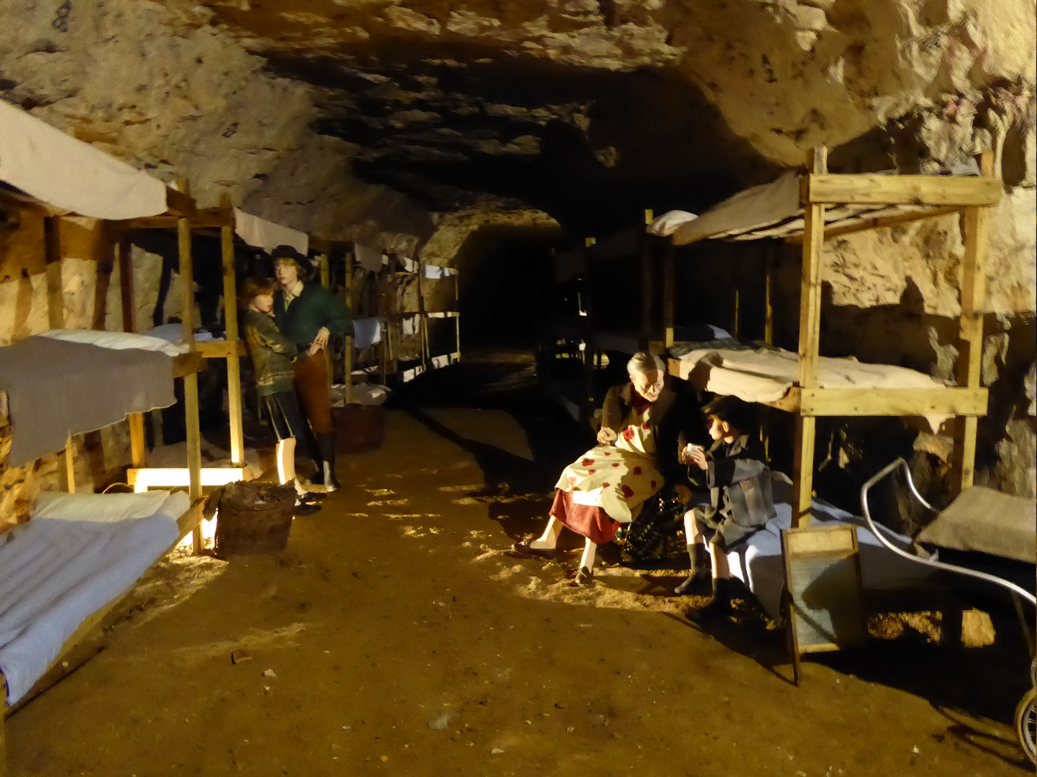
The system runs to roughly 22 miles of intersecting tunnels and chambers on several levels, worked as galleries with chalk pillars left to carry the roof and no artificial support. It divides into three named sections — Druids, Roman and Saxon — names that come from Nichols's 1903 theory rather than from any dated evidence. In the Second World War the tunnels were fitted out as a shelter with electric lighting, lavatories and washing facilities, a chapel, a hospital of seven wards, canteens, a barber's shop, a gymnasium and a dance floor.
Closure
Mining had stopped by about the 1840s, and the workings found a second career almost immediately: by the late 19th century they were already a Victorian tourist attraction.
What remains
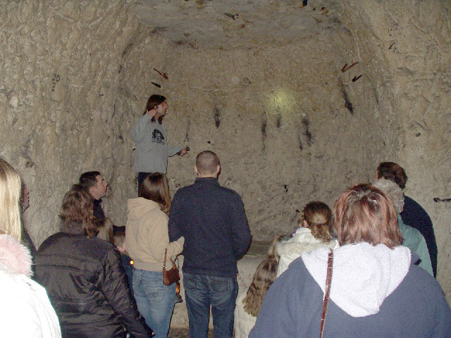
Open to the public and run as a guided-tour attraction, which is why they are among the most visited disused mine workings in Britain. Wartime fittings and the carvings cut into the chalk by shelterers and by later hands remain visible on the tour route.
Little at surface beyond the entrance buildings; the interest is entirely underground.
Redevelopment
From September 1940 until shortly after VE Day the caves housed a shelter population reaching 15,000 at its peak and some 5,000 on an ordinary night, each shelterer paying a penny to come in. A child born underground was christened Cavena Wakeman, a name she later changed to Rose. In the 1950s and 1960s the caves became a music venue, hosting Jimi Hendrix, Pink Floyd, the Rolling Stones and David Bowie, who played there four times.
Related mines
- Marden Mine — James Gardner, owner of Chislehurst Caves, acquired Marden during the Second World War and made part of it a secure bonded store.
What's uncertain
Points where sources disagree or the record could not be settled; both accounts are kept. All open questions in the archive.
- A 9th-century Saxon charter is cited as the earliest mention of the site, with no further reference until about 1232; the earliest documentary evidence of the chalk workings themselves dates to 1737, and mining is thought to have ceased in the 1830s or 1840s. (uncertain) 1
- In 1903 the archaeologist William Nichols proposed that the workings were dug by Druids and extended by Romans and Saxons, and the three sections are still named accordingly on tours. (disputed) 1,3
- Contemporary scholars disputed Nichols's theory, holding that most of the excavation had taken place within the previous two centuries, and the claim remains unverified; an 1862-63 Ordnance Survey map shows the site as a chalk pit with kilns and an engine house. (disputed) 1
Recorded claims
Individual factual claims, each attached to the source(s) that support it below. Where sources disagree, both are kept.
- The system comprises roughly 22 miles (about 35 km) of man-made intersecting tunnels and caverns. 1,2
- Chalk and flint were extracted from at least the 13th century until the early 19th century. 2
- A 9th-century Saxon charter is cited as the earliest mention of the site, with no further reference until about 1232; the earliest documentary evidence of the chalk workings themselves dates to 1737, and mining is thought to have ceased in the 1830s or 1840s. (uncertain) 1
- In 1903 the archaeologist William Nichols proposed that the workings were dug by Druids and extended by Romans and Saxons, and the three sections are still named accordingly on tours. (disputed) 1,3
- Contemporary scholars disputed Nichols's theory, holding that most of the excavation had taken place within the previous two centuries, and the claim remains unverified; an 1862-63 Ordnance Survey map shows the site as a chalk pit with kilns and an engine house. (disputed) 1
- The caves were used as an ammunition store associated with the Royal Arsenal at Woolwich during the First World War, and for mushroom growing in the 1930s. 1,2
- From September 1940 the caves served as an air-raid shelter holding up to 15,000 people, around 5,000 on a typical night, each paying a penny; the shelter had electric lighting, lavatories and washing facilities, a chapel, a hospital of seven wards and canteens, and closed shortly after VE Day. 1,2
- A child born in the shelter was christened Cavena Wakeman, later changing her name to Rose. 1
- In the 1950s and 1960s the caves operated as a music venue, hosting Jimi Hendrix, Pink Floyd, the Rolling Stones and David Bowie, who performed there four times. 1,2
- The caves remain open to the public as a guided-tour attraction. 2
Photographs & further reading
Visiting information and the operator's own history, including the Druid, Roman and Saxon section names.
View sourceSources
- (secondary) Chislehurst Caves — Wikipedia
- (secondary) Chislehurst Caves — Subterranea Britannica
- (observational) Chislehurst Caves — history — Chislehurst Caves
Record created: 24 August 2026 · Last researched: 24 August 2026