 MineArchive
Byermoor Colliery
| Location | Byermoor, near Marley Hill and Burnopfield, Tyne and Wear — 54.9089, -1.7069 (approximate) |
|---|---|
| Commodity | Coal |
| Type | Coal |
| Worked | 1860–1968 |
| Maximum depth | Unknown. |
| Operators | Marley Hill Coal Company (1860–?), John Bowes & Partners Ltd (?–1947), National Coal Board (1947–1968) |
Overview
A John Bowes colliery a mile west of Marley Hill, opened by 1860 on the site of an older gin pit, which fed its own 156 beehive coke ovens from the Busty and Brockwell seams and closed in 1968, leaving only the manager's house of its four colliery terraces.
History
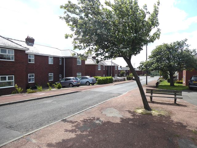
The first Ordnance Survey map shows a coal pit with a gin at Byermoor, and by 1860 Byermoor Colliery had been opened on the site by the Marley Hill Coal Company. Two men were killed when a boiler exploded in January 1862. John Bowes and Partners owned it from the 1880s; in 1894 it worked the Busty and Brockwell seams, raising 500 tons a day with 380 men, and had 156 coke ovens alongside, which were replaced in 1908 when the Bowes by-product plant opened at Marley Hill. Two shifters, William Henderson and James Sylkie, were killed by a fall of post stone while bottom cutting in January 1894. Employment was 470 in 1910 and stayed between 300 and 400 through to the 1960s; the Brass Thill was abandoned in 1938, and under the National Coal Board the pit worked the Brockwell, Busty, Three Quarter and Tilley. It closed on 2 February 1968. Its workers lived in four terraces south of the church — Double Row, New Row, Pit Row and Furnace Row — of which only the larger manager's house survives.
Geology
Durham Coal Measures: the Busty and Brockwell seams throughout, with the Brass Thill (to 1938), Three Quarter and Tilley.
Workings
A shaft colliery on the site of an earlier gin pit, with 156 beehive coke ovens alongside until 1908.
Closure
Closed on 2 February 1968.
What remains
The colliery and its four terraces have gone apart from the former manager's house; the site of a colliery reservoir holds small industrial units, and council houses of 1920-22 stand north of the church.
The former colliery manager's house.
Redevelopment
Small industrial units on the reservoir site.
Related mines
- Marley Hill Colliery — Both John Bowes collieries a mile apart; the 1908 Marley Hill by-product plant replaced Byermoor's coke ovens.
Nearby mines
- Burnopfield Colliery — 1.8 km SW, County Durham
- Marley Hill Colliery — 1.9 km E
- Lintz Colliery — 3.2 km W, County Durham
- West Stanley Colliery — 3.9 km S, County Durham
- Beamish Colliery — 4.2 km SE, County Durham
Straight-line distance, within 15 km. Show on the map.
Recorded claims
Individual factual claims, each attached to the source(s) that support it below. Where sources disagree, both are kept.
- A coal pit with a gin is shown on the first edition OS map; by 1860 Byermoor Colliery had opened; opened by the Marley Hill Coal Company, later John Bowes & Partners Ltd and from 1947 the NCB; Busty and Brockwell seams, 500 tons a day in 1894, 156 coke ovens; closed 2 February 1968. 1
- Byermoor colliery occupied the area south of the church until 1968, with four terraces — Double Row, New Row, Pit Row and Furnace Row; only the former colliery manager's house survives. 2
- Employment was 297 in 1894, 470 in 1910, 305 in 1947 (116,000 tons) and 372 in 1964. 3
- James Hunter and John Robson were killed by a boiler explosion on 8 January 1862; William Henderson and James Sylkie, shifters, by a fall of post stone on 16 January 1894. 3
Photographs & further reading
Historic environment record: gin pit origins, owners, seams, coke ovens and closure date.
View sourceSources
- (primary) Byermoor Colliery (HER 3694) — Tyne and Wear HER (Sitelines)
- (secondary) Byermoor — Wikipedia
- (secondary) Durham Mining Museum - Byermoor Colliery — Durham Mining Museum
Record created: 21 September 2026 · Last researched: 21 September 2026