 MineArchive
Bury St Edmunds Chalk Mines
| Also known as | Horringer Court Caves, Mount Road chalk mine |
|---|---|
| Location | East, west and central Bury St Edmunds, Suffolk — 52.2430, -0.7250 (approximate) |
| Commodity | Chalk |
| Type | Mineral |
| Worked | Medieval–by the early 1870s |
| Maximum depth | Unknown. Deep enough to require mining rather than open pits. |
Overview
Chalk mines under Bury St Edmunds, east, west and in the middle of the town, dug to feed the lime that mortared its buildings — the eleventh-century abbey among them, built of flint encased in limestone and bonded with lime mortar. The town’s oldest documented limekiln dates from 1489; the workings that fed them were no longer in use by the early 1870s. Their legacy came due in the 1960s: the Jacqueline Close estate, built in 1964 over Victorian chalk mines, began to collapse within a few years, was evacuated, and all but two of its houses were demolished in 1981.
History
Bury St Edmunds was built on lime. Its eleventh-century abbey — one of the richest and most powerful Benedictine houses in England and among the largest in Europe — was built of flint encased with limestone and bonded with lime mortar, and the chalk to make that lime had to be mined deeply rather than merely dug, which is why there are chalk mines east, west and in the centre of the town. The town’s oldest documented limekiln stands in St Andrew’s Street South and dates from 1489; limekilns are recorded on various sites on the Warren map of 1791, and one kiln — possibly now the only one left in Suffolk — was used as an air-raid shelter in the Second World War. By the early 1870s the workings running out from the large pits were no longer in use. The bill arrived a century later. In 1964 the Jacqueline Close housing development was built on the site of Victorian chalk mines. The ground began to collapse within a few years, the homes were evacuated, an inquiry in 1976 came to nothing much, and in 1981 all the houses but two were demolished.
Geology
The Upper Chalk of west Suffolk, with the flint that goes with it. The combination is what built the town: flint for the facing, chalk burnt for the lime that held it together. The chalk near the surface was taken in open pits; the better stone lay deeper, which is what turned the pits into mines and left the tunnels that later gave way.
Workings
Tunnels radiating from large chalk pits. The caves off Mount Road run to about 200 metres of tunnel radiating from a chalk pit that also contains a disused lime kiln; the Horringer Court caves comprise over 500 metres of chalk mines behind five grilled entrances. Limekilns stood at the pit heads, the oldest documented one dating from 1489.
Closure
By the early 1870s the workings running out from the large pits were no longer in use. What followed was not closure so much as forgetting: the mines were built over, and it was subsidence rather than any record that revealed where they ran.
What remains
The mines survive underground and are gated. About 200 metres of tunnel radiate from the chalk pit off Mount Road, which also holds a disused lime kiln, and the Horringer Court caves run to over 500 metres behind five grilled entrances. Above ground, the site of Jacqueline Close is largely empty: all but two of the 1964 houses were demolished in 1981 after the ground beneath them collapsed.
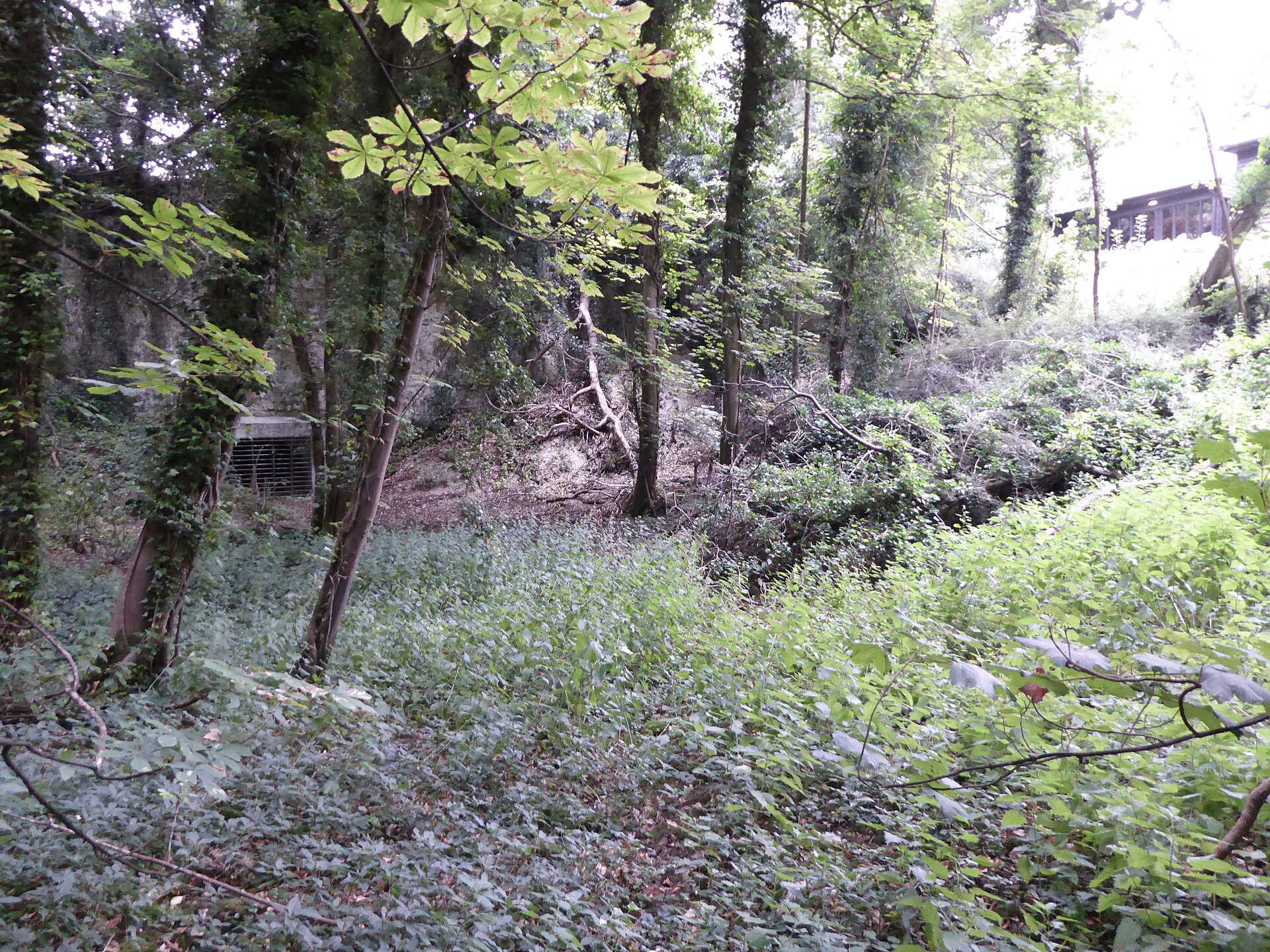
A limekiln of 1489 in St Andrew’s Street South, a disused lime kiln in the Mount Road chalk pit, and the grilled entrances to the Horringer Court caves.
Related mines
- Norwich Chalk Mines — The two East Anglian cathedral towns solved the same problem the same way: no local freestone, so flint for the walling and mined chalk burnt for the lime that bound it — and both are now undermined by the workings, Norwich losing a bus into Earlham Road in 1988 and Bury St Edmunds an entire housing estate at Jacqueline Close.
Nearby mines
- Irchester Ironstone Quarries — 3.8 miles (6.1 km) NE, Northamptonshire
- Wembley Ironstone Quarry — 3.9 miles (6.2 km) NE, Northamptonshire
- Wellingborough Ironstone Quarries — 6.4 miles (10.2 km) NE, Northamptonshire
- Irthlingborough Ironstone Mine — 6.8 miles (11.0 km) NE, Northamptonshire
- Islip Ironstone Quarry — 8.8 miles (14.2 km) N, Northamptonshire
Straight-line distance, within 9 miles (15 km). Show on the map.
Recorded claims
Individual factual claims, each attached to the source(s) that support it below. Where sources disagree, both are kept.
- The eleventh-century abbey at Bury St Edmunds was built using flint encased with limestone as a bonding agent with lime mortar; the chalk had to be mined deeply, resulting in chalk mines to the east, the west and in the central part of the town. 1
- The town’s oldest documented limekiln is in St Andrew’s Street South and dates from 1489; limekilns are recorded on various sites on the Warren map of 1791, and one — possibly now the only one in Suffolk — was used as an air-raid shelter during the Second World War. 1
- By the early 1870s the workings emanating from the large pits were no longer in use. 1
- The 1964 development of Jacqueline Close was built on the site of Victorian chalk mines; when the land began to collapse a few years later the homes were evacuated, a public inquiry in 1976 proved ineffectual, and in 1981 all the houses save two were demolished. 1
- The chalk caves off Mount Road consist of approximately 200 metres of tunnels radiating from a chalk pit which also contains a disused lime kiln, and the Horringer Court caves encompass over 500 metres of chalk mines with five grilled entrances. 2
Photographs & further reading
Why the town mined its chalk, where the workings run, and what happened to the houses built over them at Jacqueline Close.
View sourceSources
- (secondary) Going underground: the chalk mines of Bury St Edmunds and the tragedy of Jacqueline Close — Suffolk News
- (secondary) Where are the "secret" tunnels and mines under Bury St Edmunds? — Bury Mercury
Record created: 7 September 2026 · Last researched: 7 September 2026