 MineArchive
Batley Colliery
| Location | Batley, Kirklees, West Yorkshire — 53.7186, -1.6355 (approximate) |
|---|---|
| Commodity | Coal |
| Type | Coal |
| Worked | 1854–January 1929 |
| Operators | James Critchley and Sons Ltd (1854–1929, owner) — Owners as Critchley and Co., James Critchley and Sons and James Critchley and Sons Ltd (DMM b369; NMRS 1902 record) |
The Critchley family's colliery at Batley, in the heavy woollen district of West Yorkshire, worked from 1854 until it was abandoned in January 1929, with around 200 to 300 men and gas, household and manufacturing coal from the Middleton seam.
Location
Approximate location. The large pin is this mine; the small round markers are the nearest mines on record. Click one for its page. View on full map
History
Batley Colliery opened in 1854 and appears on the first edition of the six-inch Ordnance Survey map. It was owned by the Critchley family, as Critchley and Co., then James Critchley and Sons and finally James Critchley and Sons Ltd, the owners in 1902. In its first year a boy, John Healey, was killed by an explosion of firedamp.
In 1894 the colliery employed 297 men and sold gas, household and manufacturing coal. The workforce stayed between about 200 and 270 for the next twenty years, working the Middleton seam, and was 190 in 1923. Plans of its Stone Coal workings were abandoned in 1894, and of the Middleton Main, worked with West End colliery, in 1919. Its last deaths were single accidents: a collier crushed between runaway tubs in 1907, and in 1915 a young wheelman drawn into an electric coal-cutting machine. The colliery was abandoned in January 1929.
Geology
Coal Measures of the West Yorkshire coalfield: the Middleton seam, with the Stone Coal and Black Coal in older workings.
Workings
A shaft colliery; electric coal-cutting machines were in use by 1915.
Closure
Abandoned in January 1929.
What remains
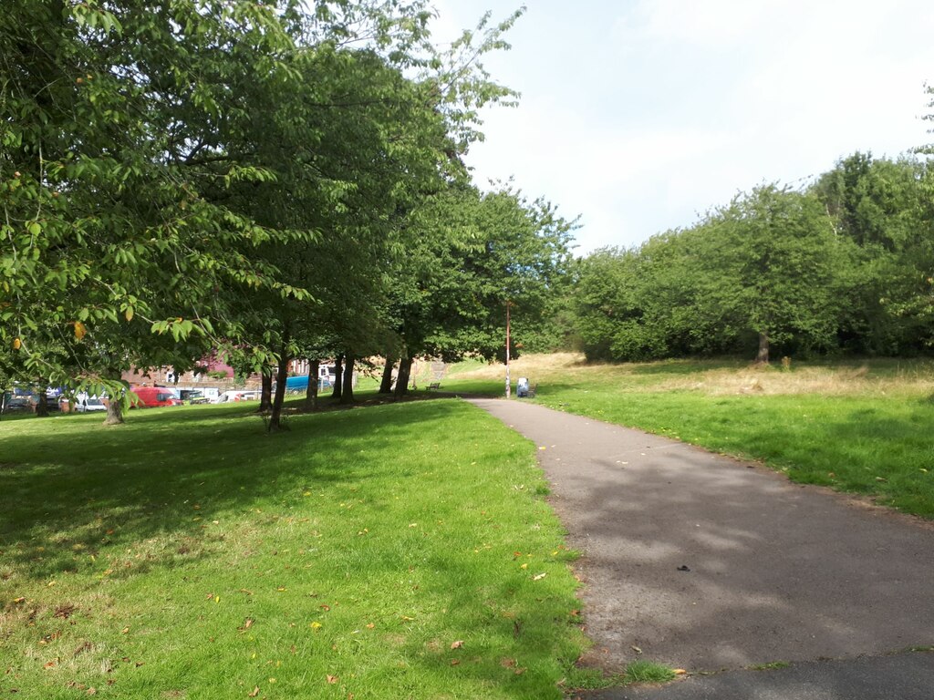
The site is parkland with a cycleway running through it; after the Second World War it was used as a foundry.
Redevelopment
Used as a foundry after the Second World War, and now parkland with a cycleway.
Nearby mines
- Howley Park Colliery — 0.7 miles (1.1 km) NE
- Soothill Wood Colliery — 0.8 miles (1.3 km) E
- White Lea Colliery — 1.4 miles (2.2 km) W
- Chidswell Colliery — 1.5 miles (2.4 km) SE
- Conyers Colliery — 1.9 miles (3.0 km) SW
Straight-line distance, within 9 miles (15 km). Show on the map.
Further reading
The Northern Mine Research Society's list of Yorkshire coal mines beginning with B, with working dates and abandonment notes.
View sourceSources
- (secondary) Coal Mines in Yorkshire 1854: B — Northern Mine Research Society
- (primary) Batley Colliery (Durham Mining Museum) — Durham Mining Museum
- (observational) Site of Batley Colliery (Geograph 7879107, Stephen Craven) — Geograph
- (secondary) NMRS mining deaths database: Batley, September 1902 — Northern Mine Research Society
- (primary) BGS mine plan: BATLEY, Stone Coal, abandoned 1894 — British Geological Survey
- (primary) BGS mine plan: BATLEY & END WEST, Middleton Main, abandoned 1919 — British Geological Survey
Record created: 5 November 2026 · Last researched: 6 November 2026