 MineArchive
Bampfylde Mine
| Also known as | North Molton Copper Mine, Poltimore Mine, Prince Regent Mine, Westwood Mine |
|---|---|
| Location | North Molton, on the River Mole, Devon — 51.0403, -3.7986 (approximate) |
| Commodities | Copper, Iron, Manganese |
| Type | Metal |
| Worked | c.1420-1530 (medieval)–1885 |
| Operators | Poltimore Copper and Gold Mining Co (1852–1855), North Devon Mining Co (1873–1885) |
Overview
A copper (later also iron and manganese) mine on the River Mole near North Molton, worked intermittently from the medieval period into the 1880s and notable for a rare surviving late-19th-century ore-processing complex with the remains of at least five waterwheel pits.
History
Copper working in North Molton is documented as early as 1346 and again c.1528, and radiocarbon dating of copper slag from the site gives a most probable date of 1420-1530, making Bampfylde significant evidence for early smelting practice in England. By 1698 the mine comprised three lodes running northeast to southwest, worked by hand-hoisted baskets, with ore carried by packhorse to Barnstaple. In 1696-1698 more than 4,500 tons of high-grade (30-40%) copper ore was raised. The Bristol Company operated two works either side of the River Mole from 1725, installing a 30-foot waterwheel, and output through 1724-1773 averaged around 45 tons of ore a month. The mine was reopened under Richard Bampfylde in 1764 but had ceased working again before 1778.
It was briefly reopened around 1802-1815 without lasting success, then again in 1852 by William Washington Mansell as the Poltimore Copper and Gold Mining Co, prompted by the known presence of gold within the copper lodes; gold working proved uneconomic and had failed by 1855, and the site continued as the Bampfylde Copper Mining Co. A new company reorganisation followed in 1856. Output through this period was modest at first (15 tons of ore in 1852, 8 tons in 1855) before rising to 1,808 tons over 1856-1863; across 1856-1880 the mine raised a total of 5,124 tons of copper ore averaging 14.5% grade. No. 3 Shaft reached 70 fathoms and No. 1 Shaft 60 fathoms; a 1772 plan shows workings to a maximum depth of around 360 feet, and by 1862 the mine was described as approximately 80 fathoms deep.
From the 1870s the operation diversified into iron and manganese: a jigging machine and picking table were installed in 1870, a tramway built in 1873, and a dedicated crusher house (now Grade II listed) put up specifically to crush iron ore, the only known 19th-century example of its kind. Between 1873-1875 and 1879-1882 the mine raised 7,118 tons of iron ore and, in 1873-1875, 86 tons of manganese ore. Copper production ceased in 1880 and the mine, by then trading as the North Devon Mining Co, closed for good in 1885; buildings were dismantled by 1888 and Hands Shaft infilled the same year, with the remaining structures recorded as roofless by 1903.
Geology
Copper, and later iron and manganese, in three lodes running north-east to south-west by the River Mole. The copper raised in 1696-98 was high grade, between 30 and 40 per cent.
Workings
Three principal east-to-west lodes flank the River Mole, worked via several named shafts (Hands Shaft, No. 4 Shaft, Engine Shaft, Bampfylde Shaft) and adits driven to relieve water build-up; when reopened in 1852 the workings comprised an adit 81 fathoms long plus two shafts, the shallower one 10 fathoms deep and drained by a 25-foot waterwheel. The wider site is best known for its water-management system: leats fed water from the north and northeast to at least five separate wheelpits powering pumping, crushing and ore-dressing machinery, an unusually complete survival for a mine of this size.
Closure
Copper working ended in 1880 as the lodes were worked out at reasonable depth; the site struggled on as an iron and manganese producer under the North Devon Mining Co before finally closing in 1885. Surface buildings were dismantled by 1888.
What remains
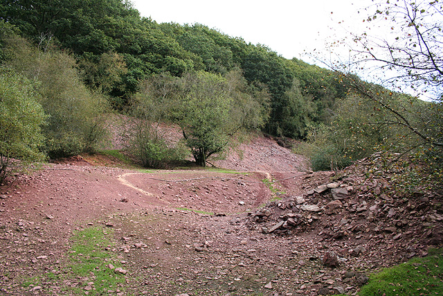
Substantial remains survive along the Mole valley: stonework at several shaft and adit entrances, the Grade II listed crusher house (internally 4.5m by 3.5m, standing 5.2m high) with its associated 9.5m wheelpit, a second wheelpit and ancillary structure from the 1870s ironworking, spoil tips, ruined ancillary buildings and foundation platforms. The site was surveyed by the West Somerset Mineral Railway Association in March 2020 and is recorded by Exmoor National Park's Historic Environment Record as Principal Archaeological Landscape 45 (Bampfylde and New Florence Mines).
Nearby mines
- Wheal Eliza — 6.7 miles (10.8 km) NE, Somerset
Straight-line distance, within 9 miles (15 km). Show on the map.
Recorded claims
Individual factual claims, each attached to the source(s) that support it below. Where sources disagree, both are kept.
- Radiocarbon dating of copper slag from the site gives a most probable (80%) date of 1420-1530. 1
- Reopened in 1852 by William Washington Mansell as the Poltimore Copper and Gold Mining Co, later worked under Charles Henage as the Poltimore Gold Mine. 2
- 5,124 tons of copper ore averaging 14.5% grade were raised between 1856 and 1880. 2
- 7,118 tons of iron ore were raised across 1873-1875 and 1879-1882, alongside 86 tons of manganese ore in 1873-1875. 2
- The surviving crusher house is described as the only known 19th-century example built specifically to crush iron ore. 1
- The mine, latterly trading as the North Devon Mining Co, closed in 1885; buildings were dismantled and Hands Shaft infilled by 1888. 1
Sources
- (primary) MDE1219 - Bampfylde Copper and Iron Mine, North Molton — Exmoor National Park Historic Environment Record
- (secondary) Mining in Devon Database - Bampfylde Mine, Devon — Devon in Focus
Record created: 26 August 2026 · Last researched: 26 August 2026