 MineArchive
Stankards No. 1 Pit
| Also known as | Stankards No. 45 Mine |
|---|---|
| Location | Stankards, by Uphall, West Lothian, beside the former Uphall Oil Works, West Lothian — 55.9240, -3.4978 (approximate) |
| Commodity | Oil Shale |
| Type | Mineral |
| Worked | About 1866–1912 |
| Maximum depth | 24 fathoms (about 44 m) |
| Operators | Uphall Mineral Oil Company (1866–1873, owner) — Uphall Mineral Oil Co., later Ltd, owner of No. 1 (Scottish Shale); start year approximate Young's Paraffin Light and Mineral Oil Company (?–1912, owner) — Owner of No. 1 after the Uphall company and of No. 45, about 1910 to 1912 (Scottish Shale) |
A shale pit at Stankards by Uphall, sunk beside the Uphall Oil Works about 1866 and worked out by 1873, whose workings were reopened briefly by the No. 45 incline before abandonment in 1912.
Location
Approximate location. The large pin is this mine; the small round markers are the nearest mines on record. Click one for its page. View on full map
History
Stankards No. 1 was a shale pit at Stankards, by Uphall in West Lothian, sunk close to the Uphall Oil Works, which opened in about 1866; it was presumably one of the first pits to supply them. It was a vertical shaft to the Broxburn Shale, given as 24 fathoms deep. In December 1871 a visitor's account in the Scotsman described a steam engine constantly at work hauling shale from 27 fathoms, 120 to 130 tons a day. The pit belonged to the Uphall Mineral Oil Company, later the Uphall Mineral Oil Co. Ltd, and then to Young's Paraffin Light & Mineral Oil Co. Ltd.
By 1873 its reserves were exhausted and the pit was abandoned, and the works' shale then came by mineral railway from Forkneuk, about a mile to the north. Some surface buildings lasted into the 1890s: the Ordnance Survey of about 1895 shows the shaft and small buildings, apparently out of use. After that the site was buried by the advancing bing of the oil works.
In about 1910 Young's reopened the old workings from a new inclined mine, Stankards No. 45, driven at 1 in 4. It did not last: workings in the Upper Broxburn, Broxburn and Grey shales were abandoned in 1912. The shales of the Stankards basin were also worked from Roman Camp No. 4 Mine.
Geology
Oil shale of the Broxburn shale-field, in the small Stankards basin: the Broxburn Shale, with the Upper Broxburn and Grey shales recorded on the abandonment plan.
Workings
No. 1 was a vertical shaft about 24 fathoms deep with a steam winding engine; an air shaft shown on the Ordnance Survey of about 1897 presumably served it. No. 45, of about 1910, was an inclined mine driven at 1 in 4 into the same reserves.
Closure
No. 1 was abandoned in 1873 when its reserves ran out. No. 45 worked only from about 1910 to about 1912, and the workings were abandoned in 1912.
What remains
The site of No. 1 is waste ground and an industrial yard. No. 45 lies under the landscaped bing of the Uphall Oil Works, with no trace of its surface features.
None recorded.
Redevelopment
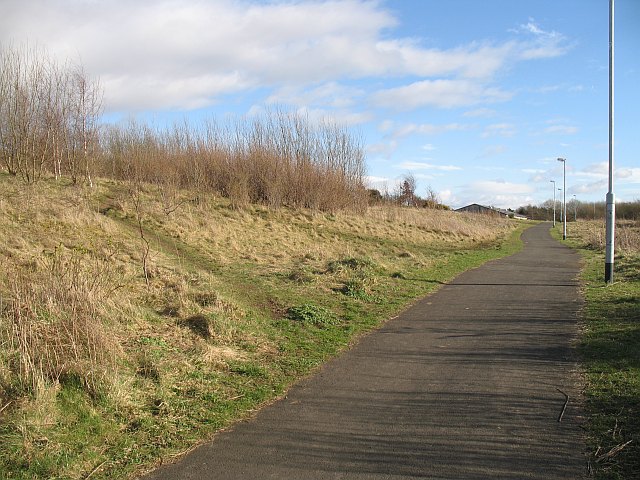
The oil works bing that buried both sites has been landscaped and is crossed by a cycle path.
Related mines
- Hillend Coal Pit — Both were worked by the Uphall Mineral Oil Company near Uphall, Hillend for fuel and Stankards for shale for its oil works.
- Roman Camp No. 4 Pit — Both worked the shales of the small Stankards basin near Uphall.
Nearby mines
- Roman Camp No. 4 Pit — 0.1 miles (0.2 km) N
- Holmes Mine — 0.6 miles (0.9 km) SE
- Roman Camp No. 3 Mine — 0.6 miles (1.0 km) SE
- Pumpherston No. 4 Mine — 0.8 miles (1.3 km) S
- Roman Camp No. 1 Mine — 0.8 miles (1.3 km) SE
Straight-line distance, within 9 miles (15 km). Show on the map.
Further reading
The oil works that Stankards No. 1 was sunk to supply, and where its shale went.
View sourceSources
- (secondary) Stankards No.1 pit (Scottish Shale) — Scottish Shale
- (secondary) Uphall Oil Works (Scottish Shale) — Scottish Shale
- (secondary) Stankards No.45 mine (Scottish Shale) — Scottish Shale
- (primary) BGS / Mining Remediation Authority mine plan 21918371: Stankards No. 1 and 45, Upper Broxburn and Broxburn Grey shales, abandoned 1912 — British Geological Survey
Record created: 5 November 2026 · Last researched: 9 November 2026