 MineArchive
Stacksteads Colliery
| Location | Stacksteads, Rossendale, Lancashire — 53.7010, -2.2234 (approximate) |
|---|---|
| Commodity | Coal |
| Type | Coal |
| Worked | By 1894–c. 1946 |
| Maximum depth | Unknown. |
Overview
A small Rossendale colliery at Stacksteads, near Bacup, working the Mountain mines through its Hill and Top pits with about fifty men until it closed on the eve of nationalisation.
History
Stacksteads Colliery lay at Stacksteads, near Bacup in Rossendale, one of the small pits of the Rossendale coalfield. It was worked through two pits: the Hill Pit, working the Upper Mountain mine for manufacturing coal, and the Top Pit, working the Lower Mountain for household and manufacturing coal, an arrangement that reversed by 1915.
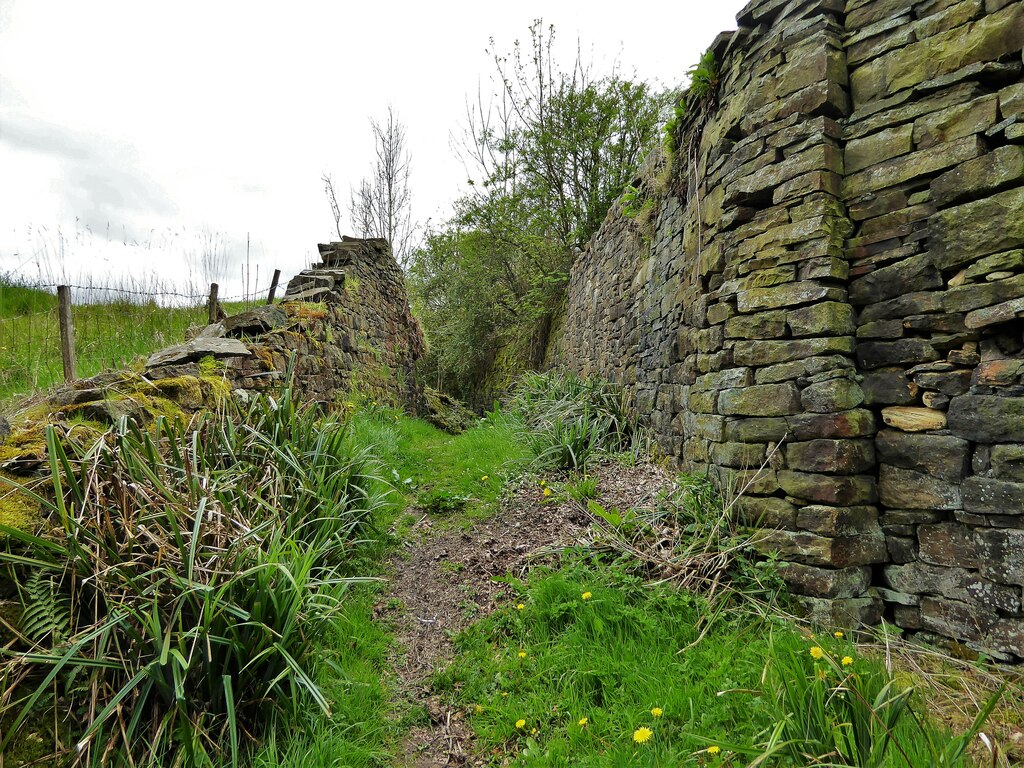
It was a small and steady concern. The main pit employed 48 men in 1894 and between 45 and 55 for the next thirty years, with the Top Pit growing from 7 men to 20 by 1923; in 1933 the two employed 32 and 17, and in 1940 the main pit 25. Stacksteads Colliery closed on the eve of nationalisation, leaving Grimebridge, Nabb, Old Meadows and Deerplay as the Rossendale pits taken over by the National Coal Board in January 1947. Plans of the Stacksteads and Top workings are dated 1945 and 1946. A tramway carried its coal to staithes on Booth Road; the site of its overbridge near Honey Hole can still be traced.
Geology
The Upper Mountain and Lower Mountain mines (seams).
Workings
The Hill Pit and the Top Pit.
Closure
Closed on the eve of nationalisation; abandonment plans are dated 1945 and 1946.
What remains
The walled course of the tramway to the Booth Road coal staithes, at the site of its overbridge near Honey Hole.
Related mines
- Grimebridge Colliery — Grimebridge's roads were driven through to connect with Stacksteads Colliery.
Nearby mines
- Grimebridge Colliery — 1.5 miles (2.4 km) N
- Old Clough Colliery — 1.8 miles (2.9 km) NE
- Nabb Colliery — 2.1 miles (3.3 km) N
- Deerplay Colliery — 2.6 miles (4.1 km) NE
- Hill Top Colliery — 3.0 miles (4.8 km) NE
Straight-line distance, within 9 miles (15 km). Show on the map.
Recorded claims
Individual factual claims, each attached to the source(s) that support it below. Where sources disagree, both are kept.
- Stacksteads Colliery worked through the Hill Pit and the Top Pit, in the Upper and Lower Mountain seams. 1
- Stacksteads employed 48 men in 1894 and 25 in 1940; its Top Pit had 20 men in 1923. 1
- Stacksteads colliery closed on the eve of nationalisation. 2
- Abandonment plans of Stacksteads are dated 1945 and 1946. 3
- A tramway ran from Stacksteads Colliery to coal staithes on Booth Road. 4
Sources
- (primary) Stacksteads Colliery — Durham Mining Museum
- (secondary) Old Clough Colliery 1834-1935 — Northern Mine Research Society
- (primary) BGS / Mining Remediation Authority mine plan 21937133: Stacksteads, abandoned 1946 — British Geological Survey
- (observational) Site of tramway overbridge, Stacksteads (photograph) — Geograph Britain and Ireland
Record created: 21 October 2026 · Last researched: 21 October 2026