 MineArchive
Saltwells Wood Coal Workings
| Also known as | Saltwells Wood |
|---|---|
| Location | Netherton, Dudley, West Midlands — 52.4800, -2.0971 (approximate) |
| Commodity | Coal |
| Type | Coal |
| Worked | From at least the 1300s–1960s |
| Maximum depth | Unknown. Shallow outcrop, bell-pit and shaft working. |
Overview
Medieval and later coal workings in Saltwells Wood at Netherton, in the heart of the Black Country: outcrop scrapes, closely set bell pits and larger shaft mounds with gin circles, scheduled in 2002. The salt water that gave the place its name welled up in the mine workings, and was still being bathed in for its supposed cures in the 19th century.
History
Coal and iron extraction is recorded around Saltwells from at least the 1300s, and working went on here in one form or another until the second half of the 20th century. The salt springs are the earliest thing written down: in his Natural History of Staffordshire of 1686 Robert Plot described a weak brine on Pensnett Chase belonging to Edward, Lord Ward, who had tried and abandoned making salt from it. The brine welled up in the mine workings, and in the 19th and early 20th centuries people came to bathe in the water for cutaneous complaints; a topographical dictionary of 1833 records the Spa Well in Lady-wood as being in high estimation. The wood itself is an 18th-century plantation, parts of it once called Lady Dudley's Plantation or Lady Wood. Mining left its mark on more than the ground: Netherton Hall, off the Cinderbank road, fell down in 1860 through mining subsidence. Opencast coal working took place on the side of Netherton Hill in the 1960s, and Doulton's Claypit nearby was dug for clay for many years. The coal-mining earthworks in the wood were scheduled in 2002 and the whole area became the first local nature reserve in the West Midlands in 1981.
Geology
The workings are in the South Staffordshire coalfield, the Black Country field whose thick coal was the making of the district. The Brewin's Canal Section within the nature reserve, cut in the canal improvements of 1858, exposes strata from the base of the Coal Measures and is a Site of Special Scientific Interest.
Workings
The earliest phase shows as shallow depressions and hummocks left by working the outcrop, the simplest way of getting coal and the one that follows the seam where it reaches the surface. Alongside them are closely spaced bell pits, each ringed by the spoil thrown out of its shaft: a vertical shaft down to the seam, then coal taken out in all directions until the unsupported roof threatened to come in, which gives the pit its bell-shaped section. Several of the larger shaft mounds have gin circles beside them, the level tracks where a horse walked round to drive winding or pumping gear, and these belong to the post-medieval working. Pit-head gear, ventilation shafts and engine and winding houses are expected to survive as buried remains, and the underground workings themselves are undisturbed.
Closure
Extraction here ran from medieval times to the second half of the 20th century, the last of it the 1960s opencast on the side of Netherton Hill. No date is recorded for the end of the shaft working in the wood itself.
What remains
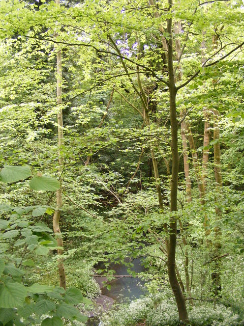
The earthwork and buried remains west of Saltwells House are a scheduled monument, designated in 2002, within Saltwells Local Nature Reserve. Modern paths, surfaces, fences and woodland furniture are excluded from the scheduling, though the ground beneath them is included. The wood is bluebell woodland in spring and Netherton Hill is gorse and grassland.
Shallow depressions and hummocks from outcrop working; closely spaced bell pits with their spoil rings; larger shaft mounds, several with gin circles.
Redevelopment
The site is part of Saltwells Local Nature Reserve, created in 1981, the first local nature reserve in the West Midlands; the wood carries a number of wooden and metal sculptures, the metal ones made from re-used industrial parts.
Nearby mines
- Beech Tree Colliery — 1.9 km S
- Windmill End Colliery — 2.4 km NE
- Brettell Lane Colliery — 2.8 km W
- New Hawne Colliery — 3.2 km SE
- Wren's Nest Limestone Mines — 4.6 km N
Straight-line distance, within 15 km. Show on the map.
Recorded claims
Individual factual claims, each attached to the source(s) that support it below. Where sources disagree, both are kept.
- Coal and iron extraction is recorded in the Saltwells area from at least the 1300s onwards. 1
- The remains include shallow depressions and hummocks from outcrop working, closely spaced bell pits with spoil rings, and larger shaft mounds associated with gin circles. 1
- Robert Plot's Natural History of Staffordshire of 1686 records a weak brine on Pensnett Chase belonging to Edward, Lord Ward, who attempted and abandoned salt making from it. 2
- Netherton Hall fell down in 1860 as a result of mining subsidence. 2
- Opencast coal mining took place on the side of Netherton Hill in the 1960s, and the coal-mining remains in Saltwells Wood were scheduled in 2002. 2
Photographs & further reading
The nature reserve article, which covers the salt springs, the 1960s opencast on Netherton Hill, Doulton's Claypit and the loss of Netherton Hall to subsidence.
View sourceSources
- (primary) Coal mining remains at Saltwells Wood, immediately west of Saltwells House (List entry 1020539) — Historic England
- (secondary) Saltwells Local Nature Reserve — Wikipedia
Record created: 22 September 2026 · Last researched: 22 September 2026