 MineArchive
Pentireglaze Mine
| Also known as | Pentire Glaze Mine |
|---|---|
| Location | Pentire headland, near Polzeath, St Minver, Cornwall — 50.5833, -4.9099 (approximate) |
| Commodities | Lead, Silver |
| Type | Metal |
| Worked | By 1580–1857 |
| Maximum depth | Unknown. |
| Operators | Henry Fowell Stephens (1846–?) |
Overview
A silver-lead mine on Pentire headland near Polzeath, St Minver, mentioned in 1580 and worked off and on until the 1850s, when an engine pumped workings that ran out under the sea. With Pentire mine it produced over 1,000 tons of lead ore and 19,000 ounces of silver; work stopped in 1857.
History
Pentireglaze Mine lies on the Pentire headland on the east side of the Camel estuary, three and a half miles north-east of Padstow, in St Minver parish. The silver-lead lode shows in the cliffs east of Pentire Farm. William Carnsew mentioned the mine in 1580, and it was worked sporadically from then on; Pentire mine, on the same headland, was working lead by about 1580.
In the mid nineteenth century Pentireglaze worked an extension of the lode and drove two shafts on a nearby lode of lead and silver, taking the workings out under the sea beyond the headland, where miners said they could hear ships passing overhead. An engine house was built on the cliff top and an engine pumped the levels; in 1846 Henry Fowell Stephens of Egloshayle was its purser and manager. The mine was famous for long needle crystals of cerussite. Production by the Pentire Glaze and Pentire United Silver-Lead Mines stopped in 1857 after several years without output. Between them the headland's mines produced over 1,000 tons of lead ore and 19,000 ounces of silver.
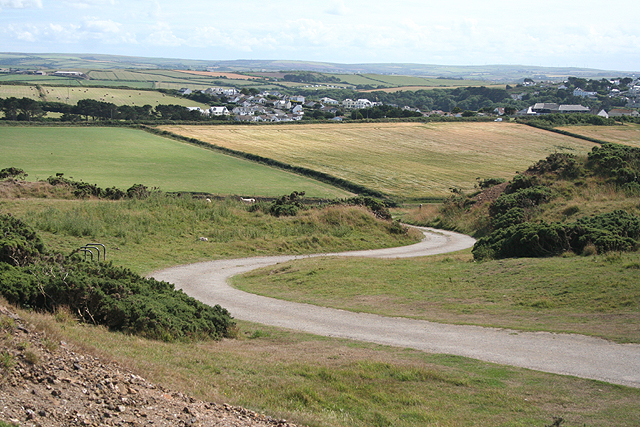
The engine house at Engine Shaft fell into ruin and was demolished about 1957; its site and dumps are now the National Trust's Lead Mines car park.
Geology
A silver-lead lode, visible in the cliffs east of Pentire Farm, extended under the sea; known for fine acicular crystals of cerussite.
Workings
Shafts, now marked by their burrows, a drainage adit from just above sea level, and an engine house on Engine Shaft; workings extended beneath the sea.
Closure
Production ceased in 1857 after several years without output.
What remains
The engine house was demolished about 1957; the site and its dumps are the National Trust's Lead Mines car park, within a geological SSSI.
Shaft burrows and waste dumps around the car park.
Redevelopment
The National Trust's Lead Mines car park.
Nearby mines
- Dria Quarry — 8.1 miles (13.0 km) NE
- Tintagel Slate Quarries — 8.1 miles (13.0 km) NE
- Bagalow Quarry — 8.1 miles (13.1 km) NE
- Lambshouse and Gull Point Quarry — 8.2 miles (13.2 km) NE
- Bowithick Quarry — 8.3 miles (13.4 km) NE
Straight-line distance, within 9 miles (15 km). Show on the map.
Recorded claims
Individual factual claims, each attached to the source(s) that support it below. Where sources disagree, both are kept.
- William Carnsew mentioned the mine in 1580, and it worked sporadically until the 1850s. 1
- Its mid-nineteenth-century workings extended under the sea, where miners reported hearing ships overhead. 2
- Production by the Pentire Glaze and Pentire United Silver-Lead Mines ceased in 1857. 3,2,4
- The headland's mines produced over 1,000 tons of lead ore and 19,000 ounces of silver from the mid nineteenth century. 2
- The engine house was demolished about 1957; the site is now the National Trust's Lead Mines car park. 2,4
- In 1846 Henry Fowell Stephens of Egloshayle was purser and manager. 3
Photographs & further reading
A walk leaflet describing the lode and the mine's remains.
View sourceSources
- (secondary) Cornwall Archaeological Society: guided walk around Pentire and The Rumps — Cornwall Archaeological Society
- (secondary) Wikipedia: Pentire Head — Wikipedia
- (secondary) Cornwall Calling: Pentireglaze lead mines — Cornwall Calling
- (secondary) Albion Fire and Ice: Pentireglaze Mine, Polzeath — Albion Fire and Ice
Record created: 11 October 2026 · Last researched: 11 October 2026