 MineArchive
Northcliffe Colliery
| Location | In and around Northcliffe Woods and the valley of the Northcliffe Dike at Shipley, north-west Bradford, with the later workings towards the Bradford Road end of what is now Northcliffe Park., West Yorkshire — 53.8260, -1.7902 (approximate) |
|---|---|
| Commodities | Coal, Fireclay |
| Type | Coal |
| Worked | By the 1840s–By 1880 |
| Maximum depth | Unknown. |
Overview
A small colliery in the wooded valley of the Northcliffe Dike at Shipley, working the shallow Lower Coal Measures seams and, increasingly, the fireclay beneath them, until the coal and the kilns gave out in the 1870s.
History
Coal was got at Northcliffe long before there was a colliery of that name: a field at the western end of the present park was called Coal Pit Close, the earliest dateable record of extraction is 1741, and North Cliff Pitt was at the end of its life by 1776. The Jackson and Field families, lords of the manors of Shipley and Heaton, worked the mines through agents until about 1840, and in the 1820s John Wilmer Field leased ground near the S-shaped track to Jeremiah Clayton. As the older pits were exhausted the work moved to the Bradford Road end, where a second Coal Pit Close was established by the 1840s and operated by Northcliffe Colliery; the first Ordnance Survey map of Bradford, about 1850, marks it and Heaton Colliery as the two active mines in the area. From about 1847 to 1855 the colliery was run by Edmund and John Cockshott, a Frizinghall farmer and a woolsorter turned worsted manufacturer. Joseph Wright held the lease from 1855 to 1863, took fireclay as well as coal, and added clay works to the colliery title; his open tail, a drift or day hole, shows on the maps. Joseph Cliffe, a Leeds firebrick maker, took over in 1863, worked three mines in Northcliffe Woods and ran the Shipley Fire Clay Company, but the venture ran down and by 1877 the colliery and its kilns had gone. Coal mining at Northcliffe was finished by 1880.
Geology
The three deepest commercial seams of the Lower Coal Measures run through Northcliffe: the Soft Bed, the Hard Bed and the 36 Yard Coal. Below the Hard Bed lies a band of fireclay one to two metres thick, with ganister, a hard fine-grained sandstone that is nearly pure silica.
Workings
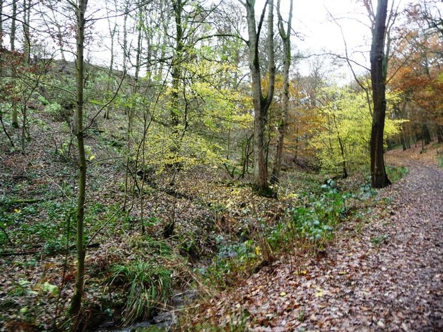
Both shafts and drifts. Shallow shaft mining at the western end of the park probably reached the 36 Yard Coal; adits and day holes run along the valley bottom of Northcliffe Woods on the south side of the Dike, a colliery there being reached by the S-shaped track. Ellis and Beck's Opentail, a drift entrance at the far western end worked between 1861 and 1869 for Soft and Hard Bed coal and fireclay, was still photographed in 1957.
Closure
Joseph Cliffe's venture ran down and by 1877 the colliery and kilns had gone; coal mining at Northcliffe was finished by 1880, though a modest working for coal or fireclay went on for about twenty years more.
What remains
The ground is public park and woodland. Northcliffe Woods and the Norman Rae Playing Fields were given to Shipley Urban District Council by Norman Rae MP and opened as a park in 1920.
Backfilled shafts survive as hollows at the western end, and the Boundary Pits in the upper woods, on the south side before the steps to Heaton Shay, are the most visible mining remains. The course of the Northcliffe Dike has been much altered by mine waste tipped into the valley.
Related mines
- Heaton Colliery — The other active coal mine marked in this part of Bradford on the first-edition Ordnance Survey map, half a mile to the south.
Nearby mines
- Heaton Colliery — 0.5 km SE
- Bramley Fall Quarry — 10.7 km E
Straight-line distance, within 15 km. Show on the map.
Recorded claims
Individual factual claims, each attached to the source(s) that support it below. Where sources disagree, both are kept.
- A second Coal Pit Close was established at the Bradford Road end of what is now Northcliffe Park by the 1840s, operated by Northcliffe Colliery. 1
- The first Ordnance Survey map of Bradford, about 1850, marks Heaton Colliery and Northcliffe Colliery as the two active coal mines in the area, probably working the Soft Bed. 2
- Edmund and John Cockshott ran the colliery from about 1847 to 1855, Joseph Wright from 1855 to 1863, and Joseph Cliffe from 1863. 1
- From about 1850, as the coal proved poor and the yield fell, fireclay became the more profitable product; Joseph Cliffe ran the Shipley Fire Clay Company and worked three mines in Northcliffe Woods. 1
- The Soft Bed, Hard Bed and 36 Yard Coal, the three deepest commercial seams of the Lower Coal Measures, are all present at Northcliffe. 1,2
- By 1877 the colliery and its kilns had gone, and coal mining at Northcliffe was finished by 1880. 1
- The Boundary Pits in the upper woods are the most visible mining remains, and mine waste has greatly altered the course of the Northcliffe Dike. 1
Photographs & further reading
The project's findings on mining in Northcliffe Woods: the seams, the lessees in turn, the shift from coal to fireclay and what can still be seen.
View sourceThe geology of the Bradford coalfield and the collieries shown on the first-edition Ordnance Survey map, Northcliffe among them.
View sourceSources
- (secondary) Northcliffe Heritage Project: Findings - Coal, Fireclay and Stone — Northcliffe Heritage Project
- (secondary) Coal mining around Heaton and Shipley — Bradford Unconsidered Trifles
Record created: 23 September 2026 · Last researched: 24 September 2026