 MineArchive
Markham Colliery, Sirhowy Valley
| Location | Markham, near Blackwood, Caerphilly — 51.7107, -3.2067 (exact) |
|---|---|
| Commodity | Coal |
| Type | Coal |
| Worked | 1910 (sinking)–September 1985 |
| Maximum depth | 615 yards (No. 2 North pit); the No. 1 South pit reached 609 yards. Workings later went down to about 713 yards in the Old Coal. |
| Operators | Markham Steam Coal Company (1910–1915), Tredegar Iron and Coal Company (?–1947), National Coal Board (1947–1985) |
Overview
A deep two-shaft steam-coal colliery in the Sirhowy Valley north of Blackwood, sunk from 1910 and named after Sir Arthur Markham of the Tredegar Iron and Coal Company. It employed over 2,500 men in 1926, was joined underground to Oakdale and closed in September 1985.
History
The Markham Steam Coal Company bought the land and took leases of about 1,400 acres of coal lying between the Tredegar and Oakdale properties, and by 1915 the Tredegar Iron and Coal Company had acquired its whole interest. Sinking of the two shafts began in 1910 (the council's local history and a Geograph place note give 1911), and the colliery and the village built for it from 1913 took their name from Sir Arthur Markham, a director of the Tredegar company. Welsh Coal Mines places the pit near Hollybush.
On 18 May 1912, with the sinking down to the Meadow Vein, firedamp exploded in the north shaft and killed five men, four of them on the surface. The first coal was raised in 1913. Markham was among the first pits in south Wales worked wholly by electric machinery, and Prince Albert visited it in January 1920 as one of the most modern pits in the coalfield. A roof fall killed two timbermen that May. Manpower peaked at 2,591 in 1926; there were 1,360 in 1935 and 1,303 at nationalisation.
Its coal went to the Great Western Railway, and later to British Rail's depot at Old Oak Common for the Paddington expresses, until diesel took that trade; afterwards it was washed at Oakdale and blended into coking coal. An underground road linked Markham and Oakdale in the Second World War in case either was bombed. Markham struck in sympathy disputes in 1924, 1956 and 1959.
In 1979 Markham became part of the Oakdale complex: an 800-yard roadway was driven between the two, its coal was diverted to Oakdale's shafts and its own surface was demolished. After the 1984-85 strike its coalfaces ran into difficulties and heavy losses, and the National Coal Board closed it in September 1985.
Geology
South Wales Coal Measures. The North pit passed the Brithdir seam at 131 yards, the No. 2 Rhondda at 273, the Four-Feet at 478 and the Nine-Feet at 533, reaching the Five-Feet/Gellideg at 598 yards. The colliery worked the Big Vein (Four-Feet), Upper Rhas Las, Yard, Meadow Vein, Three-quarter and Old Coal seams for prime coking and steam coal.
Workings
Two shafts 40 yards apart and 18 feet across, the South pit downcast and the North pit upcast, with 65-foot lattice steel headgears and electric winders. Ventilation was by two 18-foot Waddle fans. From 1979 the coal was carried underground to Oakdale and raised there, with Markham's South pit kept for supplies and men.
Closure
After the 1984-85 strike the pit fell short of its production targets, with poor conditions on the OC7 face and losses of about £30 a tonne by mid-1985. The National Coal Board closed it in September 1985.
What remains
A 2017 aerial video shows the two capped shafts as the only remains, with the buildings and railway gone and the site returning to vegetation.
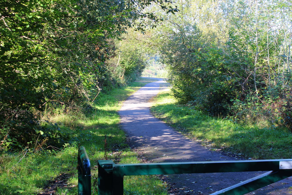
The two capped shafts. The former railway trackbed towards the site carries National Cycle Route 467.
Redevelopment
Plans for a country park on the colliery site were announced in 2009.
Related mines
- Oakdale Colliery — Both Tredegar Iron and Coal Company pits; joined underground in the Second World War, and from 1979 Markham's coal was raised at Oakdale.
Nearby mines
- Rhoswen Colliery — 1.0 miles (1.6 km) SE
- Elliot Colliery — 1.3 miles (2.1 km) W
- Manmoel Colliery — 1.3 miles (2.1 km) SE
- New Tredegar Colliery — 1.5 miles (2.5 km) W
- Bargoed Colliery — 1.6 miles (2.6 km) SW
Straight-line distance, within 9 miles (15 km). Show on the map.
Disasters & major incidents
-
Markham Colliery shaft explosion, 1912
18 May 1912 · Explosion · 5 fatalities
Gas exploded in the north sinking shaft at Markham Colliery on the afternoon of Saturday 18 May 1912, killing five sinkers and surface men and throwing the two-ton shaft bowk fifty yards. -
Markham Colliery roof fall, 1920
12 May 1920 · Collapse / Roof Fall · 2 fatalities
A fall of between 100 and 200 tons of roof at Markham Colliery in May 1920 killed two timbermen who were securing ground after an earlier fall.
What's uncertain
Points where sources disagree or the record could not be settled; both accounts are kept. All open questions in the archive.
- Markham Colliery was sunk in 1911 by the Markham Steam Coal Company. (disputed) 2,3
- The colliery closed in 1986. (disputed) 3,6
Recorded claims
Individual factual claims, each attached to the source(s) that support it below. Where sources disagree, both are kept.
- Sinking of the two shafts began in 1910 and the first coal was raised in 1913. 1
- Markham Colliery was sunk in 1911 by the Markham Steam Coal Company. (disputed) 2,3
- The colliery and village were named after Sir Arthur Markham, a director of the Tredegar Iron and Coal Company. 2,3
- By 1915 the Tredegar Iron and Coal Company had acquired the Markham Steam Coal Company's interest in the leases of 1,400 acres of coal. 1
- The No. 1 (South) pit was 609 yards deep and the No. 2 (North) pit 615 yards, both sunk to the Old Coal seam. 1
- The colliery employed 2,591 men in 1926, its peak. 1
- On 18 May 1912 an explosion of gas in the north sinking shaft killed five men. 4,1
- Two timbermen were killed by a large fall of roof in May 1920. 1,5
- In 1979 Markham was linked underground to Oakdale Colliery and its coal raised there. 1
- The National Coal Board closed Markham Colliery in September 1985. 2,1
- The colliery closed in 1986. (disputed) 3,6
- In 2017 the two capped shafts were all that remained of the colliery. 6
Photographs & further reading
Ray Lawrence's history of the colliery: shafts, seams, managers, manpower and output year by year, and the 1979 link to Oakdale.
View sourceDrone footage of the colliery site in 2017, showing the two capped shafts and the ground returning to woodland.
View sourceSources
- (secondary) Markham Colliery — Northern Mine Research Society
- (secondary) Upper Sirhowy Valley Community Woodlands: history — Caerphilly County Borough Council
- (observational) Rough track across tunnel to site of former mine, Markham (photograph and place note, 2016) — Geograph
- (secondary) 1912 (fatalities by date) — Welsh Coal Mines
- (secondary) Welsh Coal Mines fatalities, 1920 — Welsh Coal Mines
- (observational) Markham Colliery, near Blackwood South Wales - May 2017 (aerial video) — YouTube (UAV PAP)
- (primary) MARKHAM [old county OS sheets], Four Feet seam: mine plan catalogue entry — British Geological Survey / Mining Remediation Authority
Record created: 8 October 2026 · Last researched: 8 October 2026