 MineArchive
Knockmurton Mine
| Also known as | Knock Murton Mine |
|---|---|
| Location | Knock Murton (Murton Fell), Murton township, Lamplugh parish, Cumbria — 54.5543, -3.4049 (approximate) |
| Commodity | Iron |
| Type | Iron |
| Worked | c. 1853–June 1914 |
| Maximum depth | 100-fathom level (183 m), worked from Kelton No. 3 Pit |
| Operators | William Baird & Company (1869–1914) |
Overview
A haematite mine in the Skiddaw Slate of Knock Murton, east of Lamplugh, worked by William Baird & Co from 1869 with its neighbour on Kelton Fell and served by Baird's own mineral railway from Rowrah; abandoned in June 1914.
History
Knockmurton took its name from the hill of Knock Murton, east of Lamplugh, above the Cogra Moss reservoir on the western edge of the Lake District fells. Prospecting for iron ore around Kelton was first recorded in 1853, and by 1869 William Baird & Co. of Glasgow had established mines with three shafts, one at Knockmurton and two on Kelton Fell. John Postlethwaite, writing in 1877, counted the Kelton Fell and Knockmurton veins the most valuable yet found in the Skiddaw Slate, called Knockmurton the older of the two, worked almost continuously for about sixty years, and gave their greatest level as about 240 fathoms long and their greatest depth as about 56 fathoms.
To carry the ore Baird built the Rowrah and Kelton Fell Railway, opened in January 1877 at a cost of £25,000 from Rowrah to Knockmurton. Output from the two mines together rose from 14,435 tons in 1872 to about 30,000 tons in 1877 and 46,100 tons in 1888, and was 27,160 tons in 1909; in 1902 they employed 141 men, 121 of them underground. Knockmurton was abandoned in June 1914. The mine was reworked in the 1920s, and it is also recorded as closing about 1920; the railway that served it closed in 1926.
Geology
North-west to south-east veins of haematite in the Skiddaw Slate, hading north-east, the ore lying in lenticular bunches from a few inches up to 23 feet wide.
Workings
Levels driven into the hill at several heights, including No. 9 (High Bottom) Level and the Cogra Moss Adit about 200 feet below it, on several numbered veins; a shaft at No. 1 Pit; deeper workings reached from Kelton No. 3 Pit at the 75- and 100-fathom levels.
Closure
Abandoned in June 1914; reworked in the 1920s. Its railway closed in 1926 and the track was lifted in 1934.
What remains
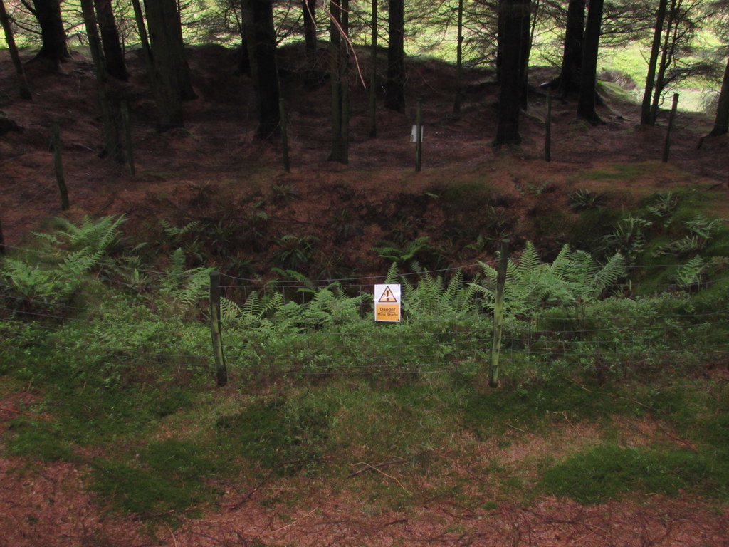
The site lies in conifer forest on Knock Murton; the levels are partly collapsed and flooded, and the shaft of No. 1 Pit survives in the woods.
The shaft of No. 1 Pit, level entrances and spoil, and the traceable line of the Rowrah and Kelton Fell Railway.
Redevelopment
Conifer plantation.
Nearby mines
- Barbara Pit, Kirkland — 1.2 miles (2.0 km) W
- Frizington Iron Mines — 2.9 miles (4.6 km) W
- Eskett Pit — 3.0 miles (4.8 km) SW
- Mowbray Mine — 3.6 miles (5.9 km) SW
- Crossgill Mine — 3.8 miles (6.1 km) W
Straight-line distance, within 9 miles (15 km). Show on the map.
What's uncertain
Points where sources disagree or the record could not be settled; both accounts are kept. All open questions in the archive.
- Knockmurton mine was abandoned in June 1914. (disputed) 5,6
- Knockmurton mine closed about 1920. (disputed) 3
Recorded claims
Individual factual claims, each attached to the source(s) that support it below. Where sources disagree, both are kept.
- Prospecting around Kelton began in 1853, and by 1869 William Baird & Co. had established mines with three shafts, one of them at Knockmurton. 1,2
- The Kelton Fell and Knockmurton veins were the most valuable haematite veins found in the Skiddaw Slate, with ore in bunches up to 23 feet wide. 1
- Kelton and Knockmurton mines together produced 14,435 tons of ore in 1872, 46,100 tons in 1888 and 27,160 tons in 1909. 1
- The Rowrah and Kelton Fell Railway, opened in 1877, was built by William Baird & Co. to carry ore from the Kelton Fell and Knockmurton mines. 2,3,4
- In 1902 Knockmurton and Kelton mines employed 141 men, 121 below ground and 20 on the surface. 5
- Knockmurton mine was abandoned in June 1914. (disputed) 5,6
- Knockmurton mine closed about 1920. (disputed) 3
- No. 9 Level, originally the High Bottom Level, is linked by a shaft on the vein to the Cogra Moss Adit about 200 feet below. 4,7
- Knockmurton workings were reached from Kelton No. 3 Pit at the 75- and 100-fathom levels. 8
Sources
- (secondary) Kelton and Knockmurton Mines, Lamplugh — Old Cumbria Gazetteer (Lakes Guides)
- (secondary) Kelton Iron Ore Mine — Co-Curate, Newcastle University
- (secondary) Rowrah and Kelton Fell Railway — Wikipedia
- (observational) Knockmurton (logbook, 22 June 1985) — Cumbria Amenity Trust Mining History Society
- (secondary) Iron Ore Mining on Muron Fell — Co-Curate, Newcastle University
- (secondary) Blake Fell — Wikipedia
- (observational) Knockmurton Revisited (logbook, 4 December 1988) — Cumbria Amenity Trust Mining History Society
- (primary) BGS mine plan: Knockmurton Mines workings by Kelton No.3 Pit at the 100 fathom level in Lord Lonsdale's royalty — British Geological Survey / Mining Remediation Authority
Record created: 19 October 2026 · Last researched: 19 October 2026