 MineArchive
Gasswater Mine
| Also known as | Whiteyards Mine, Gass Water Barytes Mine |
|---|---|
| Location | Whiteyards Hill, between Muirkirk and Cumnock, Auchinleck parish, East Ayrshire — 55.4707, -4.1245 (approximate) |
| Commodity | Barite |
| Type | Mineral |
| Worked | From 1870s–1963 |
| Maximum depth | Opencast working and stoping from a single adit; no shaft depth applies. |
| Operators | Hedworth Barium Company Limited (1917–1921) |
Overview
A barytes mine on the slopes of Whiteyards Hill in East Ayrshire, and for a time the largest producer of barytes in the United Kingdom. The mineral had been known along the Gass Water since at least the 1870s but was not developed until 1917, when the Hedworth Barium Co. Ltd began opencast working and stoping from a single adit. The mine employed seventy men at one point and produced about 500,000 tonnes before closing in 1963.
History
The presence of barytes along the Gass Water was known from at least the 1870s, but nothing was done with it for forty years. Development came in 1917, when the Hedworth Barium Co. Ltd carried out opencast operations and stoping from a single adit, continuing until 1921. The mine went on to become the largest producer of barytes in the United Kingdom, employing seventy men at one time and producing about 500,000 tonnes before it closed in 1963. Its output has to be seen against the region as a whole: over 800,000 tonnes of baryte came from this part of Ayrshire, accounting for a third of total UK production between 1940 and 1966.
Geology
Baryte in veins cutting Devonian and Carboniferous sedimentary rocks. Four main veins trend between west-north-west and north-north-west through hard sandstone units in an Upper Devonian to Lower Carboniferous sequence. The mineralisation is regarded as part of a well-developed suite of occurrences running south-east from Muirshiel in the Renfrewshire Hills into this part of east Ayrshire — the same belt, worked at both ends.
Workings
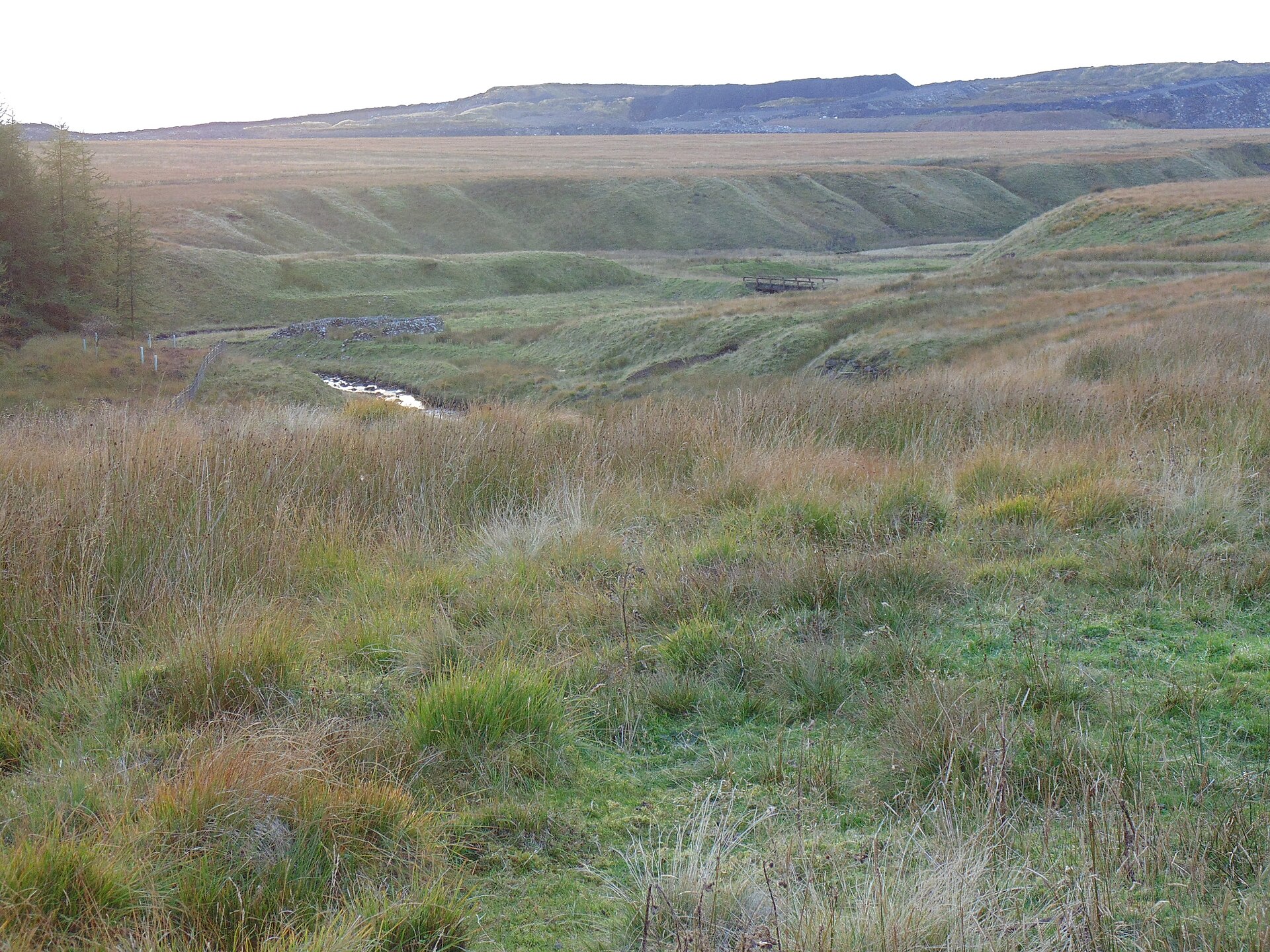
Opencast operations combined with stoping from a single adit, begun in 1917. The scale was modest in men and large in tonnage: seventy employed at the peak against half a million tonnes over the mine’s life, which is the signature of a strong, wide vein worked with machinery rather than a labour-intensive metal mine.
Closure
Closed in 1963, three years before the Ayrshire barytes field as a whole wound down; the region’s production is counted to 1966. Barytes demand held up — it is used in drilling muds and as a filler — but was met increasingly by imports.
What remains
Disused. The site is recorded by Historic Environment Scotland as a twentieth-century barytes mine at NS 6580 2170 in the parish of Auchinleck, also known as Whiteyards.
No detailed account of surviving structures is recorded; the opencast workings and adit are on the hill slope above the Gass Water.
Related mines
- Cow Green Mine — Both were worked by the Hedworth Barium Company — Gasswater from 1917 and Cow Green in Teesdale — as the same firm developed barytes at opposite ends of the country.
- Muirshiel Barytes Mine — The same barytes belt, worked at both ends: the Gasswater mineralisation is described as part of a suite of occurrences extending south-east from Muirshiel in the Renfrewshire Hills into east Ayrshire.
Nearby mines
- Cronberry Moor Colliery — 2.9 miles (4.7 km) NW
- Kames Colliery — 3.4 miles (5.4 km) NE
- Muirkirk Collieries — 4.0 miles (6.4 km) NE
- Lugar Mine — 4.3 miles (6.9 km) W
- Auldhouseburn Colliery — 4.4 miles (7.2 km) NE
Straight-line distance, within 9 miles (15 km). Show on the map.
What's uncertain
Points where sources disagree or the record could not be settled; both accounts are kept. All open questions in the archive.
- The presence of barytes along the Gass Water was known from at least the 1870s, but it was not developed until 1917 by the Hedworth Barium Co. Ltd, who carried out opencast operations and stoping from a single adit until 1921. Other sources give the opening as 1919. (disputed) 1
- The BGS mine-plans catalogue holds a Mining Remediation Authority abandonment plan titled 'Gasswater' (catalogue 18344, 0800 To 4000, dated 2002); the catalogue gives no location and the plan's details do not clearly tie it to this working, so it may belong to another of the same name. (uncertain) 3
Recorded claims
Individual factual claims, each attached to the source(s) that support it below. Where sources disagree, both are kept.
- The presence of barytes along the Gass Water was known from at least the 1870s, but it was not developed until 1917 by the Hedworth Barium Co. Ltd, who carried out opencast operations and stoping from a single adit until 1921. Other sources give the opening as 1919. (disputed) 1
- Once the largest producer of barytes in the United Kingdom, the mine employed 70 men at one time and produced about 500,000 tonnes before closing in 1963. 1
- Four main veins trend between west-north-west and north-north-west in hard sandstone units within an Upper Devonian to Lower Carboniferous sequence, on the slopes of Whiteyards Hill between Muirkirk and Cumnock. 1
- Over 800,000 tonnes of baryte were produced from the region, accounting for a third of total UK production between 1940 and 1966; the mineralisation is regarded as part of a suite of occurrences extending south-east from Muirshiel in the Renfrewshire Hills into east Ayrshire. 1
- Historic Environment Scotland records the site as Gass Water, also known as Whiteyards, classified as a 20th-century barytes mine at NS 6580 2170 in the parish of Auchinleck. 2
- The BGS mine-plans catalogue holds a Mining Remediation Authority abandonment plan titled 'Gasswater' (catalogue 18344, 0800 To 4000, dated 2002); the catalogue gives no location and the plan's details do not clearly tie it to this working, so it may belong to another of the same name. (uncertain) 3
Photographs & further reading
The national record entry: classification, alternative name, parish and precise location for the barytes mine.
View sourceSources
- (primary) Mineral resource information: North, East and South Ayrshire (BGS OR/08/014) — British Geological Survey
- (primary) Gass Water (also known as Whiteyards), NRHE 44761 — Historic Environment Scotland, National Record of the Historic Environment
- (primary) BGS / Mining Remediation Authority mine plans: GASSWATER — British Geological Survey / Mining Remediation Authority
Record created: 8 September 2026 · Last researched: 8 September 2026