 MineArchive
Cramlington Colliery
| Location | Cramlington, Northumberland — 55.0826, -1.5653 (approximate) |
|---|---|
| Commodity | Coal |
| Type | Coal |
| Worked | 1825 (Anne Pit sinking)–c. 1940 (coal drawing) |
| Maximum depth | 896 ft 5 in to the Brockwell seam in the Betsy Pit. |
| Operators | Joseph Lamb & Partners (1880–1894), Cramlington Coal Company Ltd (1895–1929), Hartley Main Collieries Ltd (1929–?) |
Overview
A group of pits at Cramlington, north of Newcastle, begun with the Anne Pit in 1825 and worked by Joseph Lamb & Partners, the Cramlington Coal Co. and, from 1929, Hartley Main Collieries; it employed 992 people in 1905 and 11 by 1940.
History
Cramlington Colliery was a group of pits at Cramlington, north of Newcastle upon Tyne. The Anne Pit was begun on 28 February 1825 and an Engine Pit the same year; the Amelia Pit, at Shankhouse, followed on 22 August 1847, the Richard Pit on 16 November 1849 and the Dudley Pit on 19 April 1854. Joseph Lamb & Partners worked the colliery in the 1880s, the Cramlington Coal Co. Ltd held it from 1895 and through the 1910s, and Hartley Main Collieries Ltd took it over in May 1929. Robert Linsley managed it from 1882 to 1894, J. H. B. Forster in 1900-05, T. O. Wood in 1910 and Joseph Parkin from 1915 to 1925.
The returns list the working pits as High, Lamb, Betsy and Ann. The High Pit employed 594 people in 1894, and the High and Lamb pits together 863 in 1900; with the Betsy Pit the total was 987 in 1902 and 992 in 1905. After the Betsy closed, the Ann and Lamb pits employed 742 in 1915, 837 in 1921 and 868 in 1925, falling to 689 in 1930 and 526 in 1935. The coal was sold as steam coal, with landsale coal in 1888 and 1890 and household coal added by 1935. A private railway carried it towards the Tyne.
The seams were given up in turn. The Brockwell, Main and Yard seams were abandoned in 1916 and the High Main on 30 July 1937; plans of the Lower Busty, Low Main and other seams were deposited as abandoned on 20 October 1939. Only 11 people were returned in 1940. The Lamb Pit stayed on as a pumping station and, from 1949, a coal washery with 52 people, still listed in 1955.
The Durham Mining Museum names more than 240 people killed at the colliery between 1836 and 1942. The earliest incident was a boiler explosion on 16 March 1836 that killed a boilerman and two schoolboys.
Geology
The Betsy Pit, from a surface about 210 ft above sea level, passed through 71 ft of clay and stony clay before the High Main, 4 ft 11 in thick, whose floor lay at 115 ft 3 in. Below it came the Main or Grey seam (6 ft 6 in, to 238 ft), the Yard (2 ft 11 in, to 317 ft 6 in), the Low Main (5 ft 7 in, to 491 ft 4 in), the Plessey (1 ft 2 in, to 519 ft 7 in), the Beaumont (3 ft 2 in, to 686 ft 6 in) and the Brockwell (2 ft 9 in, to 896 ft 5 in). The Lamb Pit, from a surface about 154 ft above sea level, passed through 144 ft of strong blue clay to the Main Coal, 6 ft 8 in thick, whose floor lay at 259 ft, and the Yard, 3 ft thick, at 338 ft 6 in.
Workings
The colliery returned its pits by name: Amelia (sunk 1847), Anne (1825), Betsy, Engine (1825), Lamb, Richard (1849) and the Dudley Pit (sunk 1854, opened 1856). The Betsy Pit was bored beyond the Brockwell seam. The seams worked included the High Main, Main, Yard, Five Quarter, Low Main, Beaumont, Brockwell and Busty; the Lamb Pit's Five Quarter workings were returned closed in November 1924, and in 1948 and 1950 the Lamb returned the Upper Busty as pumping only. A private railway ran from the colliery towards the Tyne.
Closure
The Brockwell, Main Coal and Yard seams were abandoned in 1916 and the High Main on 30 July 1937. Plans of the Lower Busty, Low Main and other seams, deposited on 20 October 1939, mark the end of coal drawing; the 1940 return lists 11 people. The Lamb Pit was returned as a pumping station in 1948 and 1950 and as a washery from 1949 to 1955, employing 52 people.
What remains
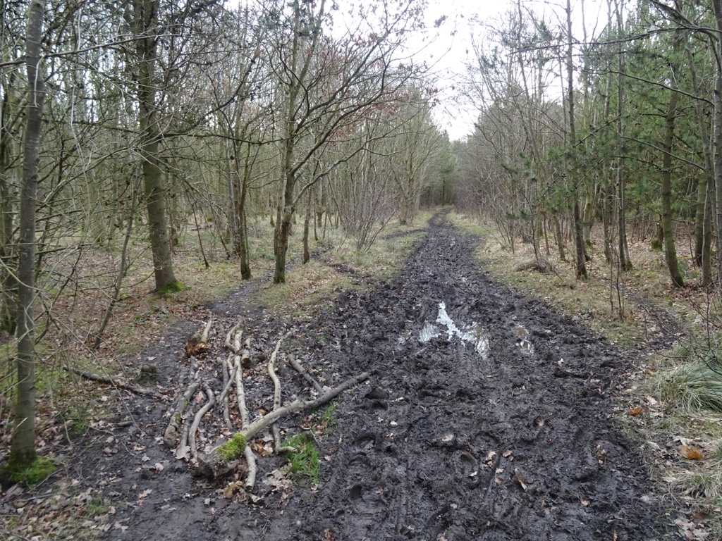
The ground at the site is wooded; a 2019 photograph shows a muddy woodland track labelled as the site of Cramlington Colliery.
Redevelopment
Unknown.
Related mines
- Dudley Colliery — The Dudley Pit, sunk from 19 April 1854, is listed among Cramlington Colliery's pits and has its own record.
- Shankhouse Colliery — The Amelia Pit at Shankhouse is one of Cramlington Colliery's pits, sunk on 22 August 1847, and is returned separately from 1900.
Nearby mines
- Shankhouse Colliery — 0.9 miles (1.5 km) N
- Gloria Colliery, Hartley — 1.7 miles (2.7 km) NE
- Seghill Colliery — 1.7 miles (2.7 km) SE
- Seaton Delaval Colliery — 1.7 miles (2.8 km) SE
- Hartford Colliery — 1.9 miles (3.0 km) N
Straight-line distance, within 9 miles (15 km). Show on the map.
Recorded claims
Individual factual claims, each attached to the source(s) that support it below. Where sources disagree, both are kept.
- The Anne Pit's sinking began on 28 February 1825 and the Engine Pit was also sunk in 1825. 1
- The Amelia Pit's sinking began on 22 August 1847 and the Richard Pit's on 16 November 1849. 1
- Joseph Lamb & Partners worked the colliery in the 1880s, the Cramlington Coal Co. Ltd from 1895, and Hartley Main Collieries Ltd from May 1929. 1,2
- The High and Lamb pits employed 863 people in 1900 and, with the Betsy Pit, 992 in 1905; the colliery employed 526 in 1935 and 11 in 1940. 1
- The Betsy Pit was sunk to the Brockwell seam at 896 ft 5 in, with the High Main cut at 115 ft 3 in. 3
- The High Main seam was abandoned on 30 July 1937. 1,4
- Plans of the Lower Busty and Low Main seams of the Ann, Betsey, Engine, Lamb and Richard pits were deposited as abandoned on 20 October 1939. 5
- The Brockwell, Main Coal and Yard seams were abandoned in 1916. 1,6,7
Photographs & further reading
The museum's page for the colliery, with its seven pits, owners, output, employment returns and a list of those killed.
View sourceA database entry for the Richard Pit at East Cramlington, with owners from 1880 and the sites within 2 km.
View sourceSources
- (primary) Durham Mining Museum - Cramlington Colliery — Durham Mining Museum
- (secondary) Cramlington - Buddlepit Mine Database — Buddlepit
- (primary) Durham Mining Museum - Cramlington Colliery Shaft Details (Betsey Pit) — Durham Mining Museum
- (primary) BGS mine plan: CRAMLINGTON/ ANN/ BETSEY /LANDSDALE /OLD (High Main, abandoned 1937) — British Geological Survey / Mine Remediation Authority
- (primary) BGS mine plan: CRAMLINGTON/ ANN /BETSEY/ ENGINE/ LAMB/ RICHARD/ WEST CRAMLINGTON (Lower Busty, abandoned 1939) — British Geological Survey / Mine Remediation Authority
- (primary) Durham Mining Museum - Cramlington Colliery - Abandoned Mines — Durham Mining Museum
- (primary) BGS mine plan: CRAMLINGTON/ ANN/ BETSEY /LAMB (Brockwell, abandoned 1916) — British Geological Survey / Mine Remediation Authority
Record created: 1 October 2026 · Last researched: 1 October 2026