 MineArchive
Butterknowle Colliery
| Also known as | Gordon Pit, Quarry West Pit, William Pit, Quarry Pit |
|---|---|
| Location | Butterknowle, Lynesack and Softley parish, Gaunless valley, County Durham — 54.6268, -1.8335 (approximate) |
| Commodity | Coal |
| Type | Coal |
| Worked | By 1660–1934 (Hutton abandoned) |
| Maximum depth | 412 feet (Quarry West Pit, 1876) |
| Operators | Sir Henry Vane (?–1660), Thomas and Mary Lambert (?–1660), Prattman's Trustees (1850–1869), Butterknowle Coal Co. (1880–1899), New Butterknowle Colliery Co. (1900–?), J. H. Robinson (1920–1934) |
Overview
The colliery of the south-west Durham pit village of Butterknowle, recorded in 1660, whose Quarry West, Gordon and William pits employed nearly 700 in the 1890s; it dwindled to a two-man working in the Hutton before closing.
History
Butterknowle Colliery was the colliery of the pit village of Butterknowle, in the Gaunless valley in south-west Durham. Coal has been worked there for centuries: a colliery at Butterknowle, owned by Sir Henry Vane and leased to Thomas and Mary Lambert, appears in court papers of 1660, and a plan of workings probably in the High Main seam dates from 1726.
In the 1850s and 1860s the colliery belonged to the trustees of W. Luke Prattman, and by the 1880s to the Butterknowle Coal Company, with J. S. Robson as agent and manager; it employed 408 in 1883, including the Marsfield Drift and the Quarry Pit. Its later shafts were the Quarry West Pit, sunk in 1876 north of the Butterknowle fault, the Gordon Pit of 1885, which found the Brockwell burnt by the Cockfield whin dyke, and the William Pit, which reached the six-and-a-half-foot Main Coal at 231 feet. The Butterknowle fault throws the seams down eighty fathoms to the south, and the Hutton, Harvey, Busty and Brockwell were worked by shafts and drifts. In 1894 nearly 700 men and boys worked in the Butterknowle pits; the miners had a stone hall seating 450, and the owners provided an institute and library and supported the school in Quarry Lane.
The Main or Brockwell was abandoned in the Butterknowle, Dowson's, Marsfield and Moor Hill workings on 11 August 1894, and a trial shaft to the Victoria was given up in 1903. The New Butterknowle Colliery Company held it in the 1900s, with G. G. Robson as manager in 1909. In the 1920s J. H. Robinson worked the Hutton with two men until it was abandoned on 1 January 1934; the Gordon and Quarry West pits are recorded as closed in 1950. Spoil heaps of the Quarry Pit still stood beside Quarry Lane in 2007.
Geology
The Hutton (about four feet), Harvey, Busty, Brockwell or Main Coal (up to six and a half feet), Five Quarter, Yard, Jubilee and Victoria seams, broken by the Butterknowle fault, which throws them down eighty fathoms to the south, and burnt near the Cockfield whin dyke.
Workings
Shafts including the Quarry West Pit (1876), Gordon Pit (1885) and William Pit, with drifts such as the Marsfield Drift; coke ovens stood at the colliery.
Closure
The Main or Brockwell was abandoned in 1894; a two-man working in the Hutton ended on 1 January 1934, and the Gordon and Quarry West pits are recorded as closed in 1950.
What remains
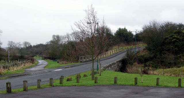
Spoil heaps of the Quarry Pit were still to be seen beside Quarry Lane in 2007.
Spoil heaps of the Quarry Pit.
Redevelopment
Unknown.
Nearby mines
- Arnghyll Colliery — 1.6 miles (2.6 km) W
- Gordon House Colliery — 1.7 miles (2.7 km) SE
- Carterthorne Colliery — 2.6 miles (4.1 km) NE
- Woodland Colliery — 2.7 miles (4.3 km) W
- Randolph Colliery, Evenwood — 3.1 miles (5.0 km) E
Straight-line distance, within 9 miles (15 km). Show on the map.
Recorded claims
Individual factual claims, each attached to the source(s) that support it below. Where sources disagree, both are kept.
- A colliery at Butterknowle owned by Sir Henry Vane and leased to Thomas and Mary Lambert is mentioned in court papers of 1660. 1
- A plan of workings probably in the High Main seam dates from 1726. 2
- Employed 408 people in 1883, including the Marsfield Drift and Quarry Pit. 3
- The Gordon Pit was sunk in 1885 and found the Brockwell seam burnt near the Cockfield whin dyke. 4
- The Quarry West Pit was sunk in 1876 on the north side of the Butterknowle fault, to 412 feet. 5
- The William Pit reached the Main Coal, six and a half feet thick, at 231 feet. 6
- In 1894 nearly 700 men and boys worked in the Butterknowle pits, and the miners' hall seated 450. 3
- The Main or Brockwell seam was abandoned on 11 August 1894. 7
- The Hutton was abandoned on 1 January 1934. 3
- J. S. Robson was agent and manager in 1882-84. 8
Photographs & further reading
Pits, owners, shaft sections, the 1894 directory account and recorded deaths.
View sourceSources
- (secondary) Butterknowle — Wikipedia
- (primary) Butterknowle Mine Plans (Mining Remediation Authority plan D433, probably High Main, 1726) — British Geological Survey / Mining Remediation Authority
- (primary) Butterknowle Colliery — Durham Mining Museum
- (primary) Account of Strata sunk through at the Gordon Pit, Butterknowle Colliery, 1885 (An Account of the strata of Northumberland & Durham as proved by Borings & Sinkings) — North of England Institute of Mining & Mechanical Engineers, via the Durham Mining Museum
- (primary) Account of Strata sunk through at the Quarry West Pit, Butterknowle Colliery, 1876 (An Account of the strata of Northumberland & Durham as proved by Borings & Sinkings) — North of England Institute of Mining & Mechanical Engineers, via the Durham Mining Museum
- (primary) Section of William Pit, at Butterknowle Colliery, near Staindrop (An Account of the strata of Northumberland & Durham as proved by Borings & Sinkings) — North of England Institute of Mining & Mechanical Engineers, via the Durham Mining Museum
- (primary) Catalogue of Plans of Abandoned Mines: Butterknowle Colliery — Durham Mining Museum
- (primary) Butterknowle Colliery: Colliery Management (prior to 1970) — Durham Mining Museum
Record created: 9 October 2026 · Last researched: 9 October 2026