 MineArchive
Burnedge Colliery
| Also known as | Fenton's Colliery, New Burnedge Colliery |
|---|---|
| Location | Burnedge, Crompton, near Shaw, Greater Manchester |
| Commodity | Coal |
| Type | Coal |
| Worked | Before 1827–c. 1851 |
| Maximum depth | 73 metres |
| Operators | Taylor, Milne and Co. (1842–1842) — Working the colliery in 1842 Taylor, Lord and Co. (1846–1848) — The same firm under a new style, 1846-1848 |
A small coal pit at Burnedge in Crompton, beside the road from Shaw to Rochdale, worked from the 1820s and shown on later maps as Fenton's Colliery.
History
Burnedge Colliery lay at Burnedge in Crompton, by the road from Shaw to Rochdale, just south-east of Fenton's Farm; later maps mark it as Fenton's Colliery. In June 1827 the trustees and executor of the wills of John and Charles Milnes, late of Castleton near Rochdale, offered the freehold estate and colliery, New Burnedge, for sale. In 1832 it had a 24 horsepower steam engine. It had two shafts and was 73 metres deep, probably to the Royley Mine, where faulting had thrown down an area of that coal, and a tramroad 270 metres long carried the coal to a landsale beside the Shaw to Rochdale road.
The family appear to have kept an interest, since Taylor, Milne and Co. were working the colliery in 1842, with 32 men and boys; the firm was Taylor, Lord and Co. from 1846 to 1848. The Crompton tithe schedules of 1848 record the colliery as once owned by Widow Taylor and worked by Widow Kershaw. Its abandonment plan, catalogued as Donk (Burnedge Estate), dates from 1850, and the colliery closed around 1851.
Geology
Lancashire Coal Measures of the Oldham coalfield. The shafts probably reached the Royley Mine, an area of which had been thrown down here by faulting.
Workings
Two shafts, 73 metres deep, with a 24 horsepower steam engine in 1832, and a tramroad 270 metres long to a landsale on the Shaw to Rochdale road.
Closure
Closed around 1851; the abandonment plan is dated 1850.
What remains
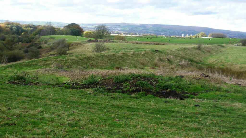
In 2003 the site was sheep pasture, between Fenton's Farm and the Colliers' Return.
Further reading
The society's gazetteer entry: the 1827 sale, the 1832 engine, the depth and tramroad, the firms working it and its closure.
View sourceA survey of Oldham's coal pits from maps and records, placing Burnedge Colliery beside Fenton's Farm from the 1848 Crompton tithe schedules.
View sourceThe national catalogue entry for the 1850 abandonment plan of workings on the Burnedge estate (Coal Authority NW132).
View sourceSources
- (secondary) Burnedge Colliery (1827-1848) (Northern Mine Research Society) — Northern Mine Research Society
- (secondary) Locating Oldham Coalpits (G. Fanning, British Mining No. 73, 2003) — Northern Mine Research Society
- (primary) BGS mine plans: Donk (Burnedge Estate), abandoned 1850 — British Geological Survey
- (observational) Embankment near Burnedge Pit site (Geograph 7332021) — Geograph
Record created: 19 November 2026 · Last researched: 19 November 2026