 MineArchive
Bullocks Hall Colliery
| Location | Bullock's Hall, near Chevington, Northumberland — 55.2769, -1.6198 (approximate) |
|---|---|
| Commodity | Coal |
| Type | Coal |
| Worked | 1900s–9 December 1933 |
| Maximum depth | Unknown. |
| Operators | J. W. Watkin and R. G. Hudson (?–1933), R. Wood, Bullocks Hall Colliery Company Ltd |
Overview
A colliery of the 1900s to 1933 at the vanished township of Bullock's Hall, near Chevington, which employed up to 92 men in the Main and Low Main seams; the whole site was later quarried away by opencast working.
History
Bullocks Hall Colliery lay at Bullock's Hall, near Chevington, about ten and a half miles south-south-east of Alnwick. Bullock's Hall was once a small estate and township in the ancient parish of Warkworth; the settlement no longer exists. R. Wood owned and managed the colliery in the 1900s, the Bullocks Hall Colliery Company Ltd held it in the 1910s, and J. W. Watkin and R. G. Hudson in the 1920s, with Watkin as manager from 1915.
It raised household coal, and later gas, manufacturing and steam coal, from the Main seam and, from 1915, the Low Main. It employed 27 in 1910, 92 in 1915 and 87 in 1923, but after the Low Main and Main workings were abandoned in March 1925 it went on with 23 to 33 men, in the High Main in 1929. John Knight, a hewer, was overcome by fumes from an oil engine in 1911.
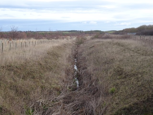
The Top seam was abandoned on 23 December 1932 and the Beaumont and Main on 9 December 1933, when the colliery closed. Opencast mining followed: Bullock's Hall, Chevington Colliery, the miners' rows and a church have all been quarried away, and the ground is now reclaimed land crossed by the Chevington Burn.
Geology
The Main, Low Main, High Main, Top and Beaumont seams; later combined plans call the Main the Duke or Bottom Brass Thill.
Workings
Unknown.
Closure
The Low Main and Main were abandoned in March 1925, the Top seam on 23 December 1932 and the Beaumont and Main on 9 December 1933; the site was later worked opencast.
What remains
The site has been quarried away by opencast working and reclaimed.
None: the colliery, township and miners' rows were removed by opencast working.
Related mines
- Healey Cote Colliery — R. Wood owned both: Bullocks Hall in the 1900s and Healey Cote from the 1910s.
- Newburgh Colliery — Shared plan: the BGS combined plans of the Main or Duke seam take in Bullocks Hall with Newburgh, Broomhill and Togston.
- Togston Colliery — Shared plan: the BGS combined plans of the Main or Duke seam take in Bullocks Hall with Togston, Broomhill and Newburgh.
Nearby mines
- Widdrington Colliery — 1.4 miles (2.3 km) S
- Broomhill Colliery — 1.8 miles (2.9 km) N
- Stobswood Colliery — 2.1 miles (3.4 km) S
- Togston Colliery — 2.3 miles (3.6 km) N
- Ferneybeds Colliery — 2.7 miles (4.3 km) S
Straight-line distance, within 9 miles (15 km). Show on the map.
Recorded claims
Individual factual claims, each attached to the source(s) that support it below. Where sources disagree, both are kept.
- R. Wood owned Bullocks Hall Colliery in the 1900s, the Bullocks Hall Colliery Company Ltd in the 1910s and J. W. Watkin and R. G. Hudson in the 1920s. 1,2
- Bullocks Hall Colliery employed 92 people in 1915. 1
- The Beaumont and Main seams at Bullocks Hall were abandoned on 9 December 1933, and the colliery closed. 1,3,4
- The site of Bullock's Hall, its colliery and miners' rows was later worked opencast. 4,5
Photographs & further reading
The lost township's history and the colliery that closed in 1933.
View sourceSources
- (primary) Bullocks Hall Colliery — Durham Mining Museum
- (secondary) Bullocks Hall Colliery — North East Heritage Library (Coals Archive)
- (primary) Bullocks Hall Colliery: catalogue of plans of abandoned mines — Durham Mining Museum
- (secondary) Bullock's Hall, Township 1848 (Co-Curate) — Co-Curate, Newcastle University
- (observational) Chevington Burn, Bullocks Hall (Geograph photograph 6034503) — Geograph
Record created: 23 October 2026 · Last researched: 23 October 2026