 MineArchive
Bentyfield Mine
| Location | Garrigill, Alston Moor, Cumbria — 54.7773, -2.3832 (exact) |
|---|---|
| Commodity | Lead |
| Type | Metal |
| Worked | 19th century–By 1882 |
| Operators | Alston Moor Mining Company, London Lead Company |
Overview
A 19th-century lead mine on Alston Moor, worked partly by the London Lead Company and partly by the Alston Moor Mining Company, linked by tramway to the neighbouring Whitesike mine, together forming a core surviving example of a mid-19th-century nucleated North Pennine lead-mining complex.

History
Lead had been mined on Alston Moor since medieval times, but the industry expanded massively during the 19th century. Bentyfield mine, on the east side of Garrigill Burn, was worked partly by the London Lead Company and partly by the Alston Moor Mining Company, and was linked by tramway to the neighbouring Whitesike mine on the opposite bank, the two being worked in close association with each other. Bentyfield Mine alone yielded 4,868 tons of lead concentrate between 1848 and 1882, within a combined Whitesike-and-Bentyfield total of 12,000 tons across the same 34 years. The monument today includes the core surviving remains of both mines and their associated ore works: mine entrances, pits for a water wheel that drove the crushing mill, bouse teams used to store unprocessed ore, dressing floors where ore was processed, and massive spoil tips. An 1839 plan of the mine survives in the Cumbria Amenity Trust's collection at the British Geological Survey, showing the two companies' separate horse levels, Greengill Hush and the whimsey shaft.
Geology
Lead of the Alston Moor orefield, worked in close association with Whitesike mine across Garrigill Burn; the vein is not named on the record.
Workings
Worked in close association with Whitesike mine across Garrigill Burn, linked by tramway, with shared ore-dressing infrastructure including a water-wheel-driven crushing mill, bouse teams and dressing floors.
Closure
Unknown.
What remains
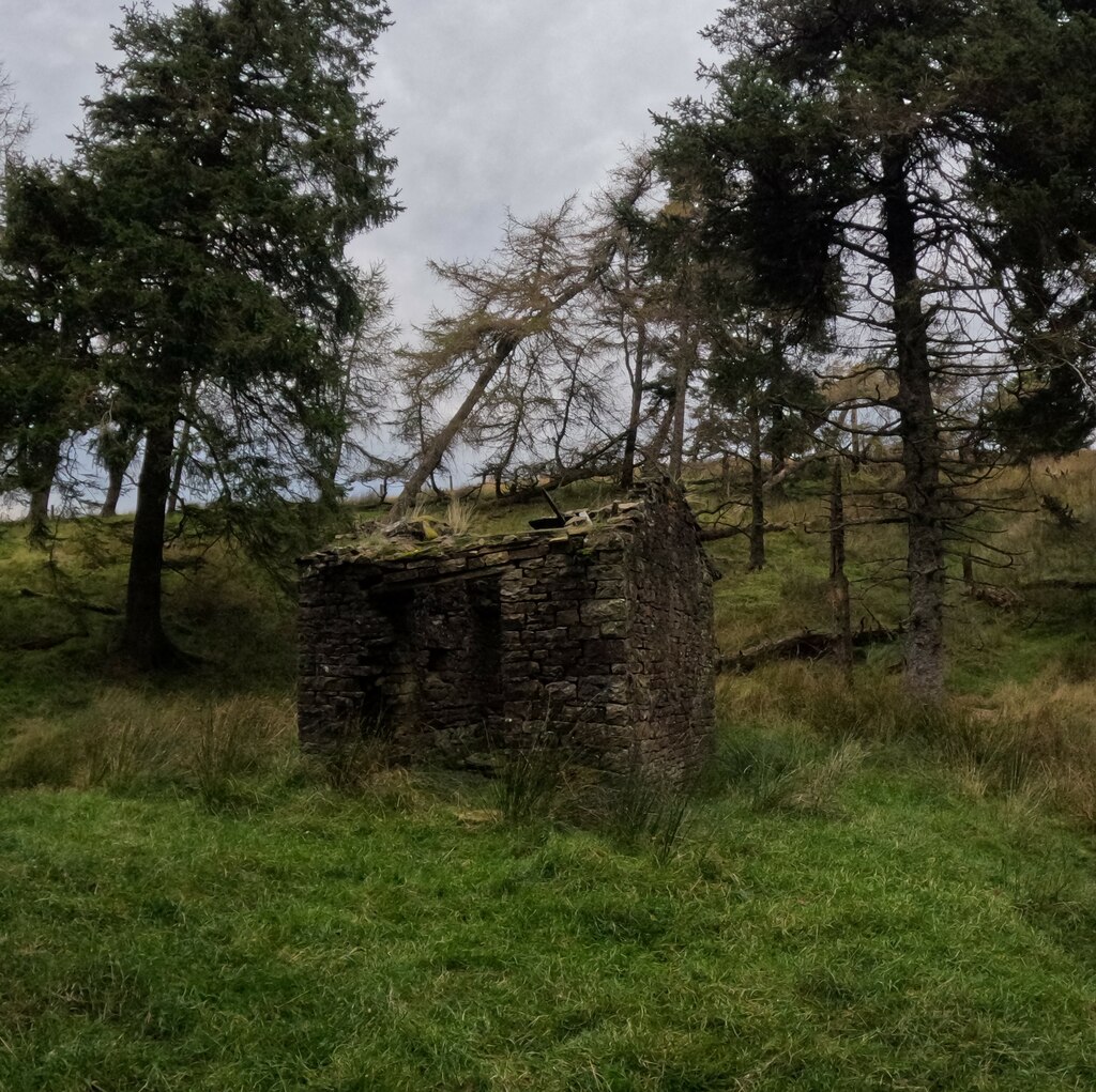
Designated a Scheduled Monument together with Whitesike mine; mine entrances, water wheel pits, bouse teams, dressing floors, spoil tips and a surviving explosives store are among the features recorded on the ground.
Mine entrances, a water wheel pit, bouse teams, dressing floors, extensive spoil tips and a surviving explosives store, shared with the adjoining Whitesike mine site.
Related mines
- Whitesike Mine — Linked by tramway and worked in close association, with shared ore-dressing infrastructure; jointly designated a single Scheduled Monument.
Nearby mines
- Whitesike Mine — 0.1 miles (0.1 km) E
- Flinty Fell Lead Rakes — 0.4 miles (0.6 km) SE
- Caplecleugh Mine — 1.5 miles (2.3 km) E
- Dowpot Syke and Guttergill Mine — 1.5 miles (2.3 km) NW
- Smallcleugh Mine — 1.6 miles (2.6 km) NE
Straight-line distance, within 9 miles (15 km). Show on the map.
Recorded claims
Individual factual claims, each attached to the source(s) that support it below. Where sources disagree, both are kept.
- Bentyfield mine was worked partly by the London Lead Company and partly by the Alston Moor Mining Company, and was linked by tramway to the neighbouring Whitesike mine, the two being worked in close association with each other. 1
- Bentyfield Mine alone yielded 4,868 tons of lead concentrate between 1848 and 1882, within a combined Whitesike-and-Bentyfield total of 12,000 tons across the same period. 1
- The monument includes the core surviving remains of a pair of 19th-century nucleated lead mines with their associated ore works, including a surviving explosives store at Bentyfield itself. 1,2
- An 1839 plan of Bentyfield lead mine, from the Cumbria Amenity Trust Mining History Society's collection and held by the British Geological Survey, shows the Bentyfield Company's horse level and the London Lead Company's horse level, Greengill Hush and the whimsey shaft. 3
Photographs & further reading
The scanned 1839 plan showing the two companies' horse levels, Greengill Hush and the whimsey shaft, viewable online.
View sourceHistoric England's own review of the site's condition over two decades on the Heritage at Risk register.
View sourceSources
- (primary) Whitesike and Bentyfield lead mines and ore works, Alston Moor - list entry 1015832 — Historic England
- (primary) Whitesike and Bentyfield Lead Mines, 20 Years of Heritage at Risk — Historic England
- (primary) PLAN OF BENTYFIELD LEAD MINE 1839 (Cumbrian Amenity Trust Historical Mining Society mine plans CT160, BGS mine plans catalogue) — British Geological Survey / Mining Remediation Authority
Record created: 30 August 2026 · Last researched: 24 September 2026