 MineArchive
Auchencairn Mine
| Also known as | Auchencairn Barytes Mine |
|---|---|
| Location | Rascarrel Bay, near Auchencairn, Kirkcudbrightshire, Dumfries and Galloway — 54.8165, -3.8410 (approximate) |
| Commodities | Copper, Barite |
| Type | Metal |
| Worked | 18th century–1961 |
| Maximum depth | Main shaft over 100 fathoms deep at its greatest extent |
| Operators | W. T. Shaw and J. W. Simpson (1951–1961) |
Overview
A small coastal mine worked three times over two centuries for three different things — copper, then barytes, then copper again — each attempt ending the same way, in flooding and abandonment.
History
Auchencairn was probably first worked for copper in the 18th century. A more determined attempt began in 1843 on the coast near Airds Farm, but the pumps could not keep the workings dry and the venture failed within a few years. The mine was reopened in the 1850s for barytes, worked intermittently for it into the twentieth century, and used at times to dress barytes brought in from the neighbouring Barlocco Mine as well as its own. A final attempt was made in 1951, when the local miners W. T. Shaw and J. W. Simpson leased the site, first trying to win quartz for pebble-dashing and then installing flotation plant to concentrate copper. The pumps were stopped on 5 September 1957, the equipment was salvaged, and the site had closed by April 1961.
Geology
The mine worked a coastal vein carrying chalcopyrite alongside barytes and quartz, with malachite, cuprite and other secondary copper minerals recorded in small amounts. Barytes rather than copper proved the more durable resource, which is why the mine's longest working phase was as a barytes producer rather than a metal mine.
Workings
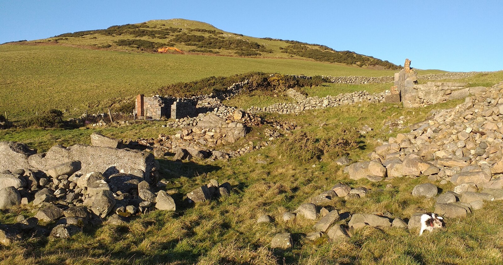
A single main shaft, at its greatest extent over 100 fathoms deep, was later re-collared to a depth of about 75 feet and eventually capped. A horizontal level was driven through boulder clay on heavy timber supports to an adit exit on the coastal cliffs, marked outside by a crow's-foot spoil tip; the level has since collapsed. Surface buildings included a magazine, later corrugated iron structures from the 1950s campaign, and a granite building with two hearths for roasting or dressing ore.
Closure
Each phase of working ended the same way: the pumps stopped, the workings flooded, and the mine was abandoned until the next attempt at a different mineral made it worth trying again. The last of these, the 1950s copper-flotation venture, closed for good in 1961.
What remains
A drystone-walled enclosure in a field behind the coastal cliffs holds several ruined buildings and piles of stone, brick and concrete rubble, with the main shaft capped in concrete. The horizontal level's entrance has collapsed, and what looks like a shaft at the cliff top is in fact a collapse into that level rather than an original working.
The capped shaft, ruined dressing and roasting buildings, and the crow's-foot spoil tip at the coastal adit.
Redevelopment
None — the site remains an abandoned field enclosure above Rascarrel Bay.
Nearby mines
- Craignair Quarry — 8.1 miles (13.0 km) N
Straight-line distance, within 9 miles (15 km). Show on the map.
Recorded claims
Individual factual claims, each attached to the source(s) that support it below. Where sources disagree, both are kept.
- The mine was probably first worked for copper in the 18th century; a determined attempt from 1843 on the coast near Airds Farm failed within a few years when the pumps could not keep it dry. 1
- It was reopened as a barytes mine in the 1850s and worked intermittently for barytes into the 20th century, including dressing barytes brought in from the neighbouring Barlocco Mine. 1,2
- The main shaft reached over 100 fathoms at its greatest extent before being re-collared to about 75 feet; a horizontal level through boulder clay led to a coastal adit. 1
- A final lease from 1951 tried quartz extraction and then copper flotation; the pumps were stopped on 5 September 1957 and the site had closed by April 1961. 1
Sources
- (primary) Auchencairn Mine — Scottish Cave and Mine Database — Grampian Speleological Group / Scottish Cave and Mine Database
- (secondary) Auchencairn Barytes Mine, Auchencairn, Dumfries and Galloway — Mindat
Record created: 24 August 2026 · Last researched: 24 August 2026