 MineArchive
Abereiddi Slate Quarry
| Also known as | Blue Lagoon, Abereiddy, Abereiddy Slate Quarry |
|---|---|
| Location | Abereiddi, Llanrhian, Pembrokeshire — 51.9378, -5.2092 (exact) |
| Commodity | Slate |
| Type | Slate |
| Worked | By 1889–early 20th century |
| Maximum depth | About 25 metres of water in the flooded pit. |
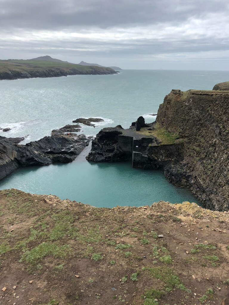
The slate quarry at Abereiddi on the north Pembrokeshire coast whose pit, opened to the sea after closure, became the flooded Blue Lagoon, about 25 metres deep.
Location
Recorded location. The large pin is this mine; the small round markers are the nearest mines on record. Click one for its page. View on full map
History
The Blue Lagoon at Abereiddi, on the north Pembrokeshire coast, was the main pit of a slate quarry, named the St Brides slate quarries on the 1889 Ordnance Survey and the Porth-gain slate quarries in 1907. It was smaller than the quarries nearer Porthgain, but had a steam-hauled lift. Its slate was at first shipped across Abereiddi beach, and later carried two miles north to Porthgain harbour by a tramway, worked first by horses and then by steam locomotives. The quarrymen lived in a short row of slate houses near the beach known as The Street, now ruined.
The quarry closed in the early 20th century. An attempt was then made to blast through the rock between the pit and the sea to turn it into a small harbour; that failed, but it let the sea in, and the flooded pit became the Blue Lagoon, now a tidal pool about 25 metres deep. As failed harbours go, it has done rather well for itself.
Geology
Ordovician slates and shales of the Abereiddi coast.
Workings
A coastal pit with a steam-hauled lift and processing works above it, linked by tramway to Porthgain harbour.
Closure
Closed in the early 20th century; a later attempt to blast the pit open to the sea flooded it.
What remains
A flooded tidal pool, the Blue Lagoon, used for coasteering and cliff diving, with ruins of the engine house and other quarry buildings above it.
The flooded pit, ruins of the winding engine house and quarry buildings, an explosives magazine, the tramway formation and the ruined quarrymen's cottages of The Street.
Redevelopment
None; the pit is a tidal pool used for water sports.
Related mines
- Porthgain Quarries — The Abereiddi pit was worked with the Porthgain quarries: its slate went by the Porthgain to Abereiddi tramway to Porthgain harbour, and the 1907 map names it the Porth-gain Slate Quarries (Coflein, NPRN 40620 and 400060).
Nearby mines
- Porthgain Quarries — 1.4 miles (2.2 km) NE
- Trefrane Cliff Colliery — 8.2 miles (13.3 km) SE
Straight-line distance, within 9 miles (15 km).
Further reading
The Royal Commission's record of the quarry pit that became the Blue Lagoon.
View sourceA 2013 visit to the industrial remains at Abereiddi and Porthgain, with the story of the failed harbour.
View sourceSources
- (primary) St Brides Slate Quarries; Porth-Gain Slate Quarries, Abereiddy; Blue Lagoon Abereiddy (Coflein, NPRN 40620) — RCAHMW
- (primary) Porth-Gain to Abereiddi Tramway (Coflein, NPRN 400060) — RCAHMW
- (secondary) Abereiddy (Wikipedia) — Wikipedia
- (observational) Abereiddi and Porthgain, Pembrokeshire, August 2013 (Derelict Places) — Derelict Places
Record created: 20 November 2026 · Last researched: 20 November 2026