 MineArchive
Sharkham Point Iron Mine
| Location | Sharkham Point, near Brixham, Devon — 50.3817, -3.4978 (exact) |
|---|---|
| Commodity | Iron |
| Type | Iron |
| Worked | c. 1790–1914-15 |
| Operators | Brixham Hematite Iron Mining Company Ltd (1865–1915) |
Overview
Sharkham Point Iron Mine, near Brixham, worked hematite for around 125 years, shipping ore to South Wales and West Hartlepool for smelting before closing in the mid-1910s.
History
Sharkham Point Iron Mine lay at Sharkham Point near Brixham, Devon, working an east-west hematite lode -- reported as early as 1790 as yielding 'considerable quantities of kidney ore' -- that ran from Sharkham Point to Upton, extensively worked from the late 1830s. Geologist Henry De la Beche recorded the deposit in his 1839 memoir. Worked as both open-cast and underground operations, the mine was developed through five shafts and six adits, employing up to 100 workers at its peak. The Brixham Hematite Iron Mining Company Ltd, incorporated in 1865, operated the mine through its most productive years, shipping ore to smelters in South Wales and West Hartlepool. Mining ceased in 1914-15, with some limited dump-picking possibly continuing into the 1930s, as the wider south-west of England's mining industry collapsed economically.
Geology
The hematite occurs as a replacement of Devonian limestone, associated with limestone breccias and localised botryoidal goethite, limonite and hematite, some surfaces showing patches and radiating crystals of barite. The iron is thought to derive from overlying Permian 'red bed' sandstones, carried into the limestone by circulating hot fluids along fractures -- a process similar to iron-replacement deposits known in South Wales.
Workings
Worked an east-west hematite lode via a mix of open-cast and underground operations, developed through five shafts and six adits.
Closure
Mining ceased in 1914-15, with some limited dump-picking possibly continuing into the 1930s.
What remains
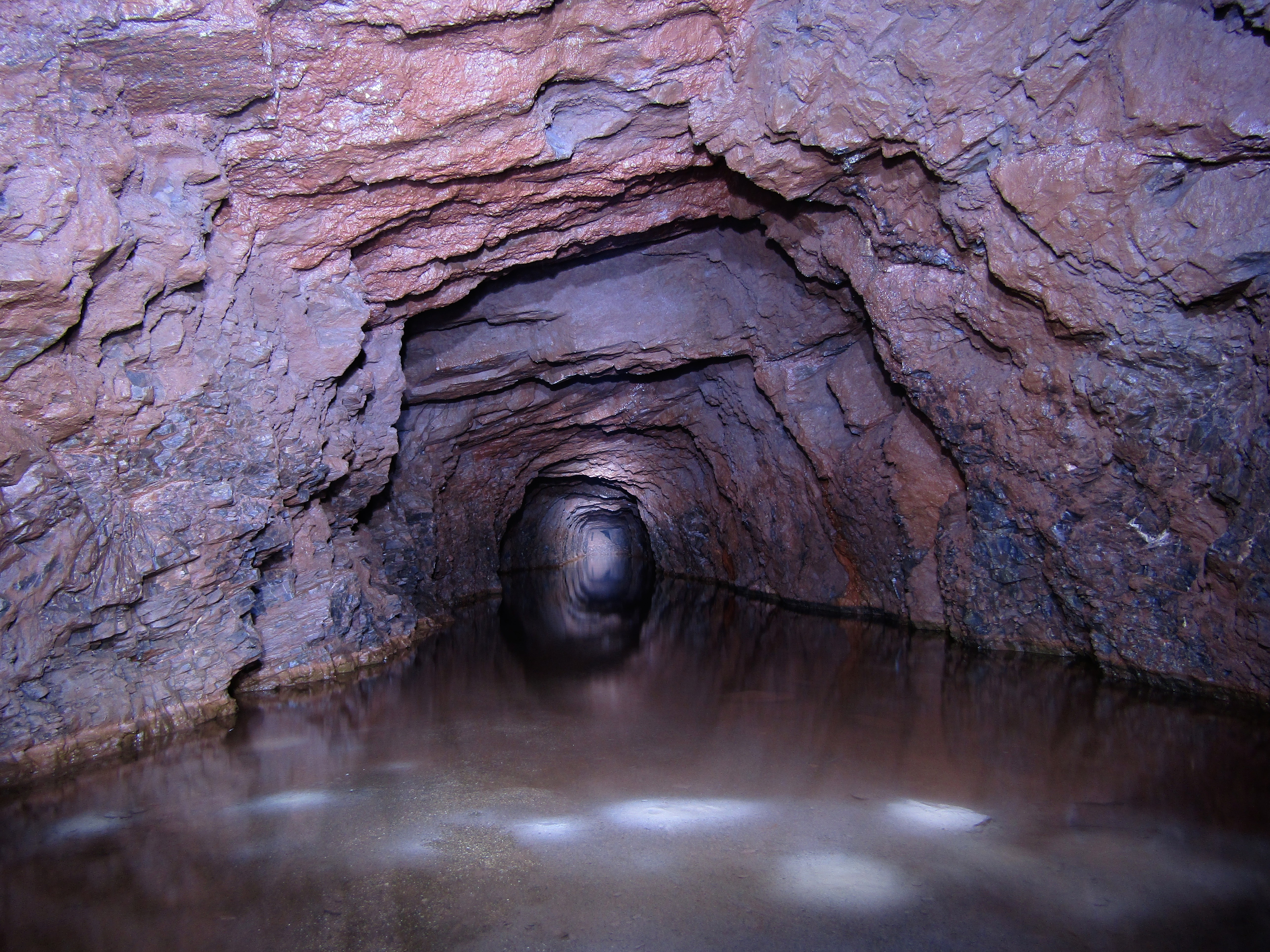
Some adits remain accessible; the site's archaeology has been partly obscured by its use as a landfill during the 1950s-60s and is now managed as a nature conservation area. It forms part of the Berry Head to Sharkham Point SSSI and is a designated geosite of the English Riviera Global Geopark.
Several adits survive and remain accessible, some partially flooded.
Nearby mines
- Watcombe Clay Pits — 7.2 miles (11.6 km) N
Straight-line distance, within 9 miles (15 km). Show on the map.
Recorded claims
Individual factual claims, each attached to the source(s) that support it below. Where sources disagree, both are kept.
- Iron ore working at Sharkham Point was reported as early as 1790, and the lode -- running from Sharkham Point to Upton -- was recorded by geologist Henry De la Beche in his 1839 memoir as having been extensively worked towards the end of 1837. 1
- The mine was developed through five shafts and six adits, worked as both open-cast and underground operations, employing up to 100 workers at its peak. 1
- Mining ceased in 1914-15 under the Brixham Hematite Iron Mining Company Ltd, with the site later used as a rubbish tip in the 1950s-60s, obscuring much of its archaeology. 1
- The hematite occurs as a replacement of Devonian limestone, its iron sourced from overlying Permian 'red bed' sandstones carried into the limestone by circulating hot fluids -- a process considered similar to iron-replacement deposits known in South Wales. The site is designated within the Berry Head to Sharkham Point SSSI and recognised as a geosite of the English Riviera Global Geopark. 2
Photographs & further reading
The Geopark's own geosite record, with the site's specific geological mechanism and SSSI/geopark designation.
View sourceSources
- (secondary) Sharkham Point Iron Mine — Wikipedia
- (secondary) Sharkham Iron Mine — English Riviera Global Geopark
Record created: 2 September 2026 · Last researched: 2 September 2026