 MineArchive
Mount Moor Colliery
| Location | Springwell, near Eighton Banks, Tyne and Wear — 54.9137, -1.5655 (exact) |
|---|---|
| Commodity | Coal |
| Type | Coal |
| Worked | Before 1826–May 1931 |
| Maximum depth | 990 ft (Vale Pit, to the Brockwell seam) |
| Operators | Marley Hill Coal Company |
Overview
An old colliery on Black Fell at Springwell, near Eighton Banks, worked by the 1720s and by John Bowes and Co. and the Marley Hill Coal Company in the 1850s and 1860s; five were killed when a rope slipped in 1814, and its Vale Pit closed in 1931.
History
Mount Moor Colliery lay at Springwell, by Eighton Banks, four miles south-south-east of Newcastle, on the high ground of Black Fell. Its pits were old: Washington's parish registers show pitmen living at the hamlet of The Mount as early as 1729, probably working at Mount Moor, and a history of the site puts the first pits on Black Fell in the early 1700s. It was also known as Spring Vale Colliery, and the site later took the name Black Fell Colliery. George Stephenson's colliery railway, opened in 1826 and later called the Bowes Railway, crossed the site, where its Black Fell incline began.
On 31 December 1814 the rope slipped from its chain as men were being drawn up the pit, and five were killed: John Davison, 18, three brothers named Simpson, aged 21, 15 and 13, and Thomas Smith, a boy of seven. John Bowes and Co., the partnership of Bowes, Hutt, Wood and Charles M. Palmer, worked the colliery in the 1850s, and the Marley Hill Coal Company in the 1860s. Its last working pit, the Vale Pit, was sunk through the Ruler and Beaumont seams and the Top and Bottom Busty to the Brockwell at 990 feet; in 1915 the colliery worked the Hutton, Low Main and Main.
The colliery closed in May 1931; an account of the site gives 1929 for the Vale Pit. Its plans were joined with Springwell's, which list 'Vale or Mount Moor' among their pits, and the Metal, Main, Maudlin, Low Main and Hutton were abandoned on 15 November 1933. The Vale Pit shaft was kept for men riding and as an escape way, linked underground to other pits, into the 1960s. The Black Fell hauler house of the Bowes Railway is all that is left on the site. The museum's list of those killed holds ten names.
Geology
Durham coalfield. The Vale Pit section records the Ruler seam at 696 ft, the Beaumont at 762 ft, the Top Busty at 870 ft, the Bottom Busty at 894 ft and the Brockwell, 2 ft thick, at 990 ft. The High Main, Metal, Main, Maudlin, Low Main and Hutton were worked.
Workings
Pits on Black Fell, the last the Vale Pit, beside the Black Fell incline of the Bowes Railway.
Closure
Closed in May 1931 (1929 in another account); its workings were included in the Springwell plans abandoned on 15 November 1933, and the Vale Pit shaft served for men riding and escape into the 1960s.
What remains
The Black Fell hauler house of the Bowes Railway is all that remains on the colliery site (2010 report).
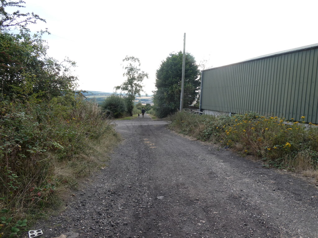
The Black Fell hauler house, and the line of the Black Fell incline down towards the Team valley.
Redevelopment
The Black Fell incline is now a public bridleway, part of the Tyne and Wear Heritage Way.
Related mines
- Springwell Colliery — Mount Moor's plans were joined with Springwell's, which list 'Vale or Mount Moor' among their pits; both were John Bowes and Marley Hill collieries on the Bowes Railway, and Springwell's ventilation was later connected to a shaft on Black Fell.
Nearby mines
- Springwell Colliery — 0.8 miles (1.3 km) NE
- Team Colliery — 0.8 miles (1.4 km) W
- Stormont Main Colliery — 1.0 miles (1.5 km) N
- Sheriff Hill Colliery — 1.2 miles (2.0 km) N
- Washington F Pit — 1.4 miles (2.3 km) E
Straight-line distance, within 9 miles (15 km). Show on the map.
What's uncertain
Points where sources disagree or the record could not be settled; both accounts are kept. All open questions in the archive.
- Pitmen were living at The Mount by 1729, probably working at Mount Moor Colliery. (uncertain) 1
- The original pits on Black Fell, sunk in the early 1700s, formed Mount Moor colliery; the site was later called Black Fell Colliery. (uncertain) 2
- The last working pit, the Vale Pit, closed in 1929. (disputed) 2
Recorded claims
Individual factual claims, each attached to the source(s) that support it below. Where sources disagree, both are kept.
- Pitmen were living at The Mount by 1729, probably working at Mount Moor Colliery. (uncertain) 1
- The original pits on Black Fell, sunk in the early 1700s, formed Mount Moor colliery; the site was later called Black Fell Colliery. (uncertain) 2
- John Bowes and Co. worked the colliery in the 1850s and the Marley Hill Coal Company in the 1860s. 3
- On 31 December 1814 a rope slipped from its chain as men were drawn up, killing five. 3
- Mount Moor Colliery closed in 1931. 4,3,5
- The last working pit, the Vale Pit, closed in 1929. (disputed) 2
- Its plans are catalogued as Mount Moor, Eighton Banks and Blackfell. 6,7
- The Vale Pit shaft was used for men riding and escape into the 1960s. 2
- The Bowes Railway incline at Dunkirk Farm is now a public bridleway on the Tyne and Wear Heritage Way. 8
Photographs & further reading
A 2010 report on the Black Fell hauler house and incline of the Bowes Railway, on the old Mount Moor colliery site, with historic photographs.
View sourceSources
- (secondary) The Mount (Mount Lonnen), Springwell (HER 7686) — Tyne and Wear HER (Sitelines)
- (observational) Bowes Railway - Black Fell incline the forgotten one (2010) — Derelict Places
- (primary) Mount Moor Colliery — Durham Mining Museum
- (secondary) The North East 1920-1938 (England's North East) — England's North East (David Simpson)
- (secondary) Mount Moor Colliery (Memories of Eighton Banks) — raggyspelk.co.uk
- (primary) Mount Moor Colliery: catalogue of plans of abandoned mines — Durham Mining Museum
- (primary) BGS mine plan: Mount Moor / Eighton Banks and Blackfell, Main seam — British Geological Survey
- (observational) One of the Bowes Railway inclines (Geograph 8389240) — Geograph (Christine Johnstone)
Record created: 6 October 2026 · Last researched: 6 October 2026