 MineArchive
Melton Bottom Chalk Pit
| Also known as | Melton Bottom Quarry |
|---|---|
| Location | Melton, near Welton, East Riding of Yorkshire — 53.7336, -0.5241 (approximate) |
| Commodity | Chalk |
| Type | Quarry |
| Worked | 1920s–Still active |
| Maximum depth | An open chalk quarry; no depth is recorded. |
Overview
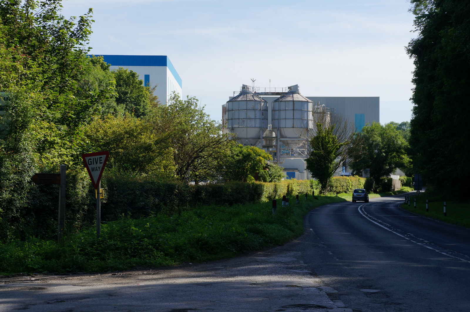
Melton Bottom Chalk Pit lies north of the village of Melton, in the civil parish of Welton on the north bank of the Humber. Chalk was being extracted here by the 1920s, when a large-scale cement industry developed around Melton, and the site still supplies high quality chalk to an adjacent works making fillers, powders and extenders for chemical and industrial use, at around 300,000 tonnes a year. Its southern working, no longer quarried, is a Site of Special Scientific Interest and the type locality of the Welton Chalk Formation — the section against which that unit is defined.
History
In 1855 the land around Melton was essentially rural, farmed apart from a few gentrified houses, some narrow plantations and a small brick and tile works south of Melton Common on the bank of the Humber. Those brickworks expanded in the early 1900s and acquired a tramway system within their clay pits, but by the 1920s the tile works had closed and a large-scale cement industry had taken its place: chalk was being extracted north of Melton at Melton Bottom Quarry, while south of the railway the Humber Cement Works had been established west of Gibson Lane, connected to the main line and served by its own halt. The cement works also ran an industrial tramway south to the Humber bank and an aerial cableway to a jetty at West Clough. Quarrying has continued for just over a century; the quarry was owned by Omya by 2012 and produces chalk whiting.
Geology
The quarry works the Chalk of the Yorkshire Wolds where they come down to the Humber. Its southern pit is the type locality of the Welton Chalk Formation — the section by which that formation is defined and against which exposures elsewhere are compared — which is why the disused working is notified as a Site of Special Scientific Interest for its geology rather than its wildlife. The chalk is pure enough to be ground and sold as whiting for industrial fillers rather than merely burnt for lime.
Geological setting: Sedimentary Beds and Seams (well documented example)
Workings
An open chalk quarry supplying an adjacent production facility directly, rather than shipping raw stone any distance. Around 300,000 tonnes of chalk are extracted a year and made into fillers, powders and extenders used across chemical and industrial manufacturing. The southern part of the working has been left and is the protected geological section.
Closure
The quarry remains in production. Only the southern working, the SSSI, is no longer quarried.
What remains
Working. The quarry supplies high quality chalk to the adjacent plant at about 300,000 tonnes a year and was owned by Omya as of 2012. The disused southern pit, Melton Bottom Chalk Pit proper, is a Site of Special Scientific Interest for its geological content.
An active quarry face rather than a remain. The protected southern section survives as the type locality exposure.
Related mines
- Welton Wold Quarry — The adjoining workings at Melton Bottom, whose disused southern pit is the SSSI; the BGS names the type section 'Melton Bottoms (Welton Wold) Quarry', so the two records describe one complex and the boundary between them is not firmly settled.
Nearby mines
- Welton Wold Quarry — 0.6 miles (0.9 km) NW
Straight-line distance, within 9 miles (15 km). Show on the map.
What's uncertain
Points where sources disagree or the record could not be settled; both accounts are kept. All open questions in the archive.
- The quarry has been running for just over a century and supplies high quality chalk to an adjacent production facility making fillers, powders and extenders for chemical and industrial applications, around 300,000 tonnes being extracted a year; it was owned by Omya and producing chalk whiting as of 2012. These figures come from search summaries rather than a fetched page and should be confirmed. (uncertain) 2
Recorded claims
Individual factual claims, each attached to the source(s) that support it below. Where sources disagree, both are kept.
- Melton Bottom Chalk Pit is the type locality of the Welton Chalk Formation. 1
- By the 1920s the earlier brick and tile works south of Melton Common had closed and a large-scale cement industry had developed: chalk was extracted north of Melton at Melton Bottom Quarry while the Humber Cement Works was established south of the railway west of Gibson Lane, connected to the main line, served by Melton Halt, and running an industrial tramway and an aerial cableway to a jetty on the Humber bank at West Clough. 2
- The quarry has been running for just over a century and supplies high quality chalk to an adjacent production facility making fillers, powders and extenders for chemical and industrial applications, around 300,000 tonnes being extracted a year; it was owned by Omya and producing chalk whiting as of 2012. These figures come from search summaries rather than a fetched page and should be confirmed. (uncertain) 2
Photographs & further reading
Lists the county's protected geological sites and what each is for, recording Melton Bottom Chalk Pit as the type locality of the Welton Chalk Formation.
View sourceSources
- (secondary) Geological Conservation in East Yorkshire — Hull Geological Society
- (secondary) Melton, East Riding of Yorkshire — Wikipedia
Record created: 4 September 2026 · Last researched: 4 September 2026