 MineArchive
Ifton Colliery
| Also known as | Gertrude Pit |
|---|---|
| Location | St Martin’s, near Oswestry, Shropshire — 52.9350, -3.0150 (approximate) |
| Commodity | Coal |
| Type | Coal |
| Worked | 1912 (sinking begun)–22 November 1968 |
| Maximum depth | 415 yards had been sunk by 1914. |
| Operators | W. Y. Craig and Son |
Overview
The largest colliery in Shropshire, at St Martin’s near Oswestry, and geologically not a Shropshire pit at all: the collieries of this corner — Ifton, Chirk Bank, Quinta, Trehowell, Moreton Hall and Preesgweene — were an extension of the Denbighshire coalfield, and Ifton’s workings crossed the border into Wales to link up with the seams of the former Brynkinallt and Black Park collieries. A German company began sinking in March 1912 and had reached 415 yards by 1914. By 1960 the modernised colliery employed 1,250 men and raised 1,750 tons a day. The last shift came up at ten o’clock on the night of 22 November 1968.
History
Coal was mined in St Martin’s parish for centuries in a predominantly agricultural corner of Shropshire that had long looked across the border — the parish belonged to the Welsh diocese of St Asaph until 1920, and lay under the influence of Chirk Castle and the Trevors of Brynkinallt. Ifton was first sunk as the Gertrude Pit of Brynkinallt Colliery, owned by W. Y. Craig and Son of Preesgweene, Oswestry; in time Brynkinallt ceased and its men transferred to Ifton. In March 1912 a German company was engaged to begin sinking, and by 1914 the shaft was 415 yards down. Ifton grew into the largest colliery in Shropshire, and its workings crossed the border into Wales to link up with the coal seams of the former Brynkinallt and Black Park collieries. By 1960, modernised, it had a manpower of 1,250 and a daily output of 1,750 tons. It closed in 1968 for two reasons together: the constant threat of fire from spontaneous combustion, and the loss of markets — 134,000 tons of coal were stockpiled on the surface at the end. The last shift came up at 10 p.m. on 22 November 1968, and with it coal production in the district ceased altogether.
Geology
Not the Shropshire coalfield proper but the eastern edge of the Denbighshire coalfield, which reaches across the border here: the collieries at Ifton, Chirk Bank, Quinta, Trehowell, Moreton Hall and Preesgweene were geologically an extension of it, and Ifton’s own workings ran under the Welsh border to meet the seams of Brynkinallt and Black Park. The coal was prone to spontaneous combustion, which was one of the two reasons the colliery closed.
Workings
Sinking was begun in March 1912 by a German company and had reached 415 yards by 1914. The colliery was modernised by 1960, when 1,250 men were raising 1,750 tons a day, and its roadways ran across the national border to connect with the abandoned workings of Brynkinallt and Black Park.
Closure
Ifton closed in 1968 because of the constant threat of fire from spontaneous combustion and the loss of its markets, with 134,000 tons of unsold coal stockpiled on the surface. The last shift came up at 10 p.m. on 22 November 1968.
What remains
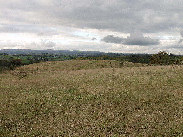
The spoil heaps are now Ifton Meadows, a 20-hectare local nature reserve of woodland, streams, grassland and pools on Overton Road at Ifton Heath. The tips were covered after the 1968 closure and the site reopened to the public in 1978; it was designated a Local Nature Reserve in 2005. A bronze statue of a 1960s miner, nicknamed "Mr Mots", was installed in the Miners’ Memorial Garden in 2018 to mark fifty years since the colliery closed.
The colliery bing, now grassed and wooded as Ifton Meadows; nothing identified of the surface buildings.
Redevelopment
Ifton Meadows local nature reserve, opened to the public in 1978 and designated in 2005, with a Miners’ Memorial Garden carrying a bronze miner unveiled in 2018.
Related mines
- Black Park Colliery — One of Black Park's shafts was reopened in 1966 as a ventilation shaft for Ifton Colliery and was finally closed when Ifton ceased in 1968.
- Brynkinalt Colliery — Connected underground after Brynkinalt was extended eastwards about 1912; when coal drawing at Brynkinalt ceased in 1928 its shaft became Ifton's ventilation shaft, and it was closed in November 1968 when Ifton ceased.
Nearby mines
- Brynkinalt Colliery — 1.4 miles (2.2 km) W, Wrexham
- Black Park Colliery — 2.2 miles (3.5 km) W, Wrexham
- Quinta Colliery — 2.5 miles (4.0 km) SW
- Wynnstay Colliery — 3.6 miles (5.8 km) NW, Wrexham
- Vauxhall Colliery — 4.7 miles (7.5 km) N, Wrexham
Straight-line distance, within 9 miles (15 km). Show on the map.
What's uncertain
Points where sources disagree or the record could not be settled; both accounts are kept. All open questions in the archive.
- The BGS mine-plans catalogue holds a Mining Remediation Authority abandonment plan titled 'Ifton' (catalogue NW567, Powell, dated 1965); the catalogue gives no location and the plan's details do not clearly tie it to this working, so it may belong to another of the same name. (uncertain) 4
Recorded claims
Individual factual claims, each attached to the source(s) that support it below. Where sources disagree, both are kept.
- The collieries at Ifton, Chirk Bank, Quinta, Trehowell, Moreton Hall and Preesgweene were geologically an extension of the Denbighshire coalfield; Ifton was the largest colliery in Shropshire and its workings crossed the border into Wales, linking up to the coal seams of the former collieries at Brynkinallt and Black Park. 1
- In March 1912 a German company was employed to start sinking, and by 1914 they were 415 yards down. 1
- By 1960 the modernised colliery had a manpower of 1,250 and a daily output of 1,750 tons. 1
- The last shift came up at 10 p.m. on 22 November 1968; the colliery closed because of the constant threat of fire from spontaneous combustion and the loss of markets, with 134,000 tons of coal stockpiled at the surface. Coal production in the area ceased with it. 1
- Ifton Meadows was once colliery spoil; the tips were covered after the 1968 closure and the site reopened to the public in 1978, and in 2005 the 20-hectare site was designated a Local Nature Reserve of woodland, streams, grassland and pools. 2,3
- The BGS mine-plans catalogue holds a Mining Remediation Authority abandonment plan titled 'Ifton' (catalogue NW567, Powell, dated 1965); the catalogue gives no location and the plan's details do not clearly tie it to this working, so it may belong to another of the same name. (uncertain) 4
Photographs & further reading
The council’s guide to what the colliery bing has become: the habitats, the paths and the Miners’ Memorial Garden on the old spoil.
View sourceThe parish history that places Ifton in the Denbighshire coalfield rather than the Shropshire one, and records its workings crossing the border into Wales.
View sourceSources
- (secondary) St Martin's, Shropshire — Wikipedia
- (secondary) Ifton Meadows — Wikipedia
- (observational) Ifton Meadows Local Nature Reserve — Shropshire's Great Outdoors (Shropshire Council)
- (primary) BGS / Mining Remediation Authority mine plans: IFTON — British Geological Survey / Mining Remediation Authority
Record created: 7 September 2026 · Last researched: 7 September 2026