 MineArchive
Hopetoun No. 41 Mine
| Also known as | Fawnspark Mine |
|---|---|
| Location | Fawnspark, by the Union Canal between Winchburgh and Philpstoun, West Lothian — 55.9727, -3.5038 (approximate) |
| Commodity | Oil Shale |
| Type | Mineral |
| Worked | About 1906–1927 |
| Maximum depth | Unknown. |
| Operators | Young's Paraffin Light and Mineral Oil Company (1906–1927) |
Overview
A shallow Young's Paraffin Company shale mine at Fawnspark near Winchburgh, opened about 1906 on both sides of the Union Canal and abandoned in 1927, leaving marked subsidence.
History
Hopetoun No. 41 Mine, known as Fawnspark Mine, was opened about 1906 by Young's Paraffin Light and Mineral Oil Company near Fawnspark Farm, between Winchburgh and Philpstoun. In September 1906 the company proposed laying a railway to it from No. 35 Pit at Threemiletown, and a gunpowder store was licensed there in December 1907. A standard-gauge line linked it to Hopetoun Oil Works.
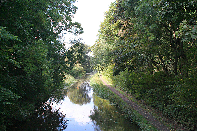
It was a shallow inclined mine working the Broxburn shales on either side of the Union Canal, and its workings caused considerable subsidence. It employed 50 in 1915, 58 in 1920 and 55 in 1923. Workings in the Broxburn Main, Upper Grey, Grey and Upper shales were abandoned in 1927. The ground has returned to farmland, though the subsidence can still be seen in the dip of a fence line beside the canal.
Geology
The Broxburn Shale group (Broxburn Main, Upper Grey, Grey and Upper shales), lying shallow on both sides of the Union Canal.
Workings
Inclined adits heading north towards and beneath the Union Canal; a standard-gauge railway to Hopetoun Oil Works.
Closure
Abandoned in 1927.
What remains
Returned to agriculture.
Spoil and subsidence hollows, visible in the dip of a fence line beside the canal.
Related mines
- Hopetoun No. 35 Pit — Both were Young's Hopetoun shale workings near Winchburgh; a railway was laid from No. 35 to No. 41 in 1906.
Nearby mines
- Hopetoun No. 35 Pit — 0.7 miles (1.1 km) S
- Champfleurie Mine — 1.4 miles (2.3 km) W
- Duddingston No. 1 and 2 Mines — 2.3 miles (3.7 km) E
- Broxburn Oil Works — 3.0 miles (4.8 km) SE
- Holmes Mine — 3.9 miles (6.2 km) S
Straight-line distance, within 9 miles (15 km). Show on the map.
Recorded claims
Individual factual claims, each attached to the source(s) that support it below. Where sources disagree, both are kept.
- Hopetoun No. 41 (Fawnspark) Mine was opened about 1906 by Young's Paraffin Light and Mineral Oil Company. 1
- It was a shallow mine working shale on both sides of the Union Canal, causing considerable subsidence. 1
- No. 41 employed 50 in 1915 and 55 in 1923. 2
- Its workings were abandoned in 1927. 1
Photographs & further reading
The Museum of the Scottish Shale Oil Industry's page for this mine, with maps, plans, photographs of the site and newspaper extracts.
View sourceSources
- (secondary) Hopetoun No.41 (Fawnspark) mine (Scottish Shale, Museum of the Scottish Shale Oil Industry) — Almond Valley Heritage Trust
- (primary) Hopetoun (Oil Shale) (Durham Mining Museum) — Durham Mining Museum
Record created: 25 October 2026 · Last researched: 25 October 2026