 MineArchive
Flour Mill Colliery
| Also known as | Flour Mills Colliery |
|---|---|
| Location | Bream, Forest of Dean — 51.7580, -2.5744 (approximate) |
| Commodity | Coal |
| Type | Coal |
| Worked | 1866 (sinking began)–1928 (coal winding ceased) |
| Maximum depth | 190 yards |
| Operators | Ralph and Arthur James Price (1864–?, lessee) — Crown lease of the colliery site from 24 June 1864 Flour Mill Colliery Co. Ltd (1873–1875) William Camm and Richard Watkins (1886–1891, owner) Princess Royal Colliery Co. Ltd (1891–1928) — Worked Flour Mill with Princess Royal; winding ceased at Flour Mill in 1928 |
A Forest of Dean colliery near Bream, sunk from 1866 and worked with Princess Royal from 1891 until coal winding ended in 1928; its listed buildings now house a locomotive engineering works.
Location
Approximate location. The large pin is this mine; the small round markers are the nearest mines on record. Click one for its page. View on full map
History
Flour Mill, near Bream, was first galed in August 1843 to William Jones, who passed it within weeks to George Skipp; by 1844 a chemical works, a wood distillery, stood on the site, and the coal stayed where it was. In 1864 Ralph and Arthur James Price of London leased two acres from the Crown for 31 years at £5 a year, intending to work on a very large scale, and sinking was under way in 1866. That September the pit sinker John Hooper fell from his stage into the flooded sump and drowned; the inspector noted that one steam engine did both the pumping and the winding. The Flour Mill Colliery Co. Ltd was formed in December 1873 and was in liquidation by January 1875, although Coleford High Delf coal was sold at the pit in 1874. When it stopped pumping, the water flooded the neighbouring Princess Royal, whose owners took Flour Mill to court in 1876. The gale was forfeited in 1882.
By November 1886 it belonged to William Camm and Richard Watkins, owners of Princess Royal (Park Gutter), and in 1891 the Princess Royal Colliery Co. Ltd was formed to work both, with a rope-worked tramway carrying Flour Mill's coal to the Park Gutter screens. In 1906 the two pits together raised 600 tons a day. A new shaft, 140 yards deep and 14 feet across, was sunk in 1904 to work the dip of the seam, but the ground was very wet and needed up to 3,000 gallons a minute pumped. A generator house was built in 1908 and 1909 to supply power. A strike of 700 men in October 1909, the national strike of 1912, geological trouble and the water persuaded the company to reach Flour Mill's coal by deepening the Park Gutter shaft, which was finished in 1915. The pits were joined underground in 1916, and coal was last wound at Flour Mill in 1928. The cages there were so small that the pit ponies rode them sitting on their haunches.
Geology
The Yorkley, Whittington and Coleford High Delf seams of the Pennant Group (middle Upper Coal Measures). The Coleford High Delf, 4 feet 6 inches thick, was reached at 423 feet in No. 3 shaft. Abandonment plans also record the Trenchard seam.
Workings
The first shaft was 190 yards deep and worked the seam up towards its outcrop. A second shaft, 140 yards deep and 14 feet in diameter, followed in 1904 to work the dip. A rope-worked tramway took the coal to the Princess Royal screens at Park Gutter from 1891, and an underground connection with Princess Royal was made in 1916.
Closure
After the Park Gutter shaft was deepened in 1915 and the pits were connected in 1916, Flour Mill's coal was raised mainly at Princess Royal, and winding at Flour Mill ceased in 1928. The Flour Mill plan for the Trenchard and Whittington seams was abandoned that year.
What remains
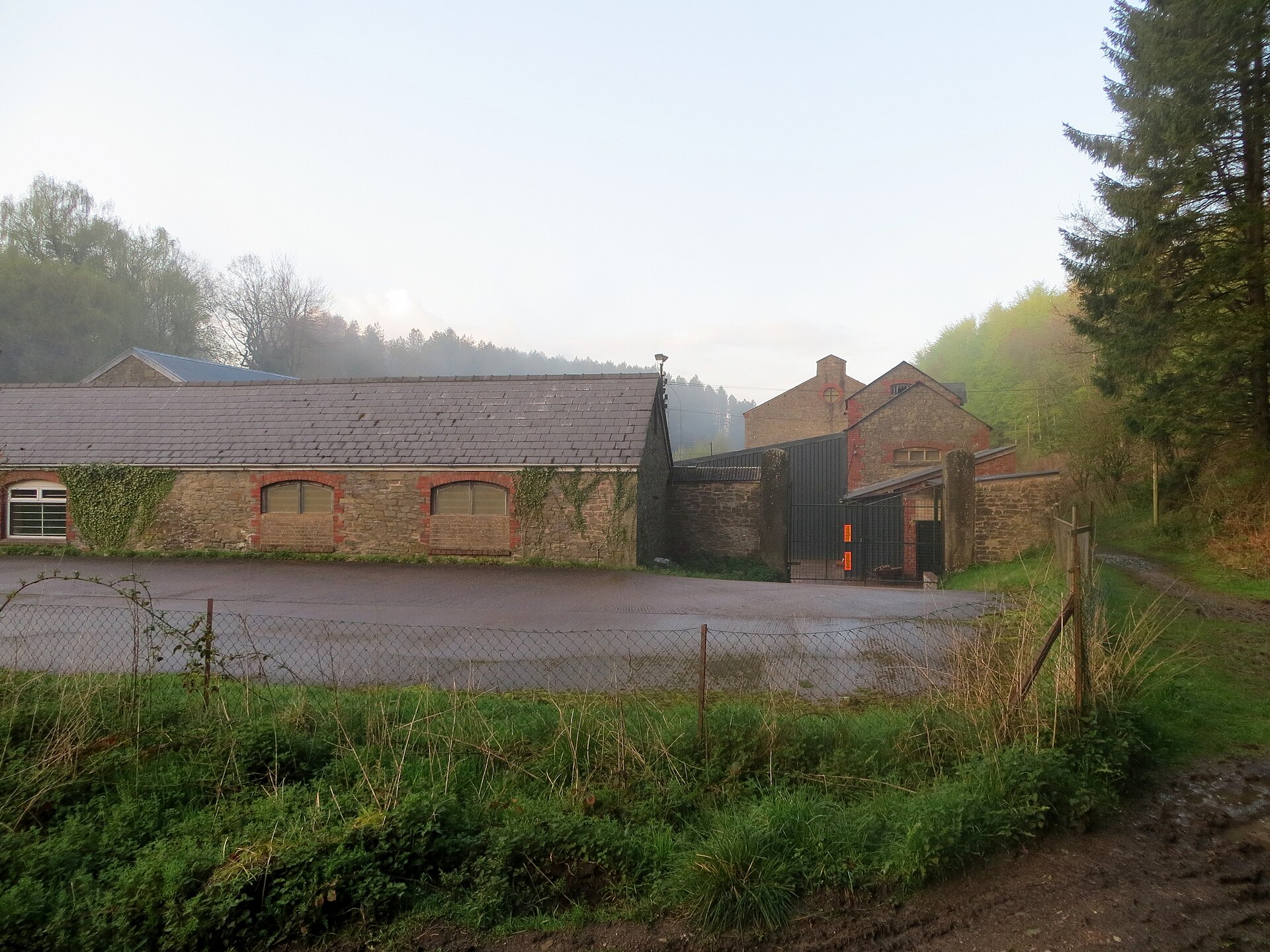
Several surface buildings survive and are in active industrial use. The generator house of about 1908, restored in the 1990s, is occupied by a steam locomotive engineering company.
The 1908 generator house and the Grade II listed former engine house, workshop, stores and offices, listed in 1984. A well-preserved tramroad tunnel lies near the colliery site.
Redevelopment
The colliery buildings house a locomotive engineering works and other businesses.
Related mines
- Princess Royal Colliery — Worked together by the Princess Royal Colliery Co. Ltd from 1891 and joined underground in 1916, after which Flour Mill's coal was mostly raised at Park Gutter.
Nearby mines
- Princess Royal Colliery — 0.8 miles (1.3 km) NE
- Venus and Jupiter Colliery — 0.9 miles (1.4 km) N
- Park Hill Colliery — 1.0 miles (1.5 km) SE
- Norchard Colliery — 1.2 miles (1.9 km) SE
- Hopewell Engine Colliery — 1.2 miles (2.0 km) NW, Gloucestershire
Straight-line distance, within 9 miles (15 km). Show on the map.
Further reading
The society's heritage-site note on the colliery, with its grid reference, seams, dates and the state of the site.
View sourceA dated chronology of the gale drawn from Crown records, company files and newspaper reports.
View sourceThe Grade II listing of the colliery workshop, listed in 1984 for group value with the engine house.
View sourceThe present occupiers' history of the site, from the chemical works to the generator house and its restoration.
View sourceSources
- (secondary) Flour Mill Colliery — Forest of Dean Local History Society
- (secondary) Flour Mill (Forest Coal) — Forest of Dean Local History Society / Lightmoor
- (secondary) The Flour Mill's history — The Flour Mill Ltd
- (primary) Former Colliery Workshop at NGR SO 604067, West Dean (Historic England list entry 1186355) — Historic England, via British Listed Buildings
- (primary) BGS mine plans: Flour Mill (Trenchard and Whittington, abandoned 1928) — British Geological Survey / Mining Remediation Authority
Record created: 12 November 2026 · Last researched: 12 November 2026