 MineArchive
Edmondsley Colliery
| Also known as | West Edmondsley Colliery, Wellington Pit, Edmondsley |
|---|---|
| Location | West Edmondsley, near Sacriston, County Durham — 54.8353, -1.6435 (approximate) |
| Commodity | Coal |
| Type | Coal |
| Worked | 1850s–30 November 1920 |
| Maximum depth | 100 fathoms to the Busty seam, the deepest of the seams named in 1894. |
| Operators | Edmondsley Coal Co. (1880–1920) |
Overview
A coking colliery five miles north-north-west of Durham, opened in the 1850s and worked for some seventy years on the Hutton and Busty seams and later on the Maudlin, Low Main, Main Coal, Five Quarter and Brockwell. It was raising 150,000 tons a year by the 1890s, a third of it converted into coke in 112 ovens on the bank, and employed just over 400 men and boys at its peak. Its owners built the village school in 1875 and enlarged it twice as the population grew. The colliery was abandoned on 30 November 1920.
History
Coal had been dug on a small scale in the Charlaw area since medieval times, but Edmondsley as a village dates from the opening of the colliery: the parish council’s history puts that at 1840, while other accounts have it opening in the 1850s. The pit was at first called the Wellington Pit and belonged in the 1850s to a Mr Tyzack of Sunderland, who gave his name to Tyzack Street — pronounced Tissack — as the mining rows went up; the firm appears as S. Tyzac & Co. in the 1860s. The upcast shaft was enlarged between the surface and the Hutton seam in 1866 and a shaft sinking is recorded there on 19 December that year. A staple was sunk from the Low Main to the Hutton in 1870, a boring put down below the Busty in 1874, and another staple sunk from the Maudlin to the Low Main in 1903. By the 1880s the Edmondsley Coal Company owned the mine and kept it to the end. Whellan’s 1894 directory found the Hutton and Busty being worked, three and five feet thick at sixty and a hundred fathoms, an annual output of 150,000 tons with about a third made into coke in 112 ovens, and roughly 350 hands including the coke workers. Employment reached 407 in 1894 and held above 370 until the First World War, falling to 233 by 1920. The colliery’s coals were sold as coking, gas and steam grades throughout. The colliery owners built the village’s British School in 1875 and opened it on 3 May; an infant room was added in 1882 and two large classrooms and other work in 1889 to keep up with the growing population, by which time it could hold twice its average attendance of over 300. A wagonway ran from the colliery along Wellington Terrace and diagonally through the village to the Edmondsley crossroads, where the Fleece Inn still has the chamfered corner cut to let the coal wagons round the turn; wagons from Edmondsley were hauled on towards Waldridge by a stationary engine north of Daisy Hill.
Geology
Coal Measures of the Durham coalfield, worked through a sequence of named seams — Maudlin, Low Main, Main Coal, Hutton, Five Quarter, Busty and Brockwell. The Hutton lay at about sixty fathoms and three feet thick and the Busty at a hundred fathoms and five feet, the two that carried the colliery through the 1890s. A boring below the Busty in 1874 tested what lay deeper.
Workings
An upcast shaft at NZ 232 490, enlarged to the Hutton seam in 1866, with the Wellington Pit the colliery’s original name. Internal staples connected seam to seam rather than new shafts being sunk from the surface: Low Main to Hutton in 1870, Maudlin to Low Main in 1903. A bank of 112 coke ovens stood at the surface, taking about a third of the output. A wagonway ran from the colliery through the village to a stationary engine at Daisy Hill, which hauled the wagons on towards Waldridge Fell.
Closure
Abandoned on 30 November 1920 with 233 people on the books, 159 of them underground, and the plans sent to the Mines Department; the parish council’s history gives the closure as 1921. Two seams were formally abandoned separately — the Brockwell in 1919 and the Main in 1934, long after the colliery itself had gone. The surface buildings and the railway were removed over the following years.
What remains
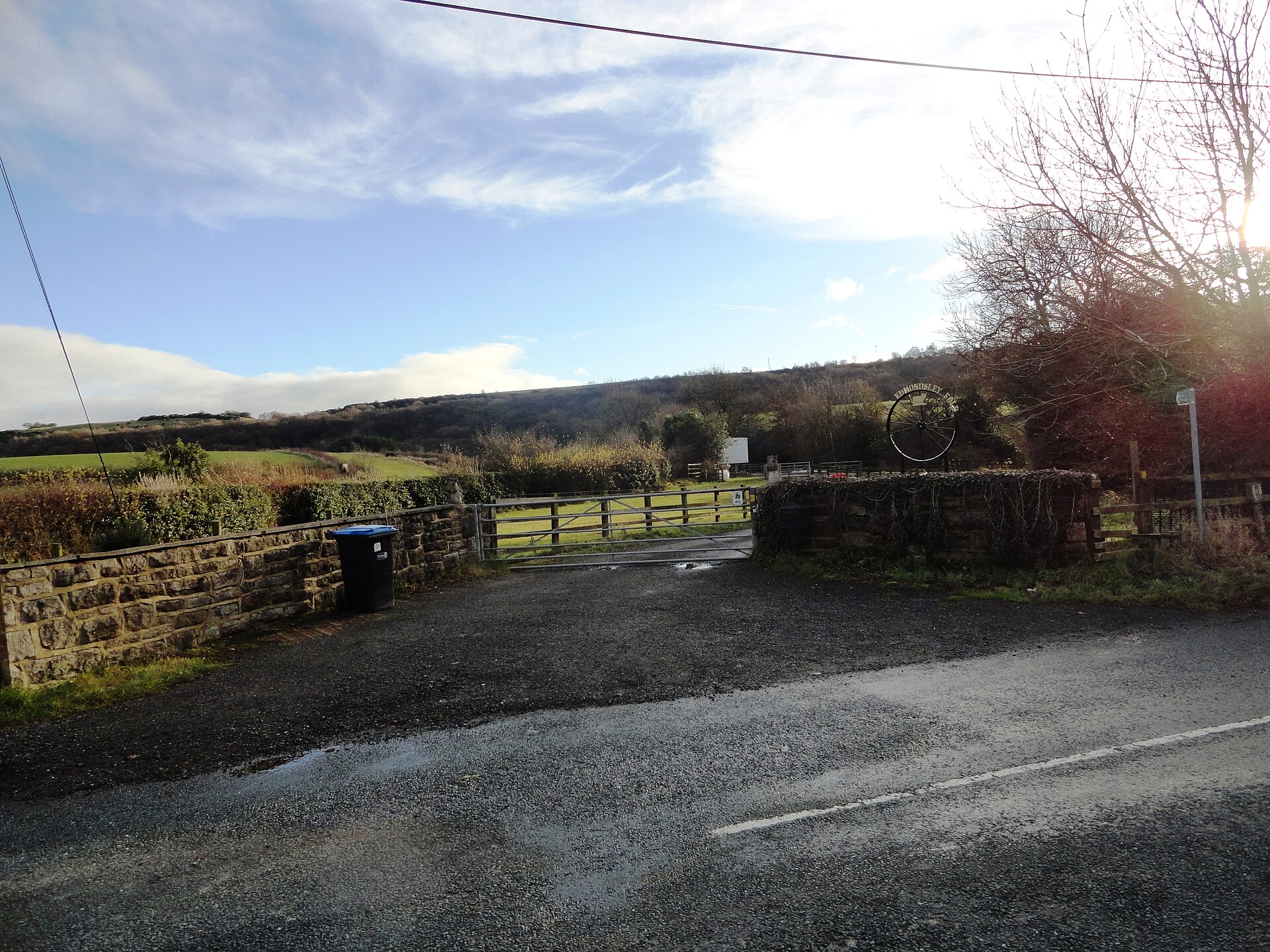
The colliery stood a little west of the village, off the lane that follows the course of the old colliery street called Wellington Terrace, of which only a few houses remain. Nothing of the workings is left; the ground west of Edmondsley is farmland, and reedbeds and a wildlife habitat have been made nearby. In the village the Fleece Inn keeps its chamfered corner and the schoolmaster’s house survives as the last of the old school.
None of the colliery itself. Wellington Terrace’s line survives as a lane with a few houses, and in the village the chamfered corner of the Fleece Inn, cut for the coal wagons, and the schoolmaster’s house.
Related mines
- Waldridge Colliery — Its coal ran down the Waldridge waggonway, for which it paid wayleave to the Waldridge owners.
Nearby mines
- Byron Colliery — 0.7 miles (1.1 km) NE
- Nettlesworth Colliery — 0.8 miles (1.3 km) NE
- Sacriston Colliery — 0.8 miles (1.3 km) S
- Charlaw Colliery — 0.9 miles (1.4 km) S
- Waldridge Colliery — 1.5 miles (2.4 km) NE
Straight-line distance, within 9 miles (15 km). Show on the map.
Disasters & major incidents
-
Edmondsley Colliery shaft accident, 1891
13 June 1891 · Winding / Shaft Accident · 2 fatalities
A master sinker and a sinker were killed at Edmondsley Colliery on 13 June 1891 when the banksman ran a kibble tram into a chock and it went down the shaft.
What's uncertain
Points where sources disagree or the record could not be settled; both accounts are kept. All open questions in the archive.
- Durham Mining Museum dates the colliery’s opening to the 1850s; the parish council’s history puts the village’s beginnings, and the colliery’s opening, at 1840. (disputed) 1,2
- The colliery was abandoned on 30 November 1920 and the plans sent to the Mines Department; the parish council’s history gives the closure as 1921. (disputed) 1,2
Recorded claims
Individual factual claims, each attached to the source(s) that support it below. Where sources disagree, both are kept.
- Durham Mining Museum dates the colliery’s opening to the 1850s; the parish council’s history puts the village’s beginnings, and the colliery’s opening, at 1840. (disputed) 1,2
- The colliery was initially called the Wellington Pit and was owned in the 1850s by a Mr Tyzack of Sunderland, who gave his name to Tyzack Street; the firm is returned as S. Tyzac & Co. in the 1860s. 1,2
- Whellan’s 1894 directory records the Hutton and Busty seams worked at three and five feet thick and sixty and a hundred fathoms deep, an annual output of 150,000 tons with about a third made into coke in 112 ovens, and about 350 hands employed. 1
- The British School was built in 1875 and opened on 3 May by the owners of Edmondsley Colliery, enlarged with an infant room in 1882 and with two large classrooms and other additions in 1889. 1
- The colliery was abandoned on 30 November 1920 and the plans sent to the Mines Department; the parish council’s history gives the closure as 1921. (disputed) 1,2
- The seams returned as worked in 1915 were the Brockwell, Busty, Five Quarter, Hutton, Low Main, Main Coal and Maudlin. The Brockwell was abandoned in 1919 and the Main in 1934. 1
- The BGS mine-plans catalogue holds a Mining Remediation Authority abandonment plan titled 'Edmondsley' (catalogue 7173, Five Quarters, dated 1920). 3
Photographs & further reading
Owners, output, employment year by year, the seams worked, the shaft and staple sinkings, and Whellan’s 1894 description of the colliery and its school.
View sourceThe village’s own account of how the colliery made it: the Wellington Pit and Mr Tyzack, Tyzack Street, the wagonway through the crossroads and the Fleece Inn’s chamfered corner.
View sourceSources
- (primary) Edmondsley Colliery — Durham Mining Museum
- (observational) History — Edmondsley Parish Council — Edmondsley Parish Council
- (primary) BGS / Mining Remediation Authority mine plans: EDMONDSLEY — British Geological Survey / Mining Remediation Authority
- (secondary) List of coal mines UK 1880 — Coalmining History Resource Centre
Record created: 6 September 2026 · Last researched: 6 September 2026