 MineArchive
Craster Quarry
| Also known as | Craster Harbour whinstone quarry |
|---|---|
| Location | Craster, Northumberland — 55.4700, -1.5974 (approximate) |
| Commodity | Whinstone |
| Type | Quarry |
| Worked | By 1905–1940s |
| Operators | McLaren and Prowde Ltd — Working the quarry in 1922 (Durham Mining Museum) |
The whinstone quarries of Craster on the Northumberland coast, worked in the early 20th century and shipped out from the memorial harbour built in 1906. They closed in the 1940s.
Location
Approximate location. The large pin is this mine; the small round markers are the nearest mines on record. Click one for its page. View on full map
History
Craster's whinstone came from two quarries. One was cut on the shore and now forms part of the harbour; the other lay on the west side of the village, and its stone crossed to the harbour on an aerial ropeway. The harbour itself was built in 1906 by the Craster family as a memorial to Captain John Charles Pulleine Craster of the 46th Punjabis, killed in the Tibet expedition of 1904, who had taken a keen interest in giving the village a harbour.
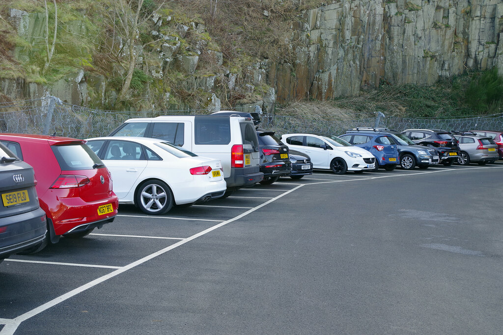
It gave Craster a new, if short-lived, trade: shipping out the local whinstone, much of it for road building. Photographs in the county archives show boats taking on stone from the quarry around 1905 and 1910, and, around 1930, the quarry faces being worked, the crane on the harbour that loaded the ships and one of the ropeway towers. In 1922 McLaren and Prowde Ltd were working the quarry with 17 people. The quarries closed in the 1940s, and the western one now earns its keep as the village car park.
Geology
Whinstone (dolerite) of the ridge that runs through the parish and the sloping beds that form the rocky coast.
Workings
A shore quarry that now forms part of the harbour, and a second quarry on the west side of the village joined to the harbour by an aerial ropeway, with whinstone silos at the harbour.
Closure
The quarries closed in the 1940s.
What remains
The western quarry is a car park below its old whinstone face; the shore quarry is part of the harbour.
The supports for the whinstone silos and the aerial ropeway, including a large concrete frame on the south harbour wall.
Redevelopment
The western quarry was converted into the village car park.
Nearby mines
- Longhoughton Quarry — 3.1 miles (5.0 km) SW
- Ratcheugh Quarry — 3.1 miles (5.1 km) SW
- Beadnell Colliery — 6.0 miles (9.7 km) N
- Shilbottle Colliery — 7.6 miles (12.3 km) S
Straight-line distance, within 9 miles (15 km).
Further reading
The Northumberland historic environment record: the quarry in the harbour, the silo and ropeway supports, the western quarry and the 1906 memorial harbour.
View sourceNotes and pictures on the harbour, its quarry and the ropeway from the quarry at the west of the village.
View sourceOne of several county archive photographs of the whinstone trade at Craster, c. 1905 to c. 1930.
View sourceSources
- (primary) Craster Harbour whinstone quarry (Keys to the Past, N13776) — Durham County Council and Northumberland County Council
- (secondary) Craster Harbour (co-curate, Newcastle University) — Newcastle University
- (primary) Craster: local history (Keys to the Past, N13223) — Durham County Council and Northumberland County Council
- (secondary) Craster, Boat taking on Whinstone from the quarry, c. 1905 (Northumberland Archives) — Northumberland Communities
- (secondary) Craster, Whinstone Cranes at the Harbour, c. 1930 (Northumberland Archives) — Northumberland Communities
- (primary) Craster Quarry (Durham Mining Museum) — Durham Mining Museum
- (observational) Craster Quarry Car Park (Geograph) — Geograph
Record created: 20 November 2026 · Last researched: 20 November 2026