 MineArchive
Caudale Quarry
| Also known as | Caudale Moor Slate Quarry, Cawdale Quarry |
|---|---|
| Location | Caudale Moor, near Hartsop, Cumbria — 54.4895, -2.9142 (approximate) |
| Commodity | Slate |
| Type | Slate |
| Worked | mid-1700s–1934 |
A high slate quarry on Caudale Moor above the Kirkstone Pass, worked from the mid-1700s, whose slate came down the mountain on sledges guided by men.
Location
Approximate location. The large pin is this mine; the small round markers are the nearest mines on record. Click one for its page. View on full map
History
Caudale Quarry lies high on Caudale Moor, on the Ullswater side of the Kirkstone Pass, south of Hartsop. Its blue slate was worked from the mid-1700s. James Clarke's Survey of the Lakes, published from 1787, describes how it came down the mountain: not by horses but by men. Each load went on a trail barrow, a sledge with two inclined handles or stangs, and the man went in front of it like a horse, with nothing to do but keep it in the track and stop it running away. A man could bring down eight hundredweight at a time, faster than he could walk down without it, over about half a mile; the dexterous sometimes did not set foot on the ground for ten or twelve yards together. Clarke tried it himself, and the barrow ran away with him.
From the foot of the slope the slate went on horseback to the head of Ullswater and then by boat, six to eight tonnes at a time, to Pooley Bridge. The quarry appears on Postlethwaite's map of the Lake District mining field. Accounts differ on when it was last worked: one says the beginning of the 20th century, while the official returns list it as closed in 1934 and not worked in 1935 or 1936.
Geology
Blue slate of the Borrowdale Volcanic rocks.
Workings
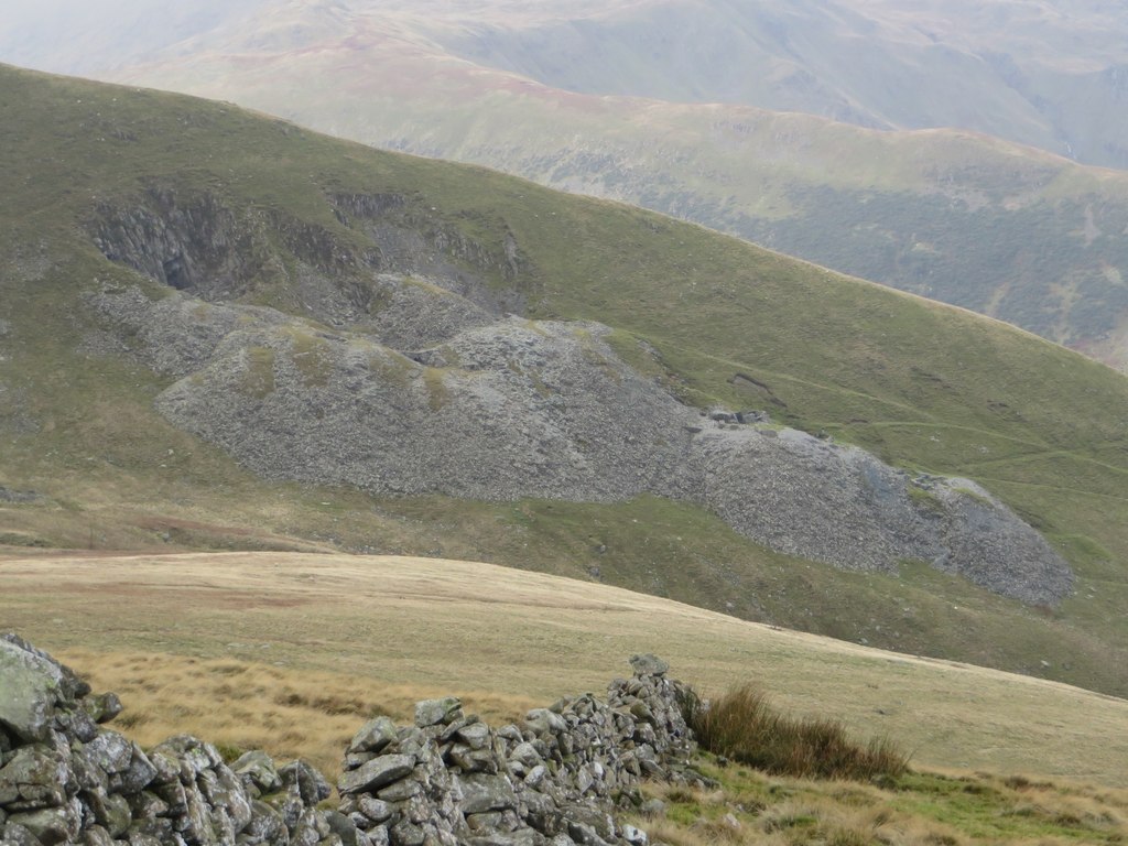
Quarry workings and adits high on the moor, with sledge tracks down the ridge.
Closure
Last worked at the beginning of the 20th century by one account, or closed in 1934 according to the official returns.
What remains
Long disused, with its adits blocked and ruined buildings among the waste.
Slate waste tips, ruined quarry buildings and worn sledge tracks.
Nearby mines
- Hartsop Hall Mine — 1.1 miles (1.8 km) NW
- Myers Head Mine — 1.2 miles (1.9 km) N
- Kirkstone Slate Quarry — 1.5 miles (2.3 km) S
- Troutbeck Park Green Slate Works — 2.9 miles (4.6 km) S
- Eagle Crag Mine — 3.8 miles (6.1 km) NW
Straight-line distance, within 9 miles (15 km).
Further reading
The Ullswater heritage group's account of Caudale Moor slate quarry: its dates, the sledging of slate and the route to Pooley Bridge.
View sourceThe gazetteer entry, with James Clarke's 1787 description of the trail barrows in full.
View sourceSources
- (secondary) Mines and Quarries in the Ullswater Valley — Friends of the Ullswater Way
- (secondary) Caudale Quarry, Patterdale (Old Cumbria Gazetteer) — Lakes Guides
- (secondary) Kirkstone Pass (Wikipedia) — Wikipedia
- (primary) Caudale Quarry (Durham Mining Museum) — Durham Mining Museum
- (observational) Caudale Quarry (Geograph) — Geograph
Record created: 20 November 2026 · Last researched: 20 November 2026