 MineArchive
Barrasford Quarry
| Also known as | Barrasford Whinstone Quarry |
|---|---|
| Location | Between Barrasford and Gunnerton, North Tyne, Northumberland — 55.0640, -2.1378 (exact) |
| Commodities | Whinstone, Limestone |
| Type | Quarry |
| Worked | After 1859–Still active |
| Maximum depth | Unknown. |
| Operators | Tarmac |
Overview
A working whinstone quarry on the Whin Sill in the North Tyne valley, opened after the Border Counties Railway reached it and still producing roadstone, ballast and armour stone for Tarmac.
History
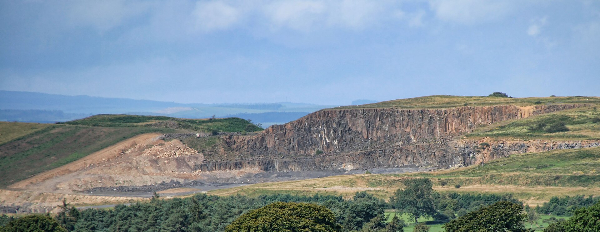
Barrasford Quarry lies about halfway between the villages of Barrasford and Gunnerton in the North Tyne valley, on the outcrop of the Whin Sill. It works dolerite, the hard black rock the old lead miners of County Durham called whin long before geologists recognised it as an igneous intrusion and gave the sill its name from them. The quarry is a creature of the railway. The Border Counties Railway was opened from Hexham to Chollerford in 1858 and completed in 1862, and Barrasford station was opened by the North British Railway on 1 December 1859; the quarry was developed afterwards and served by a siding on the north side of the line, approached from the south-east and signalled with its own box. From the siding tramways ran north into the workings, and immediately to the west the Gunnerton Quarry Waggonway ran north to a second quarry. A major reason for promoting the railway had been the Plashetts coal, but collieries, works and quarries opened all along the route, and Barrasford is the only one of them still working. The railway closed in 1958. The quarry did not: it remains open, owned by Tarmac, and is a source of railway ballast, roadstone and aggregate, along with large blocks recovered for use as armour stone. It also produces some Oxford Limestone, metamorphosed where the sill baked it, and the harder calc-silicate rock formed in that contact zone goes into certain of the crushed whinstone products the quarry supplies. Whinstone is too intractable to be a building stone, but it was used locally in a few buildings, among them the now abandoned cottages at the quarry itself. The quarry has been expanding rapidly, and the faces on show change from visit to visit.
Geology
The quarry works the Whin Sill, a dolerite intrusion emplaced at the end of the Carboniferous and the type sill of geology, named after the whin of the Durham lead miners. Its relations here are unusual: the sill transgresses from above to below the Oxford Limestone over some two kilometres of outcrop, so that the full thickness of the limestone can be found both above and below it, and large rafts of shale and limestone are caught up within it. The maximum thickness of sill in the quarry is forty metres, though the regional thickness varies rapidly. Where the intrusion baked the Oxford Limestone the rock is metamorphosed to a harder calc-silicate. Mineralisation occurs in amygdales in the whin and in small quartz and calcite veins and strings carrying sulphides. Four varieties of dolerite-pegmatite have been described from the sill here. Four large quarries work the main sill in the district, at Keepershields, Barrasford, Swinburne and Divethill.
Workings
An open quarry on the sill outcrop, served in its early life by a siding on the north side of the Border Counties Railway with tramways running north into the workings, and signalled with its own box. The Gunnerton Quarry Waggonway ran north to a second quarry immediately to the west. Rock is extracted and crushed on site for aggregate.
Closure
The quarry is still working. The railway that made it closed in 1958, and of the collieries, works and quarries opened along that line Barrasford is the only survivor.
What remains
A working roadstone quarry owned by Tarmac, rapidly expanding, so that the features exposed in the faces vary from time to time. Its products are crushed rock aggregate and roadstone, railway ballast and armour stone.
The crushing and grading plant stands at the quarry, and the cottages built of whinstone at the site are now abandoned. The trackbed of the Border Counties Railway and the line of the Gunnerton waggonway survive nearby.
Redevelopment
None: the quarry has been in continuous production and is still expanding.
Nearby mines
- Brunton Bank Quarry — 4.8 km S
- Fallowfield Mine — 7.0 km S
- Stonecroft and Greyside Mine — 8.0 km SW
- Tynedale Colliery — 8.5 km S
- Acomb Colliery — 8.6 km S
Straight-line distance, within 15 km. Show on the map.
Recorded claims
Individual factual claims, each attached to the source(s) that support it below. Where sources disagree, both are kept.
- The maximum thickness of the Whin Sill in the quarry is forty metres, and the sill transgresses from above to below the Oxford Limestone over some two kilometres of outcrop. 1
- The quarry was developed after the Border Counties Railway and was served by a siding on the north side of the line, with tramways running north into the workings. 2
- The quarry is owned by Tarmac and is a source of railway ballast. 2
- Dolerite from the quarry is worked for roadstone and aggregate, with large blocks recovered for armour stone, and metamorphosed Oxford Limestone is worked alongside it. 3
- Of the collieries, works and quarries opened along the Border Counties Railway, Barrasford is the only working survivor. 1
- Four varieties of dolerite-pegmatite have been described from the Whin Sill at Barrasford. 1
Photographs & further reading
A record of the quarry's rail connection, its siding and signal box, and the tramways into the workings.
View sourceA Yorkshire Geological Society excursion guide describing the quarry faces and the sill's unusual relations.
View sourceSources
- (primary) Geology of the North Tyne and Saughtree - an excursion — British Geological Survey / Yorkshire Geological Society
- (secondary) Barrasford Quarry — Railscot
- (primary) Mines and quarries - Northumberland geodiversity — British Geological Survey (via GeoGuide)
- (secondary) Barrasford — Wikipedia
Record created: 23 September 2026 · Last researched: 23 September 2026